Learn the land, not just the listing.
LastLake reads 88 provincial, federal and community datasets for any rural or waterfront property in Ontario, then writes back a fourteen to twenty-one page report in plain language. What the records say about the shoreline. How far the nearest mapped road is. What the province has mapped around it, out to five kilometres.
It lands in your inbox within one business day, whether you are weighing a purchase, planning what to build, or just want to know what you already own.
Public records summary · № 2026-0147
Township of Muskoka Lakes, District Municipality of Muskoka, Ontario
What’s inside the report
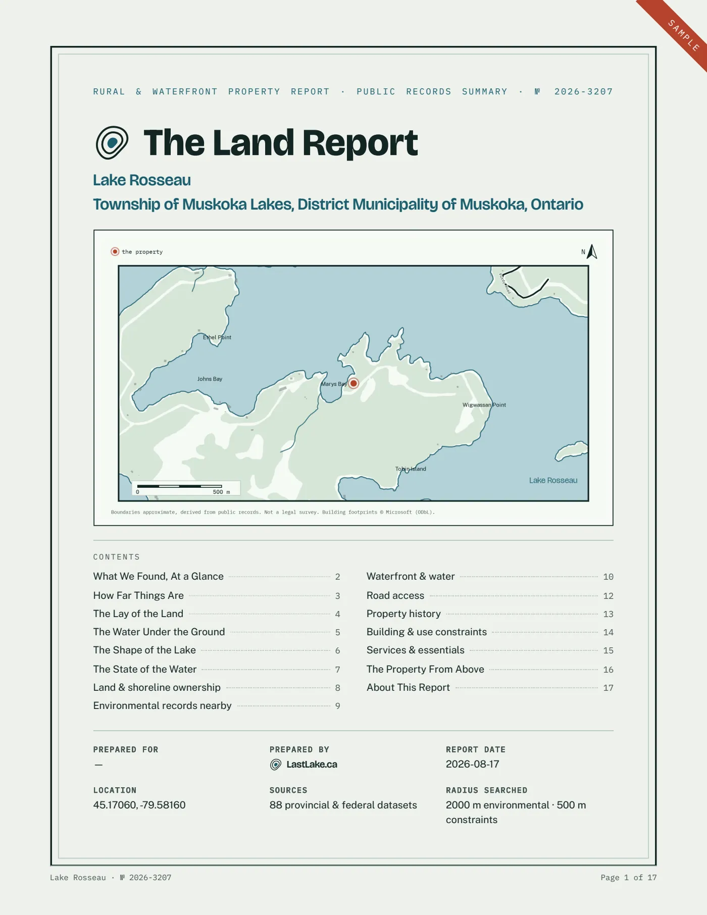
ContentsCover and context map
The property marked on the lake, with the roads in, the buildings around it, and the islands, bays and points named.
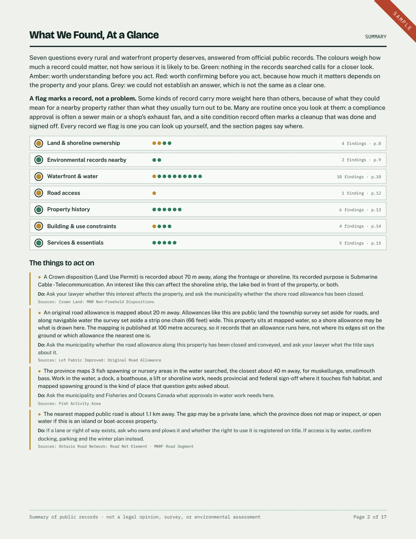
At a glance verdict
One line per section with its colour, a dot for every finding under it, then the things to act on and what we could not establish.
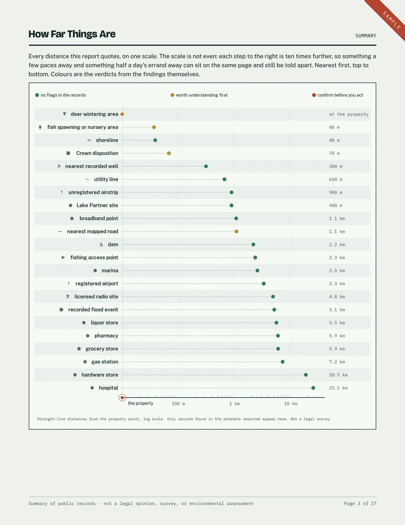
How far things are
Every distance the report quotes on one scale, from ten metres to forty kilometres, each mark in the colour its own section gave it.
The lay of the land
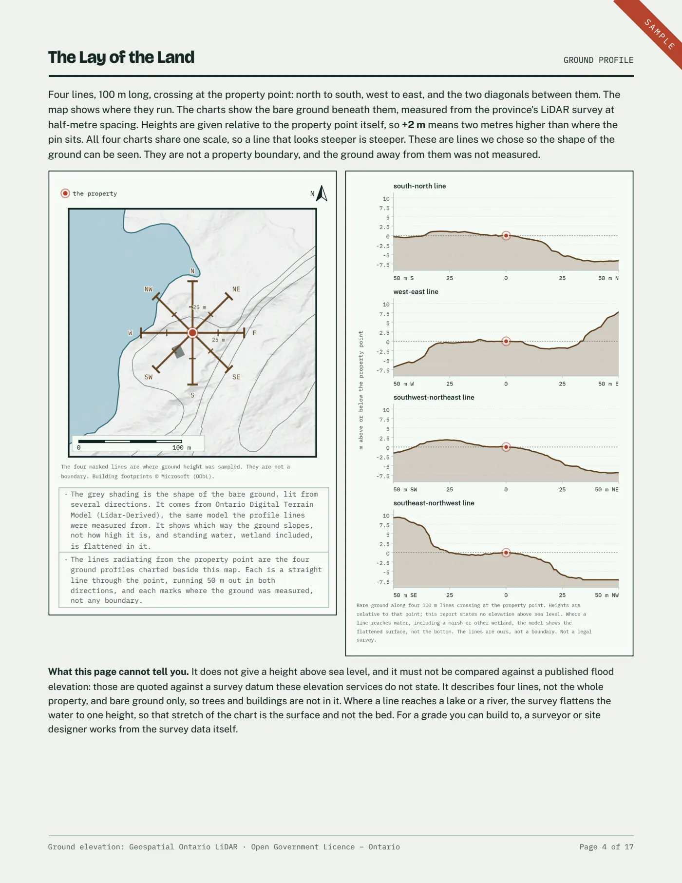
How the ground rises and falls along four 100 m lines crossing at the property point, measured from provincial laser survey and charted beside a map of where they run.
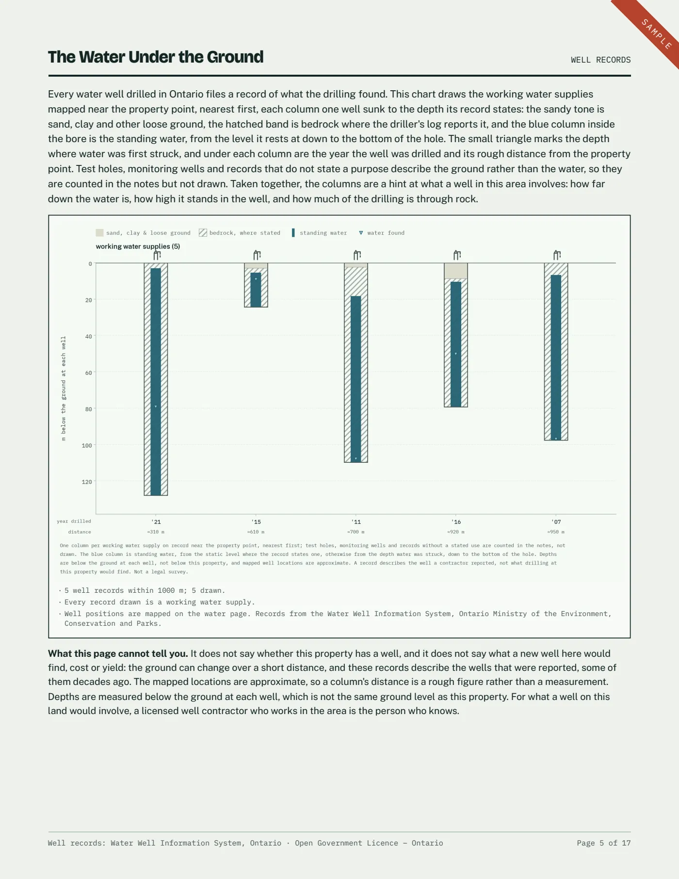
The water under the ground
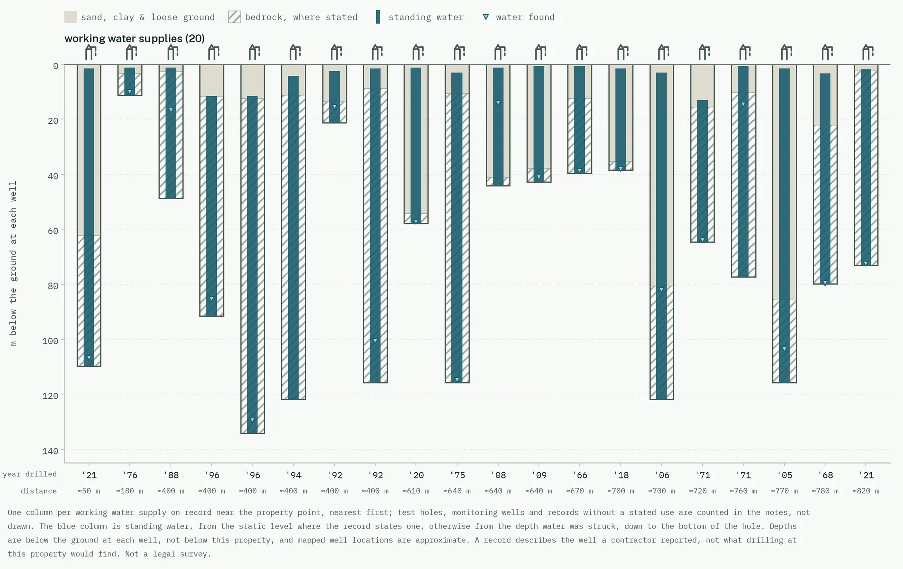
Every working water supply on record within a kilometre, each drawn as a column at its own depth, so you can see how far down the neighbours had to go.
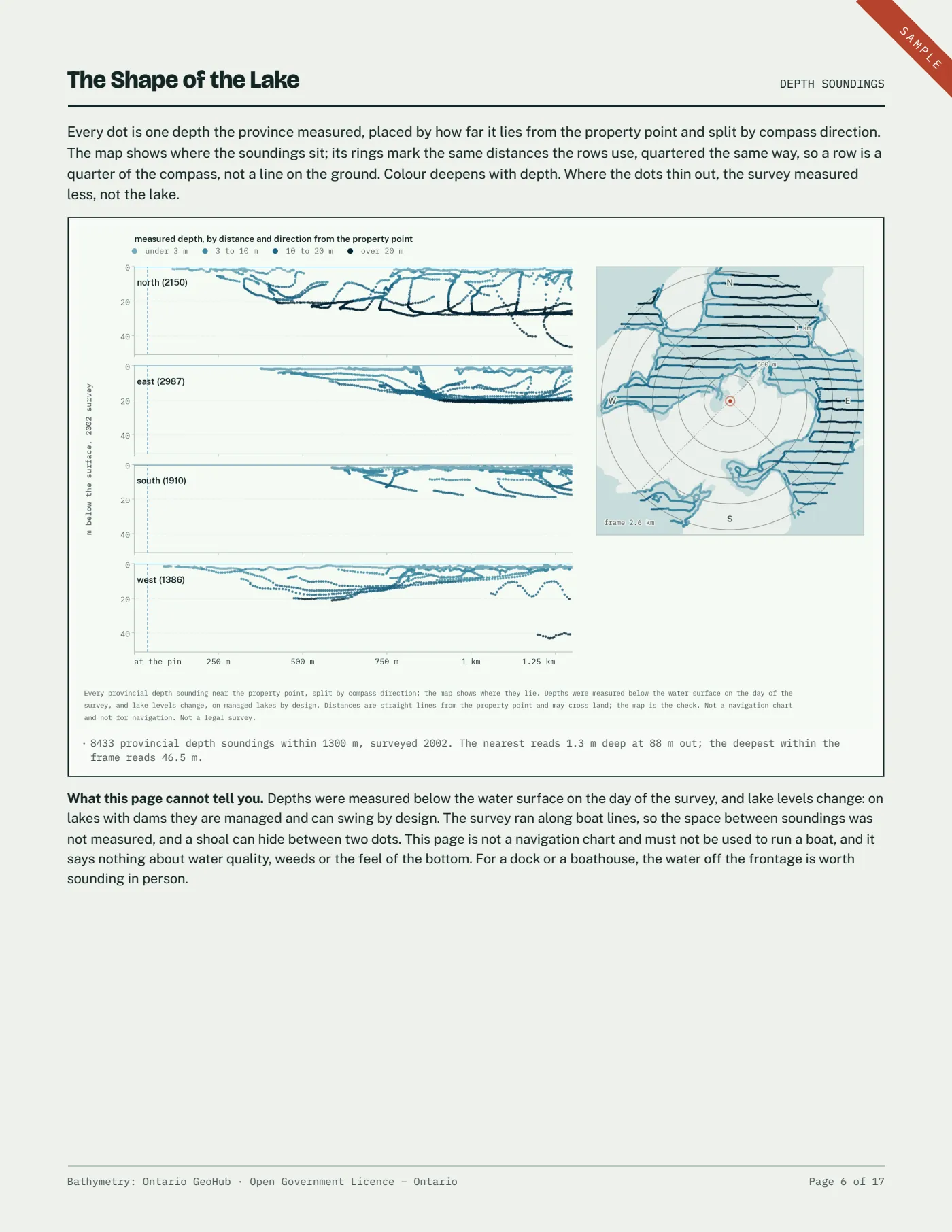
The shape of the lake
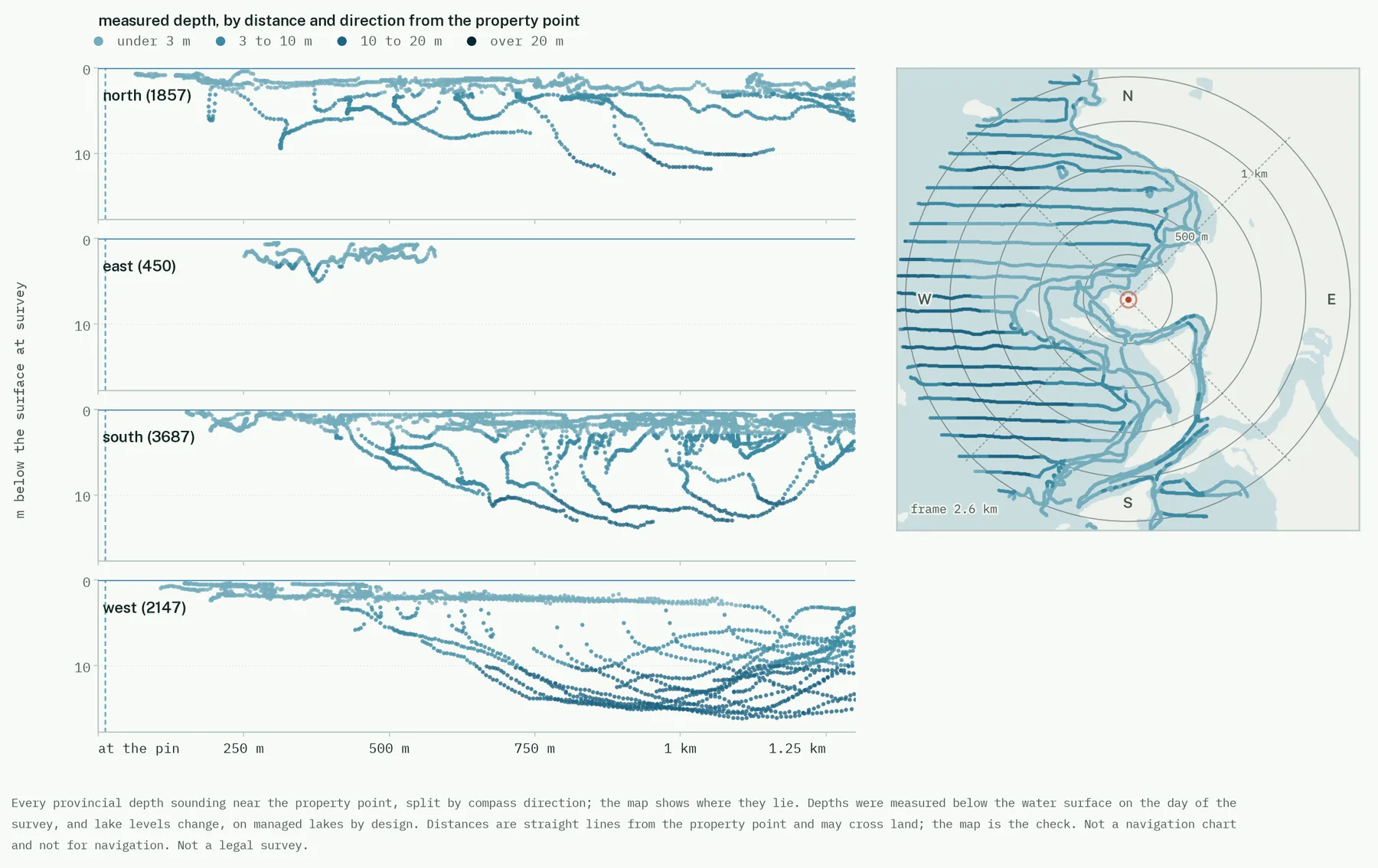
Every provincial depth sounding around the property, split into the four compass directions and mapped beside them, on water the province has surveyed.
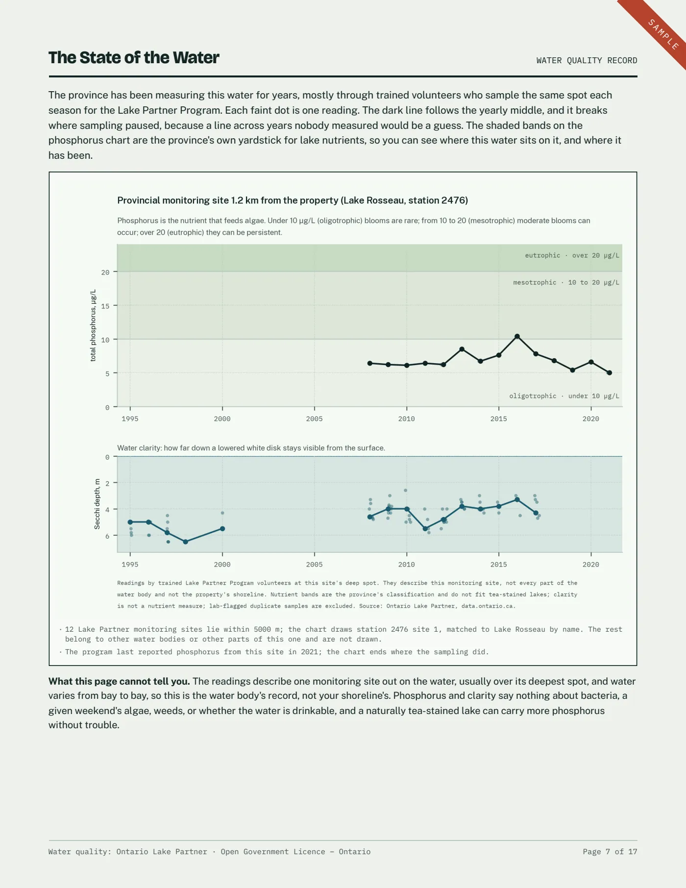
The state of the water
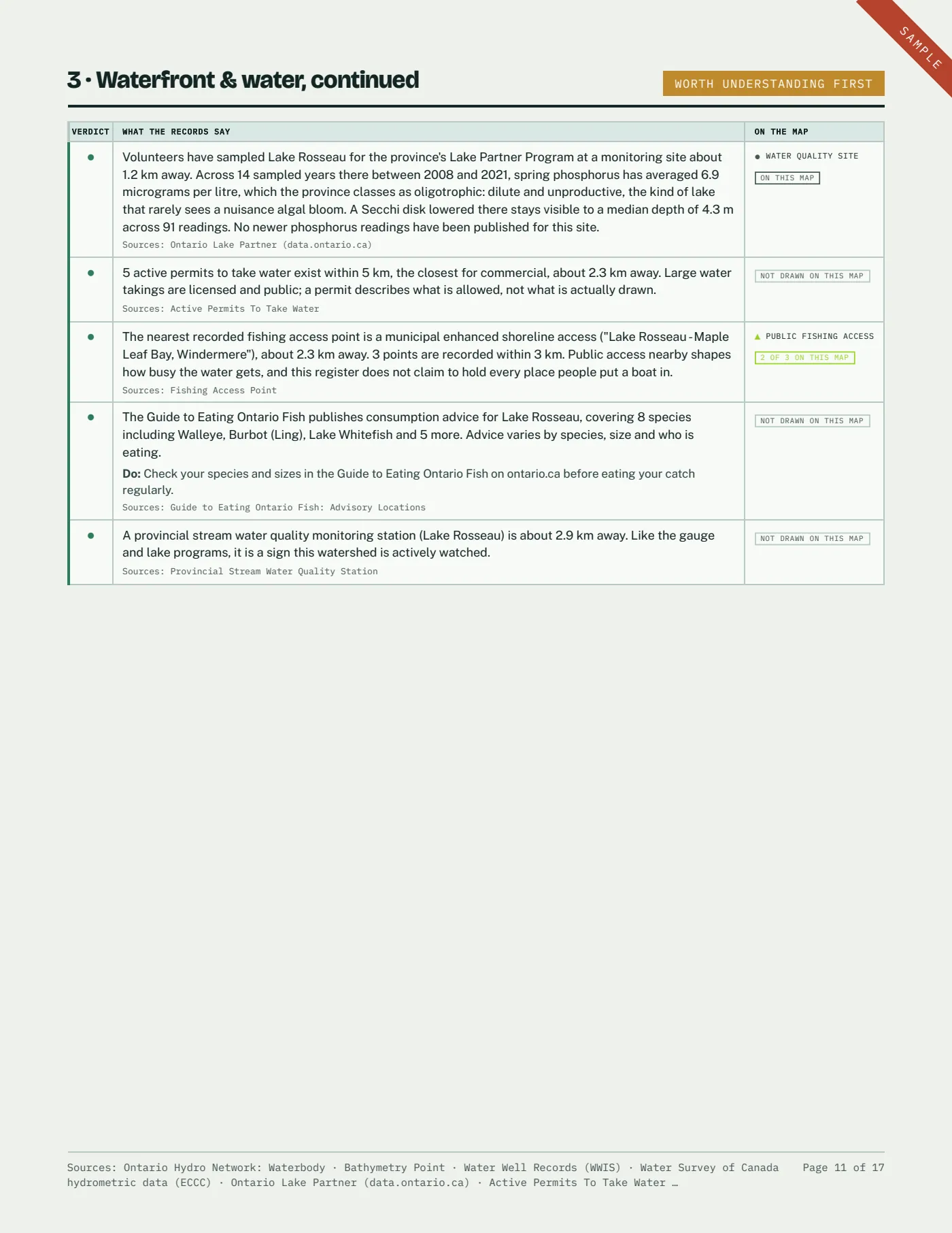
Spring phosphorus and water clarity year by year, from the volunteer monitoring site on that lake, set against the bands the province grades lakes by.
Land & shoreline ownership
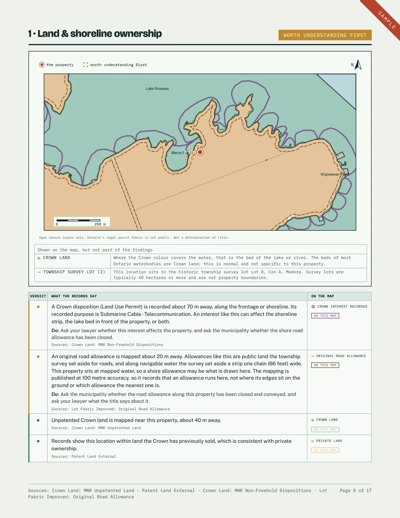
Crown land, patented land, and any Crown interest recorded along the frontage, named from the record’s own wording.
Environmental records nearby
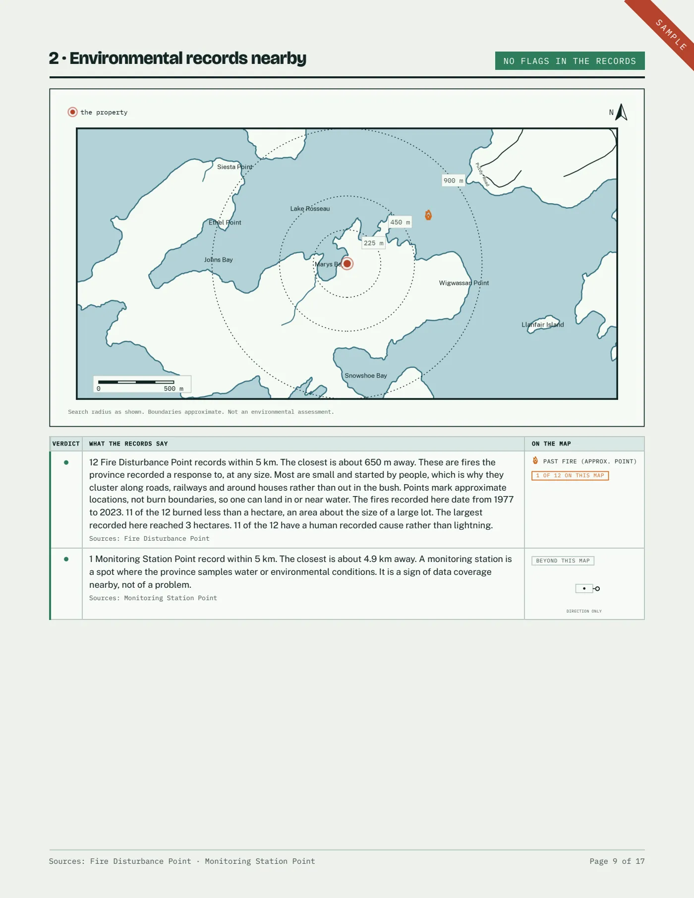
Waste sites, pits and quarries, petroleum wells, site condition records, approvals and fire history, out to 5 km.
Waterfront & water
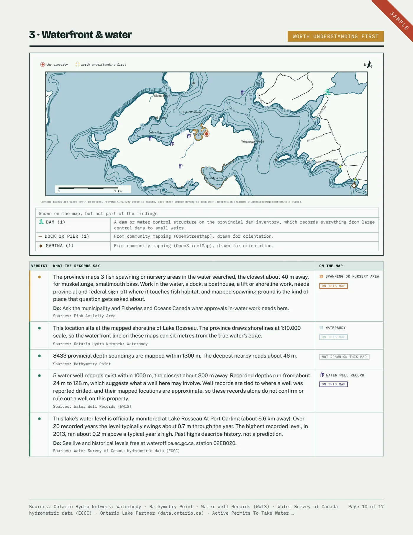
Labelled depth contours off the frontage, nearby well records and their depths, dams, water quality monitoring, permits to take water, and the nearest federal level gauge.
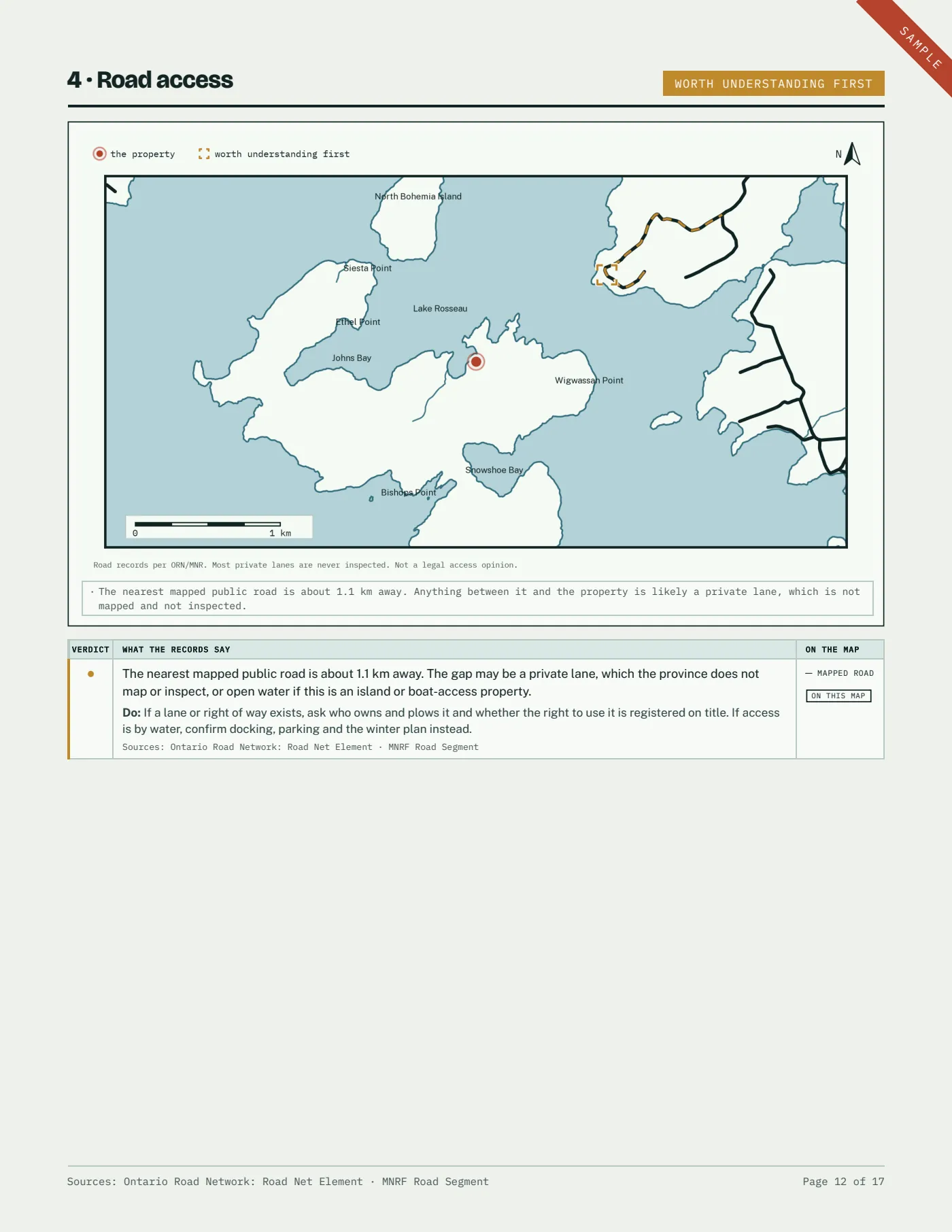
Road access
How far the nearest mapped public road is, water crossings, fords, recorded road obstacles, and rail crossings on the way in.
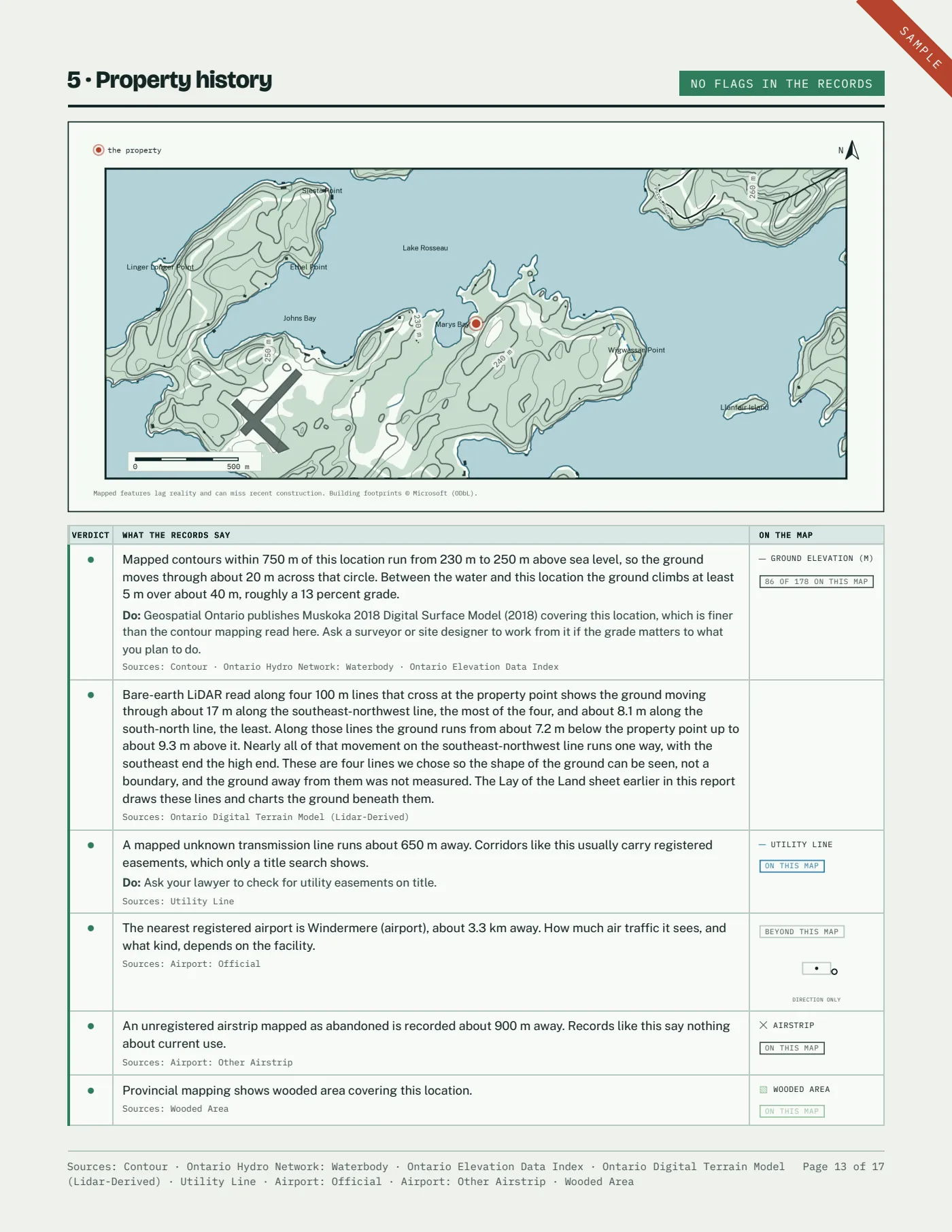
Property history
What surrounds it: woods, mapped building footprints, rail lines, trails, utility corridors and airstrips, and how the ground rises and falls around the property point.
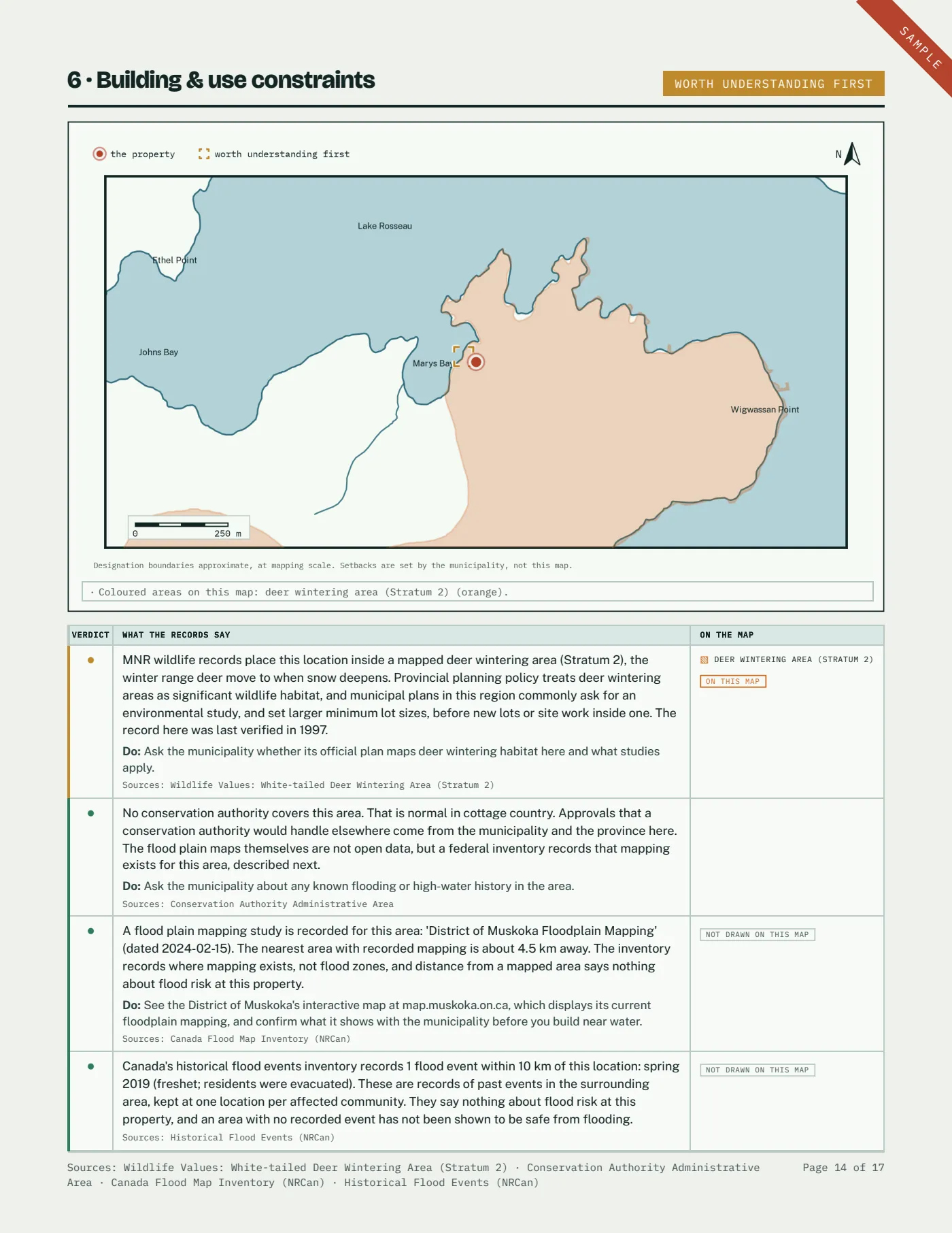
Building & use constraints
Wetlands, protected plans, source protection areas, parks and reserves, and whether a conservation authority covers the area at all.
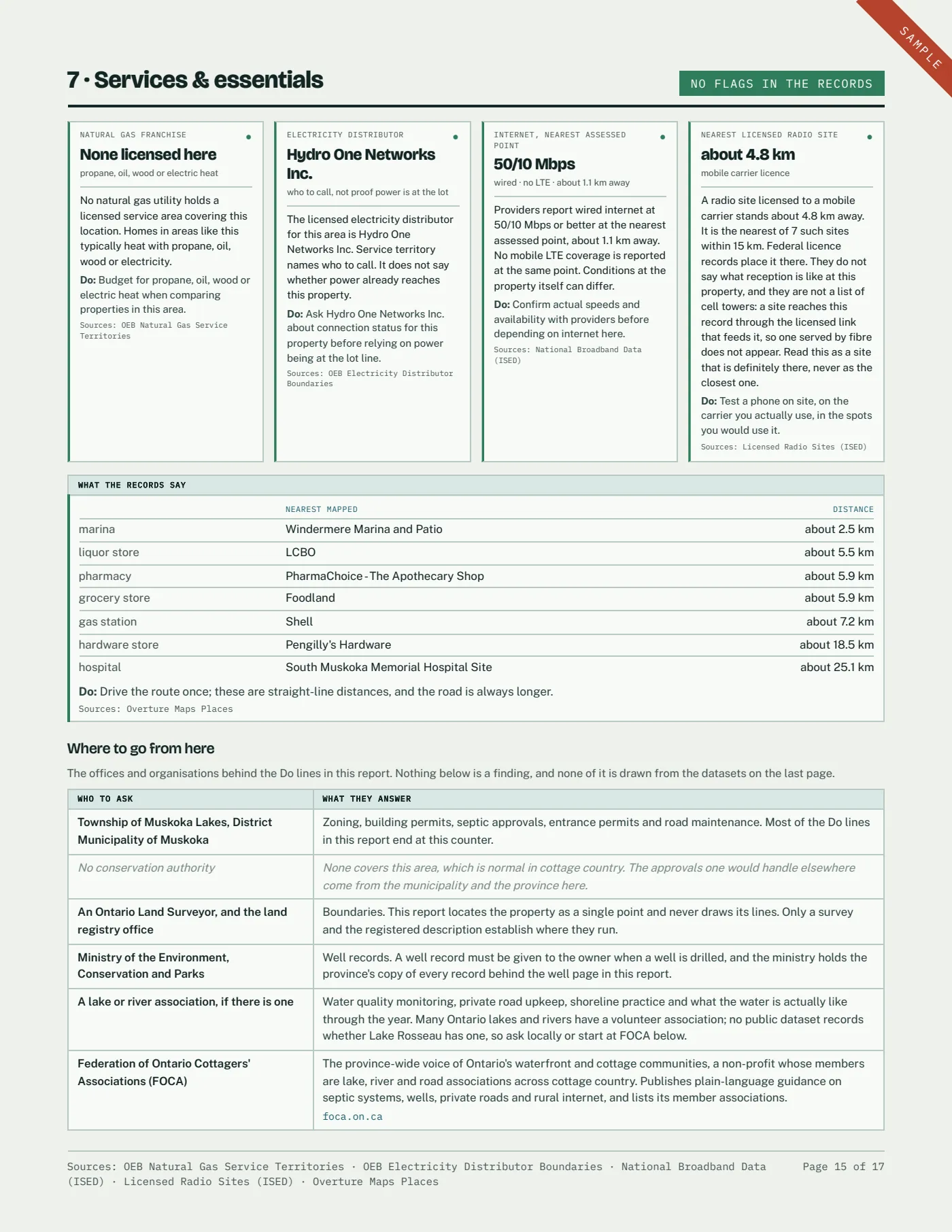
Services & essentials
Which utilities are licensed to serve the area, what providers report for wired internet and mobile coverage, and how far the nearest grocery, fuel, pharmacy and hospital are.
The property from above
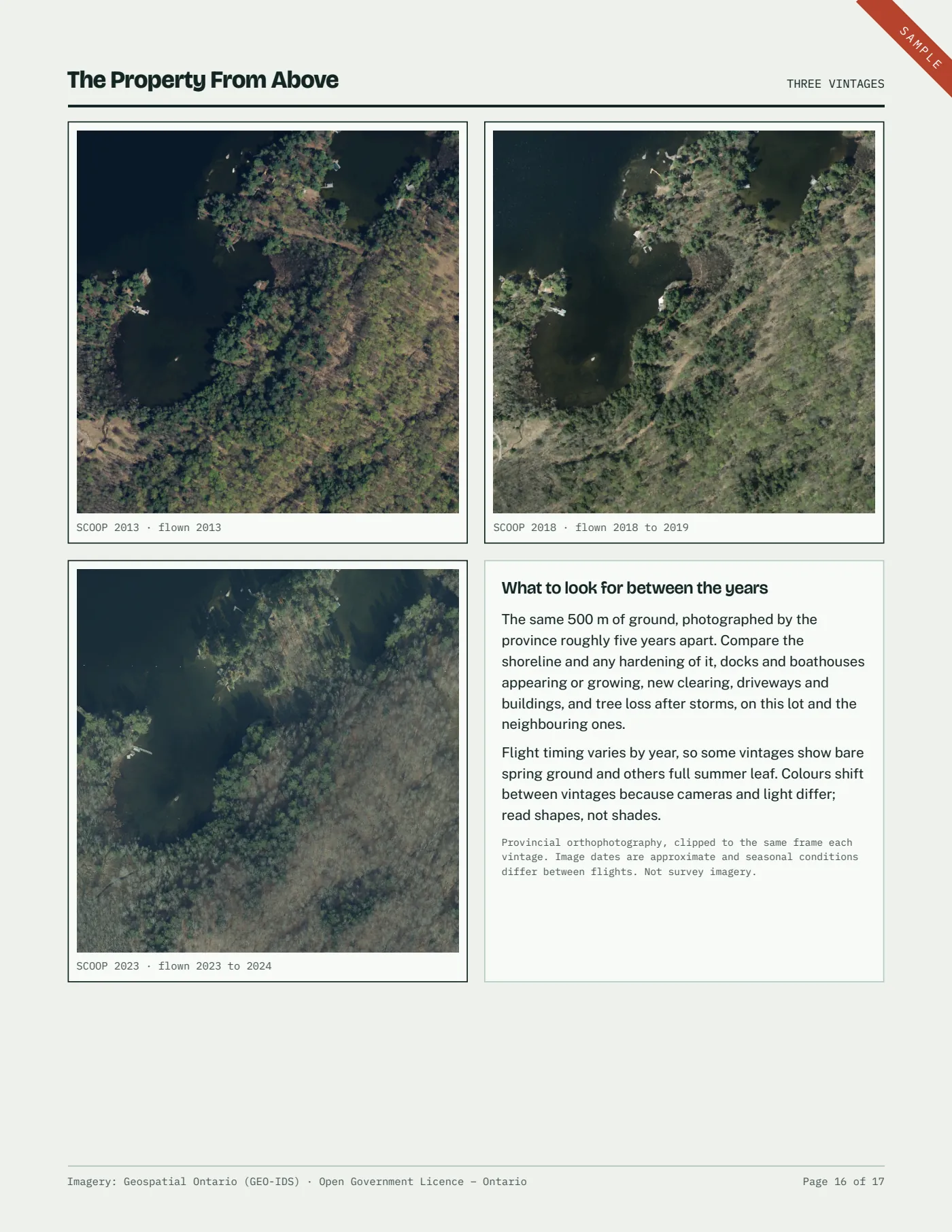
The same 500 m of ground in up to three provincial air photo vintages, flown about five years apart, and what to look for between them.
Sources and limits
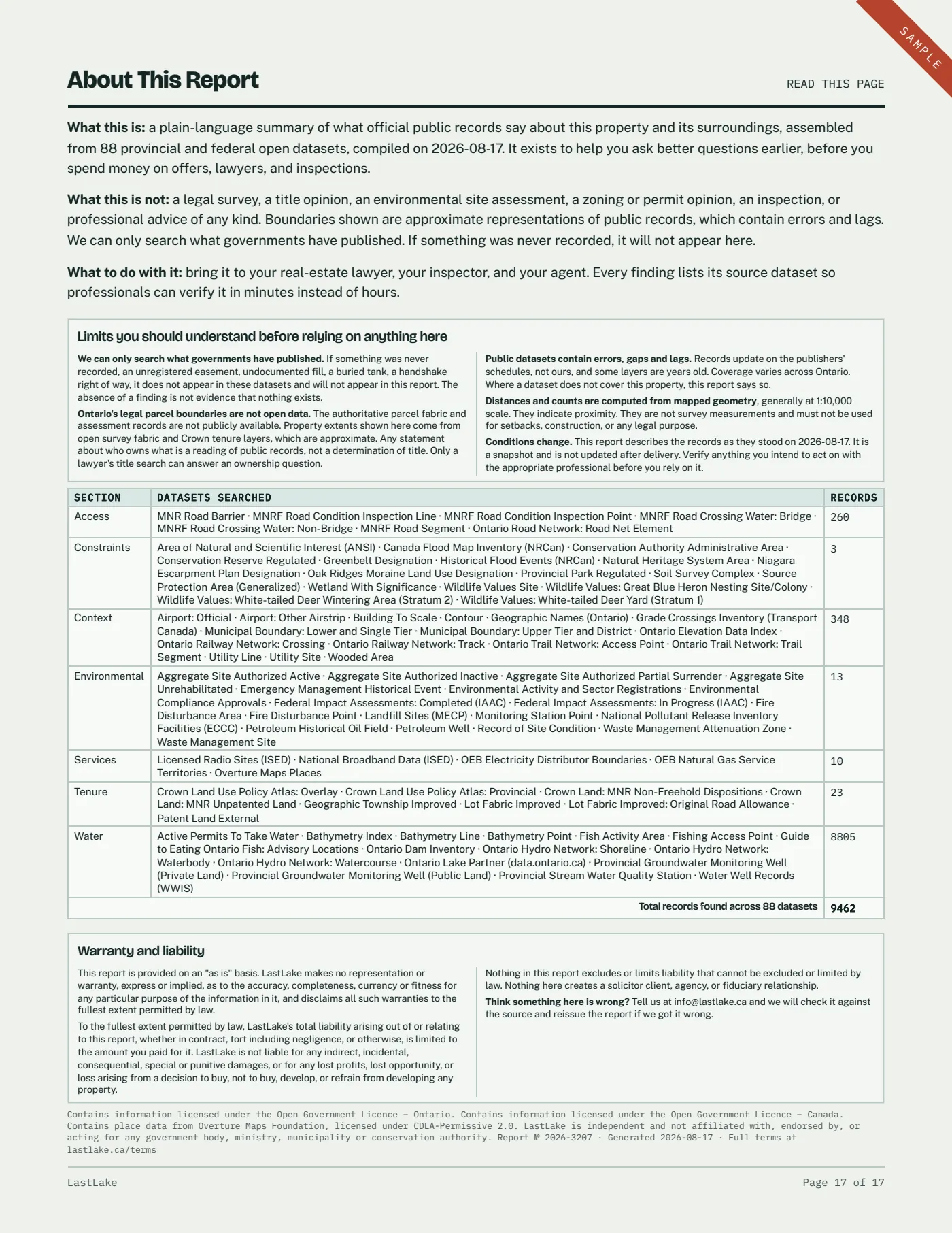
Every dataset we searched, with how many records each returned. A service that was unreachable the day we ran it is listed as unavailable, never counted as nothing found.
Sections 05 to 07 appear where the records do: the well sheet needs a logged water supply nearby, the depth sheet needs water the province has surveyed, and the water record needs a monitoring site on that lake. Where one of them is missing, the report says so on the page that would have carried it. It is part of why a report runs fourteen to twenty-one pages rather than a fixed number.
Examples from finished reports
Four reports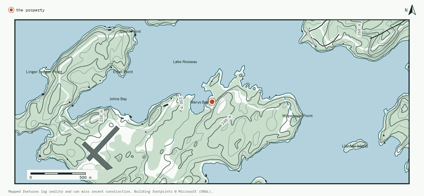
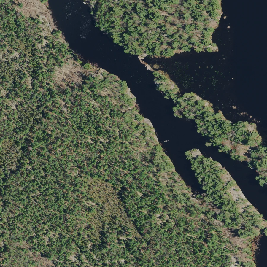
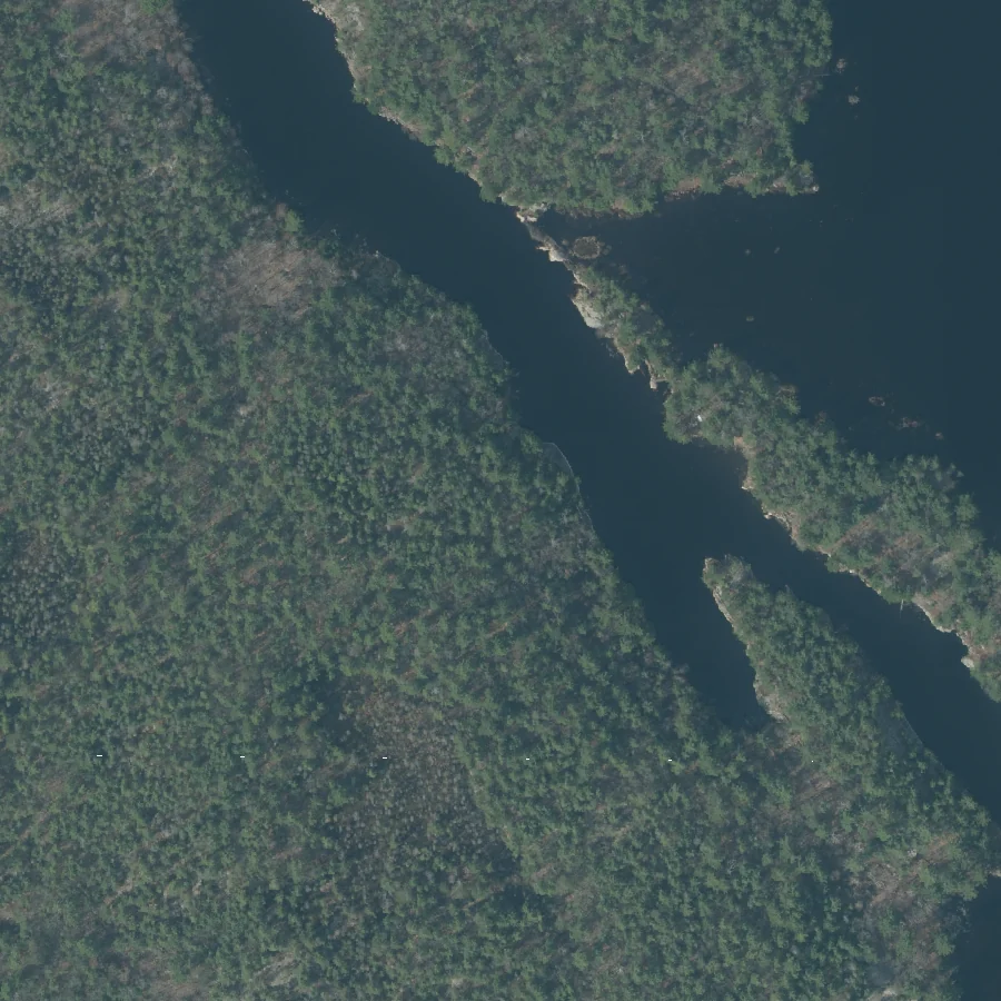
The same ground, photographed by the province about five years apart, so you can see what changed. Shoreline and any hardening of it, docks and boathouses appearing or growing, new clearing, driveways and buildings, tree loss after storms.
Read a full sample report, all 17 pages Lake Rosseau · exactly as delivered
This is the Lake Rosseau sample report, every page, stamped as a sample. Every report is written fresh from that property’s own records, so yours will differ wherever the records do: a different lake, different wells, different findings.
One price, one report
PricingLess than a tenth of a septic inspection, and about a thirtieth of the cheapest published Ontario land due diligence report. If it turns up nothing, you have the records that say so, in writing, with every source named.
| The next step, if you take it | Typical Ontario cost |
|---|---|
| Home inspection | $400 to $700 |
| Septic inspection | $150 to $500 |
| Rural boundary survey | $1,500 to $2,200 |
| Planning due diligence report | $2,500 and up |
LastLake does not replace a survey, a title search, an inspection or a planning opinion. It comes first, and tells you which of them are worth paying for on this particular property.
For professionals
Agents · inspectorsRural and waterfront files turn on things no listing sheet, inspection form or title search was built to hold. What the Crown has recorded along the shoreline, how far the nearest mapped road actually is, what the province has mapped on the back half of the lot. You already know to ask. LastLake is how you get it in writing within a business day, with a source line under every finding, instead of a week inside provincial portals.
If you expect to order more than the occasional report, get in touch. We will work out an arrangement that fits how your office runs.
Pull one while a file is live
Order it early on a purchase, or run a listing before you go live so you know what the records hold. Your client reads plain language, their lawyer reads the source line under it.
Know the site before you drive out
Wetlands, mapped water crossings, well records and how the site is reached all shape what you look at on the day and what you flag afterward. Attach the report as an appendix and your findings sit beside the records that back them up.
Who makes these
About
Dillon Koolhaas
I have spent most of my life reading maps, professionally and otherwise, and have never lost interest in them. Seventeen years in civil engineering has taken me through land development projects, design, construction, estimating, road safety, traffic signals and data management. Different work, same habit: find the record that answers the question, then check it against what is actually on the ground.
LastLake exists because the information is already public and almost nobody can get at it. Ontario publishes hundreds of map layers for free, but finding the handful that matter to one property means hours of clicking through portals that were not built for someone with an offer deadline. I go through them so you do not have to.
Fair questions
FAQHow fast do I get it?
One business day for anywhere in Ontario, often sooner. The clock starts when you confirm the location on the map, not when you order, so we are never counting time spent waiting on a pin. If your deadline is tomorrow morning, say so in the order notes and we will move you up.
Is this a survey or a title search?
No. It is a summary of published government records. Ontario’s legal parcel boundaries are not open data, so the property is shown as a point rather than an outline. Your lawyer still confirms title, and a surveyor still draws the line. This tells you where to point them first.
What if the property is not on water?
That works too. Every report covers nearby well records, watercourses and water quality monitoring, whether or not there is a lake. Waterfront properties also get depth contours off the frontage, dams and the nearest federal water level gauge.
What if the report finds nothing wrong?
Then you have six green lights and a document with every source named on it. Most reports come back mostly green, which is exactly the point. Green means nothing turned up in the records searched, which is not the same as nothing existing, and the report says so on its own face.
Can my agent or lawyer order it for me?
Yes. Put their email in the order and we will send it to both of you. If you expect to order often, get in touch and we will sort something out.
What if you cannot find the property?
Some rural addresses are hard to pin down. We will email you to confirm the location on a map, and if we still cannot match it, we refund your payment in full and no report is issued. You never end up paying for a report we cannot write.
Tell us where it is. We will do the rest.
Give us an address, a lot and concession, or a pin on a map. You will get a confirmation right away and the finished report by email within one business day. Payment is a single $50 charge on Stripe’s secure page, and if we cannot match the location we refund you in full.