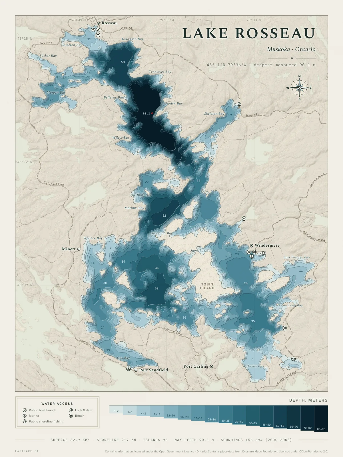
Every charted depth, on one sheet.
Each sheet is drawn from every depth the province has on record for the lake. The shoreline, the islands, the bays and the roads are taken from the same provincial surveys, so the shape of the water on the paper is the shape the surveys recorded.
24 lakes are drawn, with more on the way. Printed to order in four sizes and two colourways.
On the wall
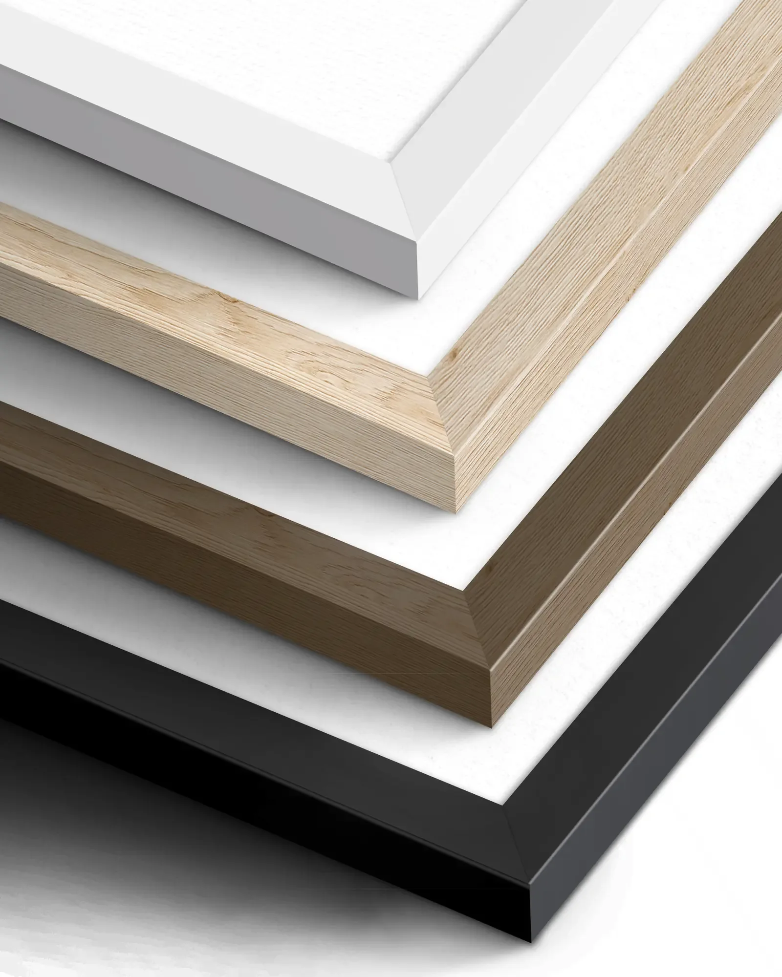
Framing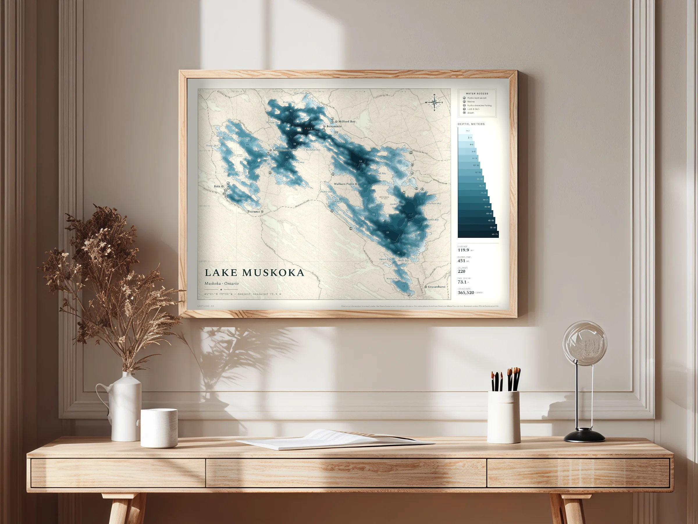
Each print is made to order. A framed print is supplied glazed, behind a wide mat, ready to hang or to stand on a shelf. An unframed print is supplied rolled, for framing elsewhere.
Frame finishes
- White
- Light wood
- Dark wood
- Black
What is drawn
The sheetSurveyed depths
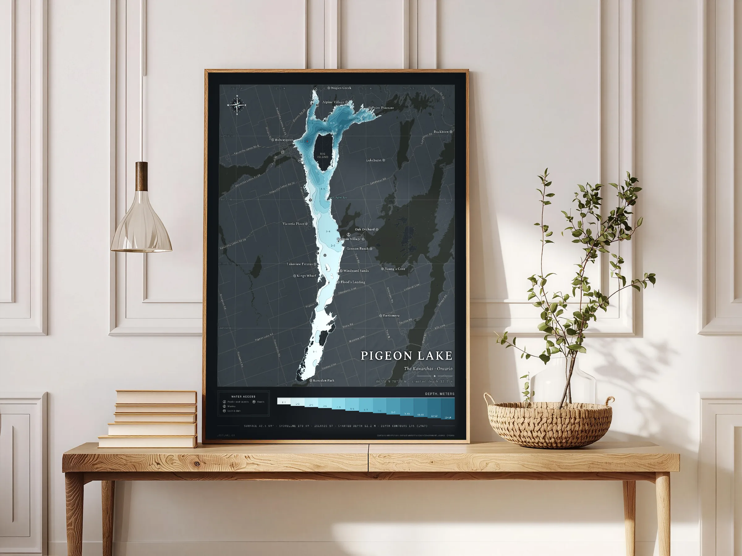
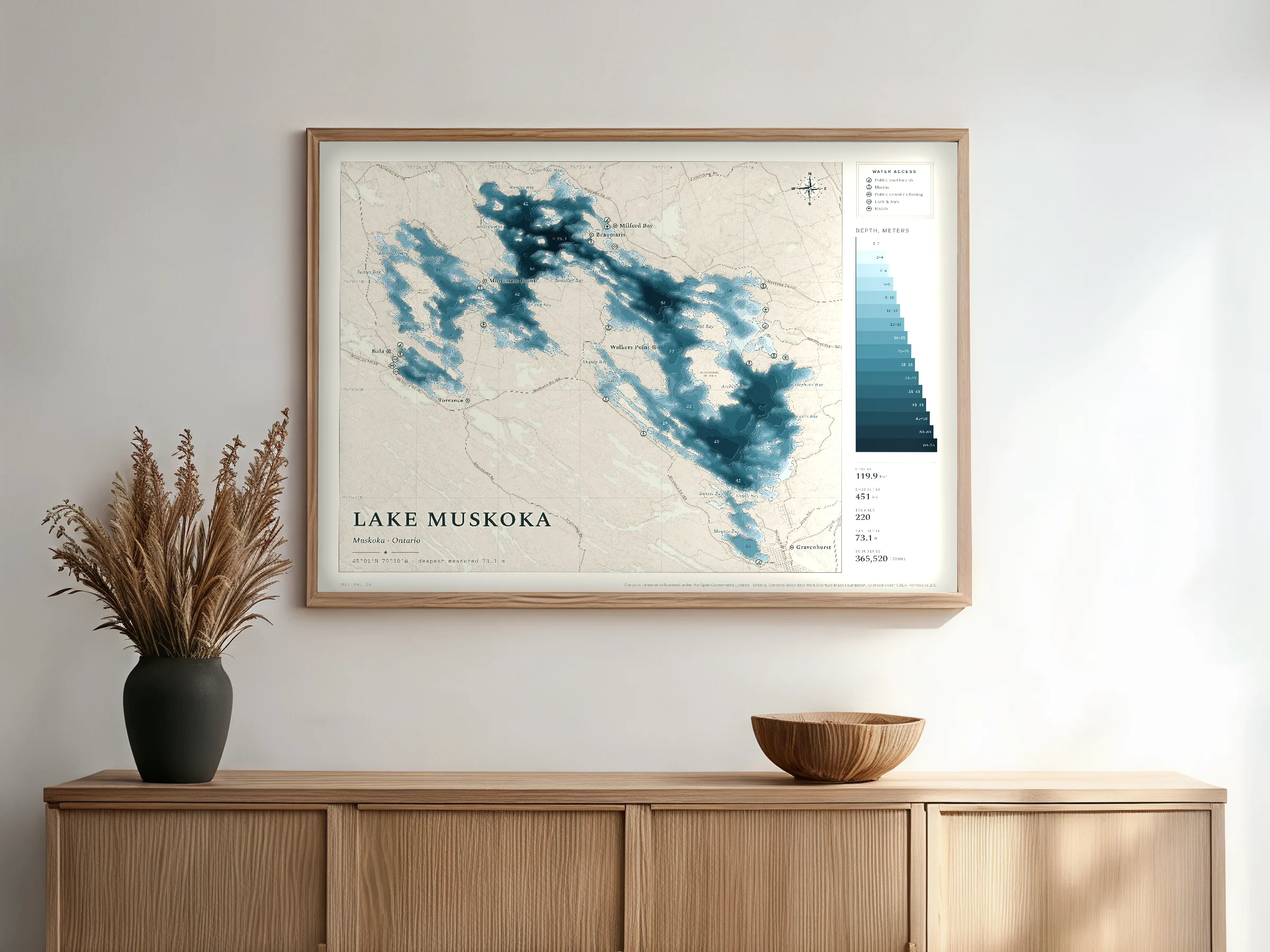
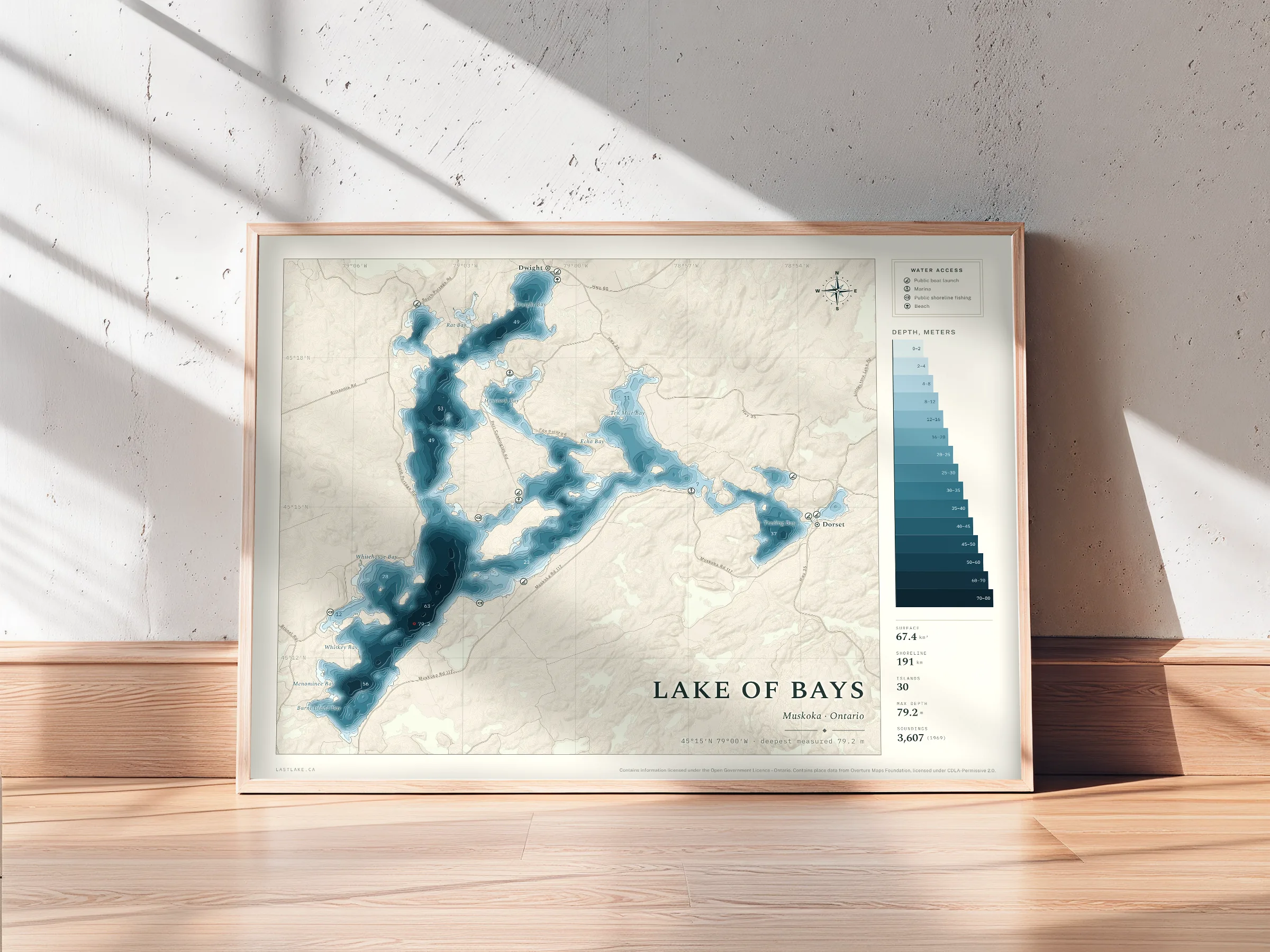
The depth bands are drawn from the province’s own depth records for the lake, so the shape of the deep water is the shape the survey recorded. The deepest reading on the lake is marked in red at the position it was taken, with its depth printed beside it.
Names and roads
Bays, islands, points and towns are named from Geographic Names Ontario, and the roads are drawn from the province’s road network. Every label is placed by measurement, and a name that cannot be set legibly at the printed size is left off.
Drawn to be printed
The sheet is laid out at 18 by 24 inches and keeps the same proportion at every size from 12 by 16 to 30 by 40, so no size is cropped or bordered. The lettering is part of the drawing and prints sharp at every size.
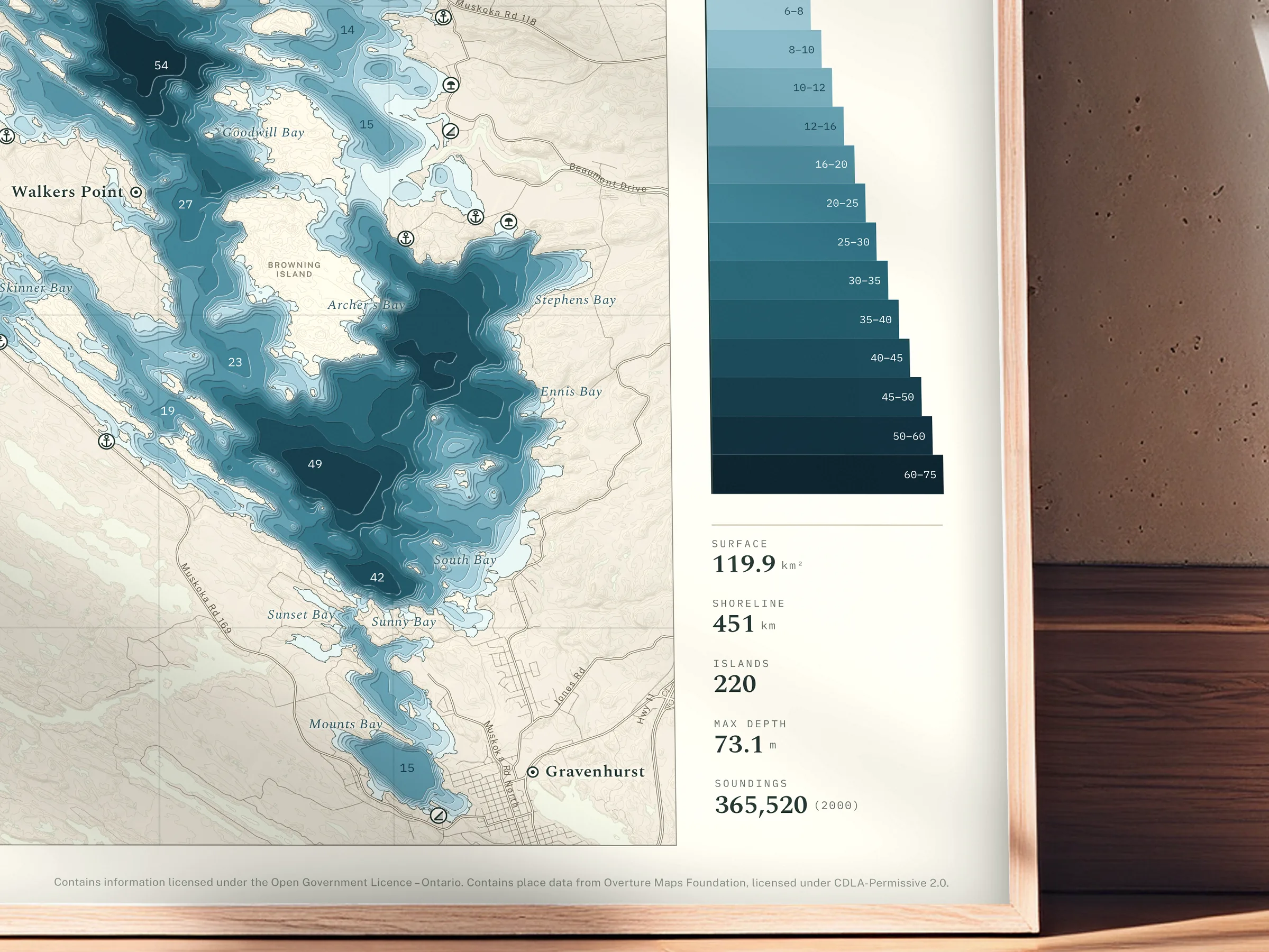
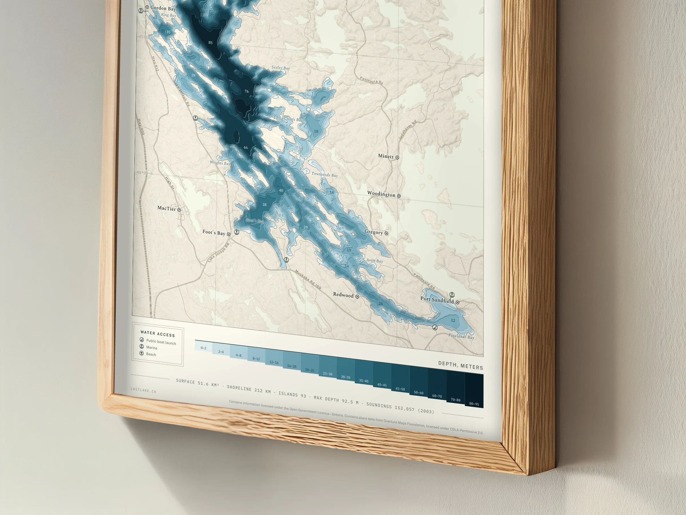
Public access to the water is marked with badges, and each badge has the same meaning on every sheet. The badges are compiled for each lake from the province’s own access registers, and each one records a place the province lists.
Public boat launch
A boat ramp, from the province's fishing access register. The record notes no fee.
Marina
A marina: fuel, docking, service, or moorage. A marina is a business, so each one is confirmed before it is drawn.
Public shoreline fishing
A public place to reach the water on foot, often a dock or the end of a road. The record describes no ramp.
Lock & dam
A lock or a dam: water held back, or a boat lifted past it.
Beach
A beach named by the province. The record is a place name, and describes neither the sand nor the bottom.
The lakes
24 drawnEach lake is drawn once and checked by eye before it is offered. The figures under each lake are read from that lake’s own sheet.
All 24 lakes
Largest first within each region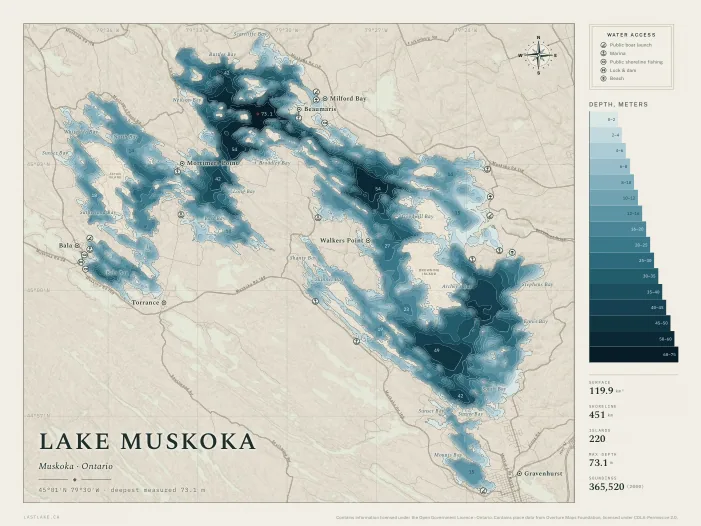
Lake Muskoka
Muskoka, OntarioTwenty-two kilometres of water from Gravenhurst to Bala, two hundred and twenty islands, and a shoreline that runs longer than the drive around it.
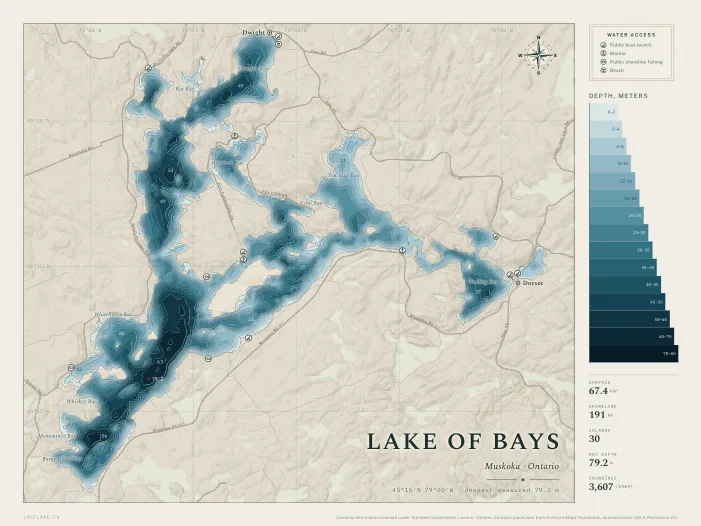
Lake of Bays
Muskoka, OntarioA hundred and ninety kilometres of shoreline folded into bays, with Dorset at one end and Dwight at the other.
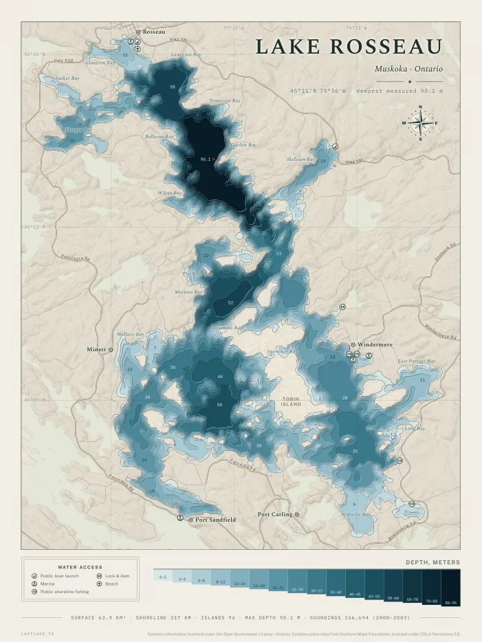
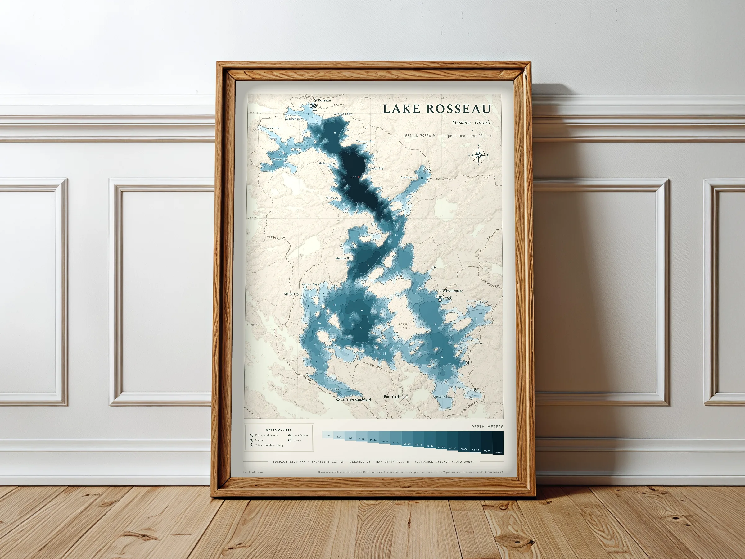
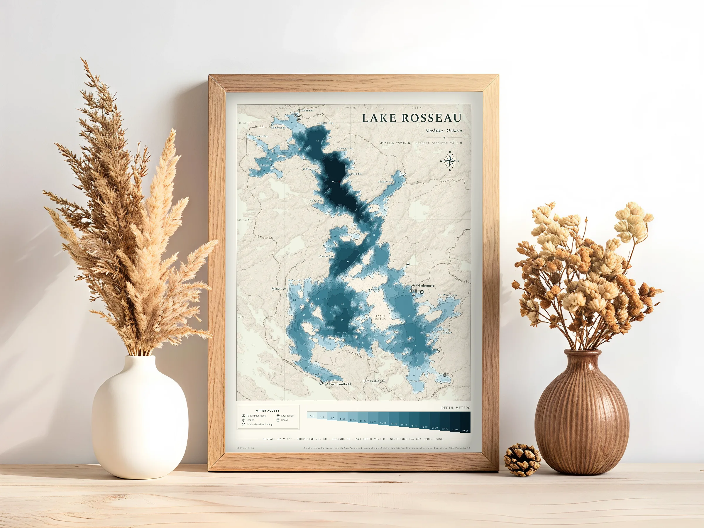
Lake Rosseau
Muskoka, OntarioNinety metres of water through the middle, ninety-six islands, and the locks at Port Carling on the way out.
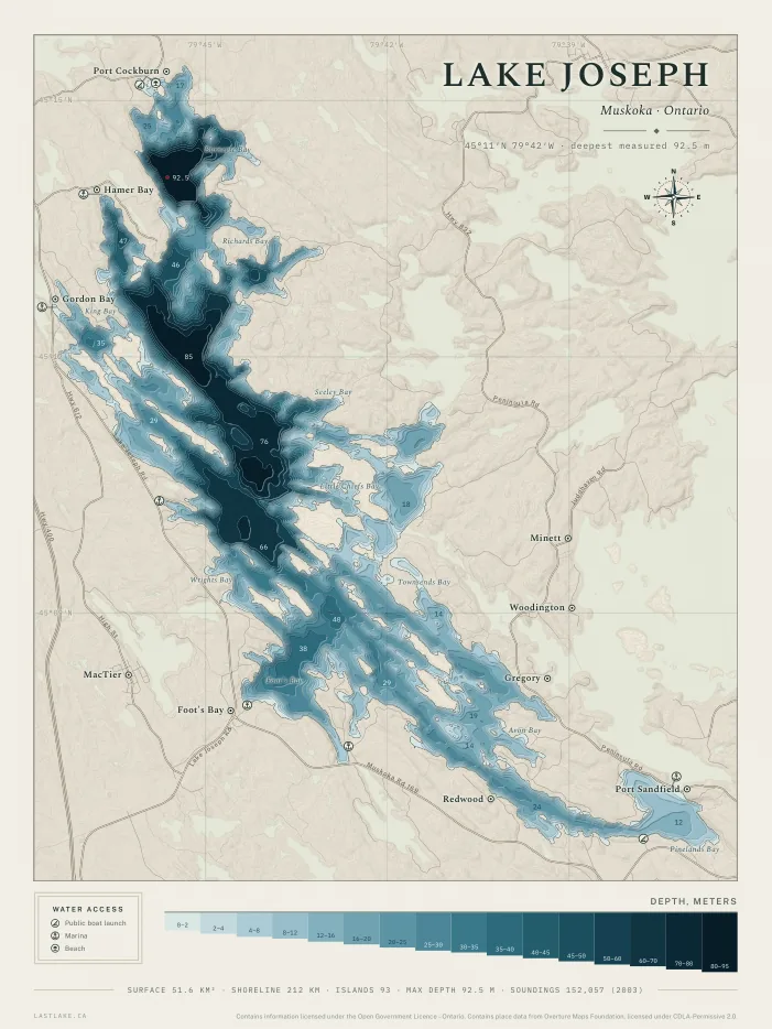
Lake Joseph
Muskoka, OntarioNinety-two metres at the deepest sounding, and ninety-three islands from MacTier down to Foot's Bay.
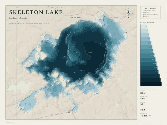
Skeleton Lake
Muskoka, OntarioEighty metres of water inside twenty square kilometres. Thirty islands and a shoreline that barely wanders.
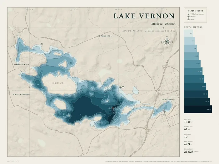
Lake Vernon
Muskoka, OntarioThe west end of the Huntsville chain, running out past Hunters Bay toward Ravenscliffe. Big Island sits in the middle of it.
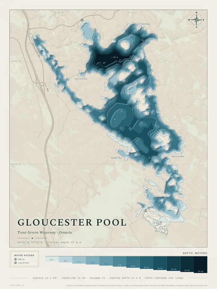
Gloucester Pool
Muskoka, OntarioNinety-one islands inside twelve square kilometres, at the foot of the Severn where the marine railway carries boats over at Big Chute.
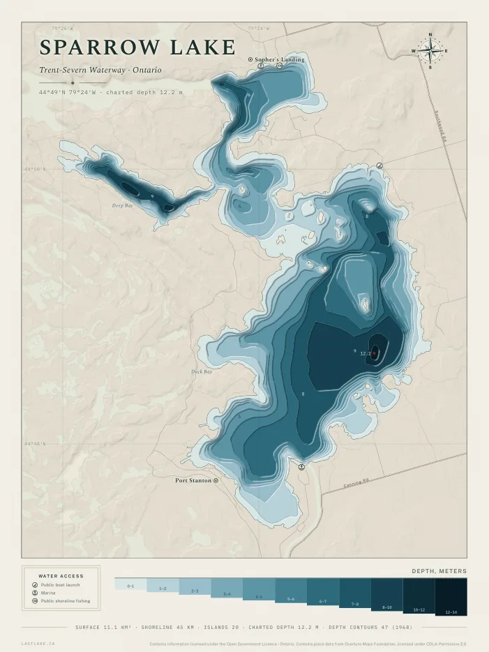
Sparrow Lake
Muskoka, OntarioShallow water throughout, twelve metres at the deepest charted contour, on the Severn at Port Stanton.
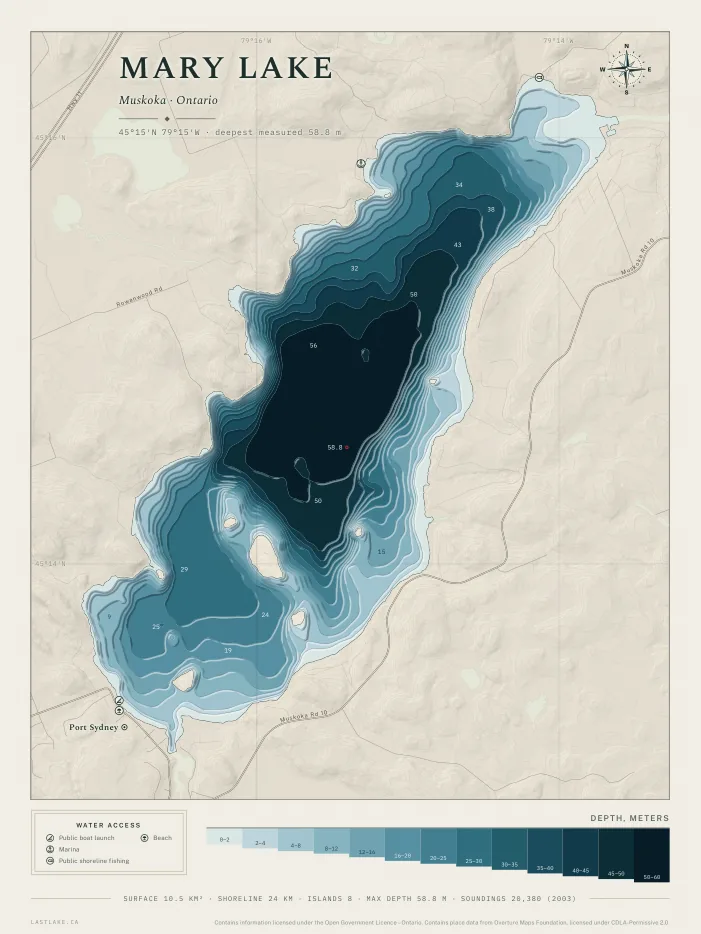
Mary Lake
Muskoka, OntarioPort Sydney at the south end, and nearly sixty metres of water in a lake you can see straight across.
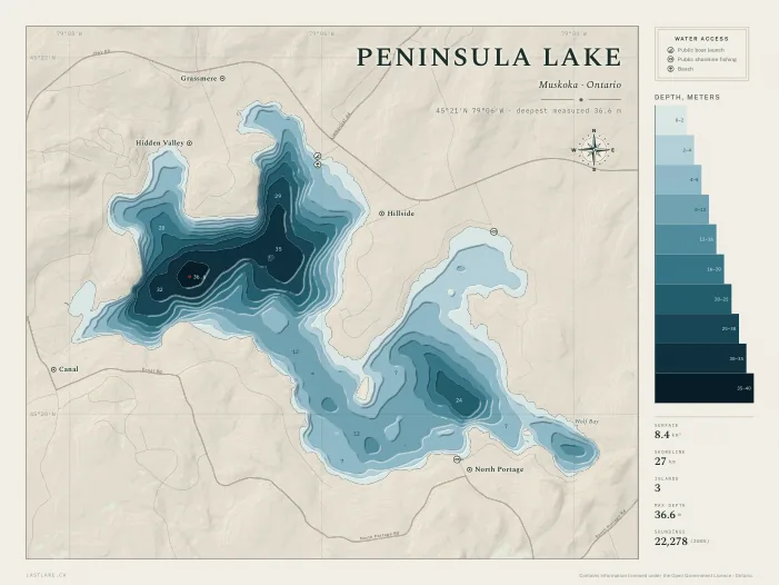
Peninsula Lake
Muskoka, OntarioJoined to Fairy by the cut at North Portage, with Hidden Valley along the north shore. The shallowest link in the Huntsville chain.
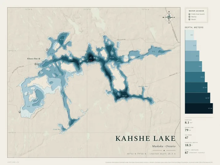
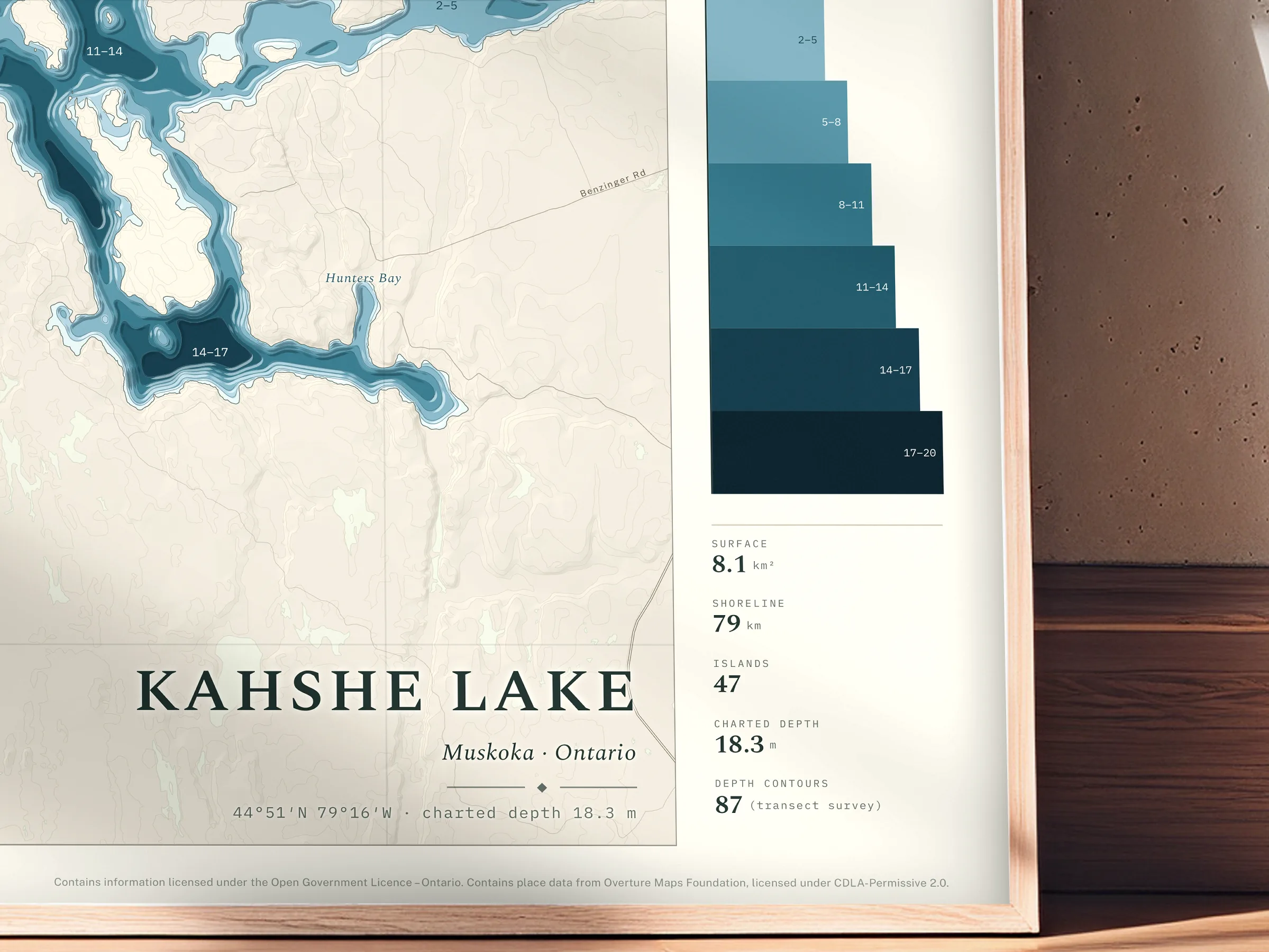
Kahshe Lake
Muskoka, OntarioForty-seven islands and nothing deeper than eighteen metres, so the shape is all bays and narrows.
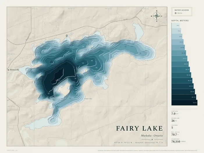
Fairy Lake
Muskoka, OntarioHuntsville stands on its shore, and the town's own water goes seventy metres down. Small on the map and a long way under.
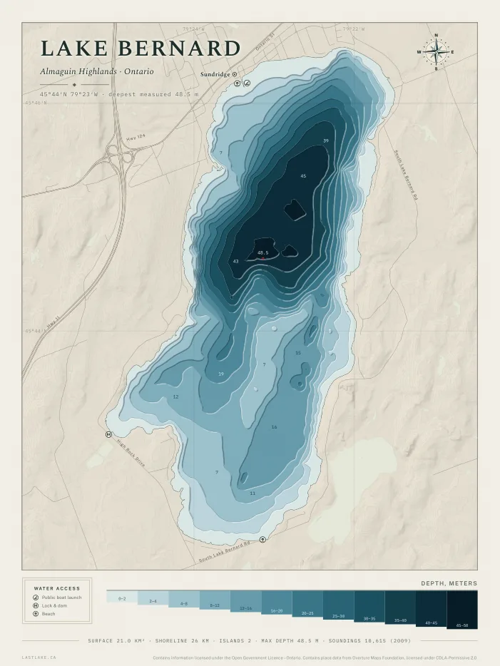
Lake Bernard
Parry Sound District, OntarioSundridge on the shore, one open basin to 48 metres at its middle, and lake trout water the province still stocks each year. Long, open water.
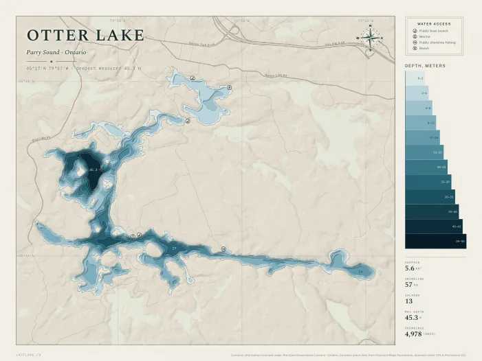
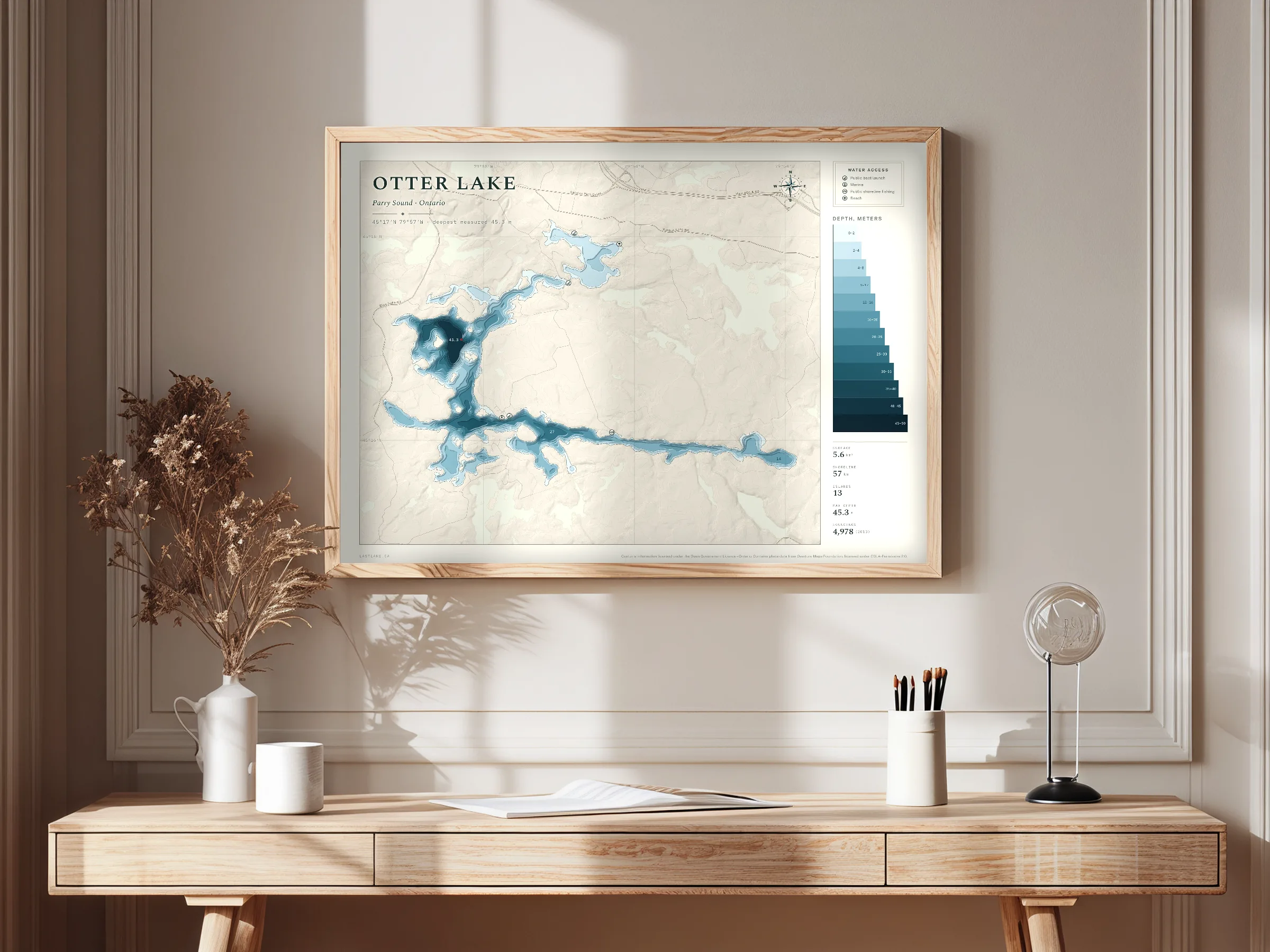
Otter Lake
Parry Sound District, OntarioSmall, deep and quiet, west of the highway in Parry Sound District. Forty-five metres inside five and a half square kilometres.
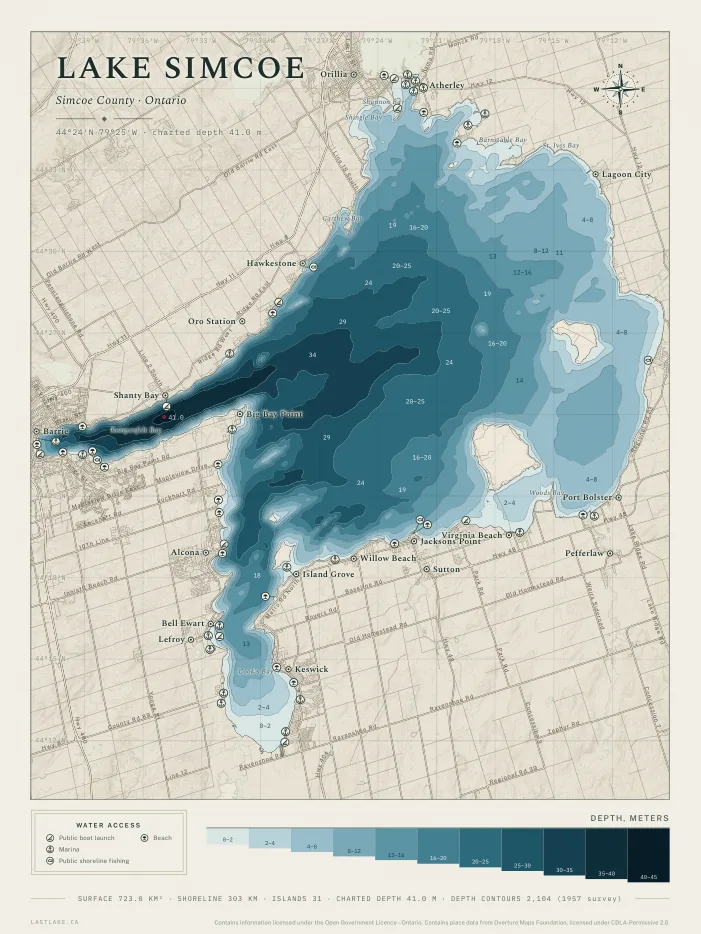
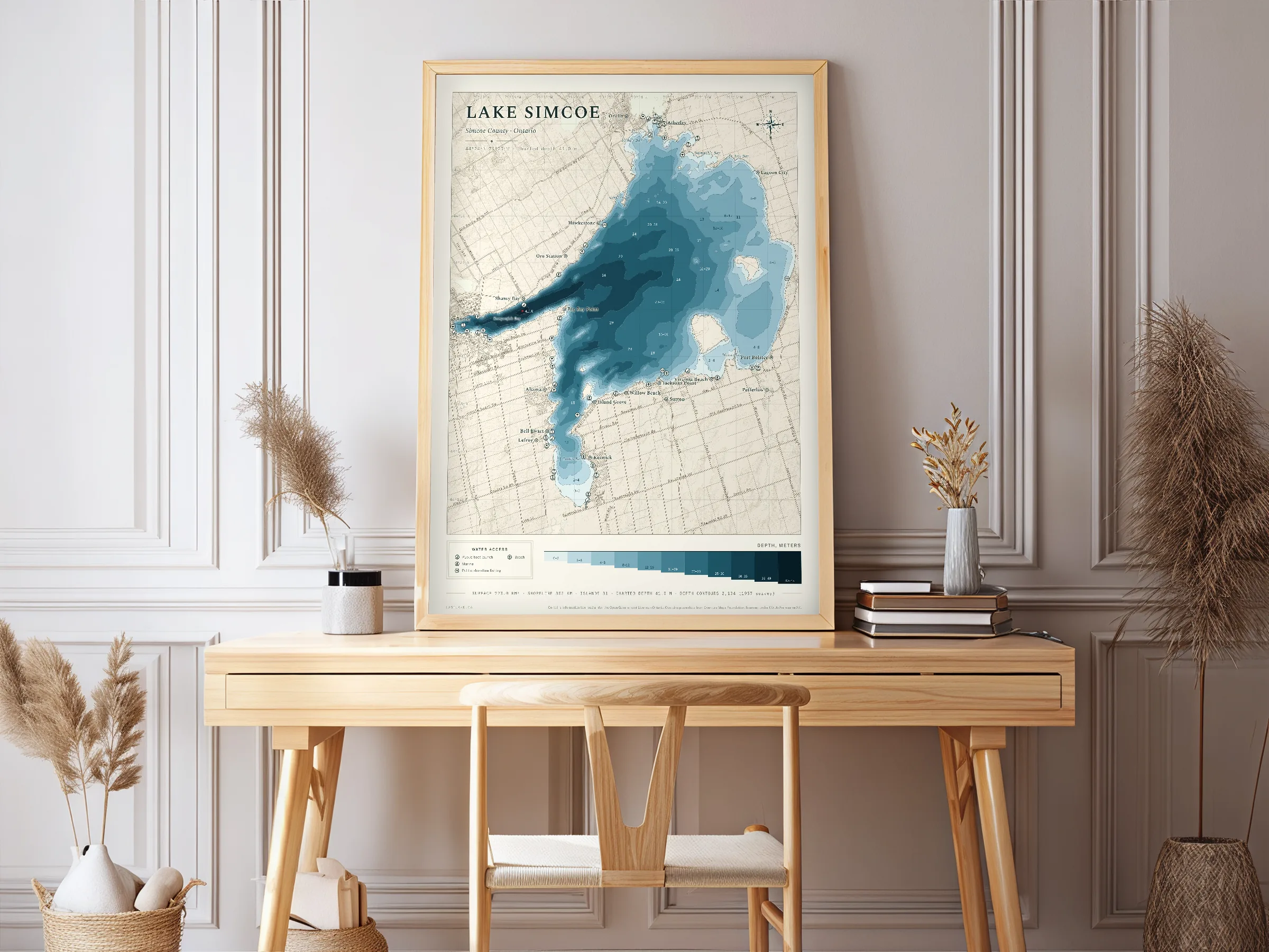
Lake Simcoe
Simcoe County, York and Durham, OntarioBarrie and Orillia on its shores, Kempenfelt Bay falling to 41 meters on the 1957 chart, and the province's own temperature and oxygen record kept at fixed stations since 1980. The largest lake on the catalogue.
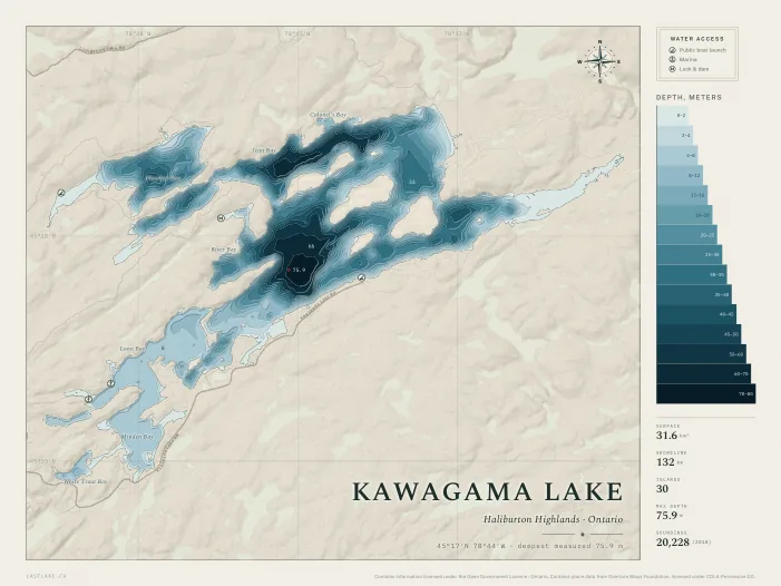
Kawagama Lake
Haliburton County, OntarioThe largest lake in Haliburton County. Seventy-six metres at the deepest sounding, thirty islands, and a hundred and thirty-two kilometres of shoreline wound into bays, with Dorset a few minutes off the west end.
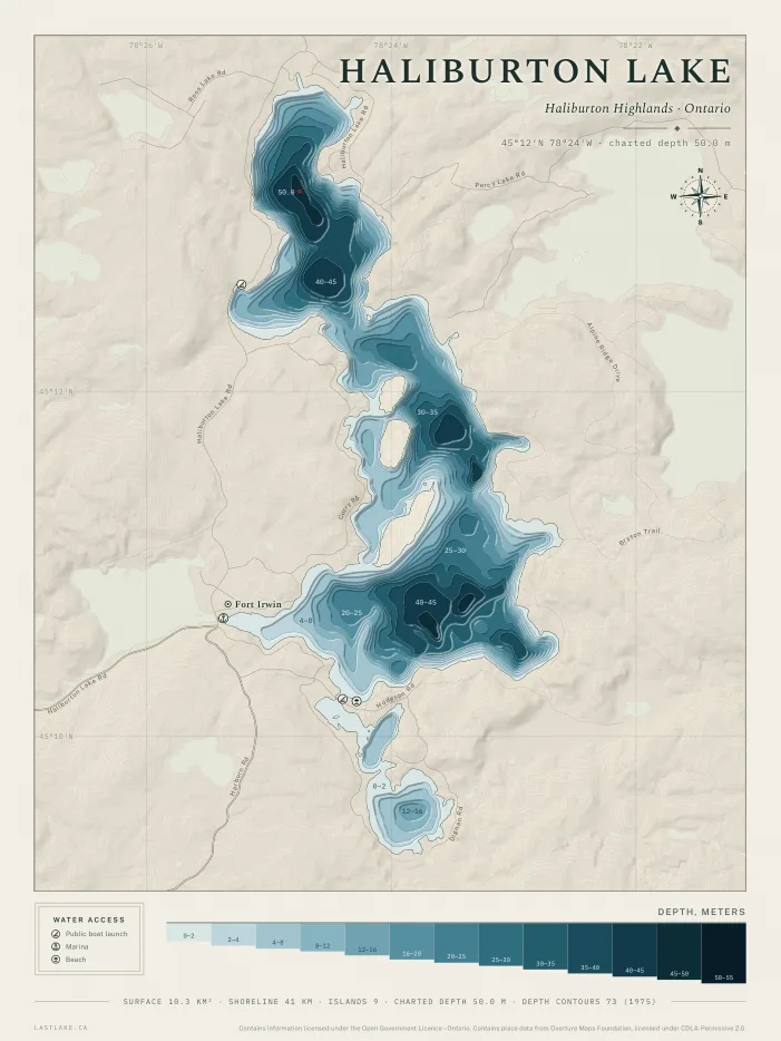
Haliburton Lake
Haliburton County, OntarioNine islands and a charted depth of 50 metres, from the province's 1975 survey. Cold water, with eleven lake trout spawning shoals and 18 species in Ontario's aquatic resource record.
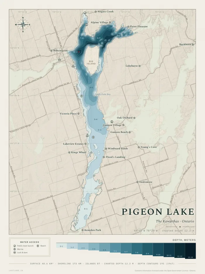
Pigeon Lake
Kawartha Lakes and Peterborough County, OntarioEighty-seven islands and a charted depth of 12.2 metres, from the province's 1967 survey, with Big Island filling the north basin. The Trent-Severn Waterway enters from Sturgeon Lake at Bobcaygeon and leaves for Buckhorn Lake through Gannons Narrows, and half of the lake's water is less than two metres deep.
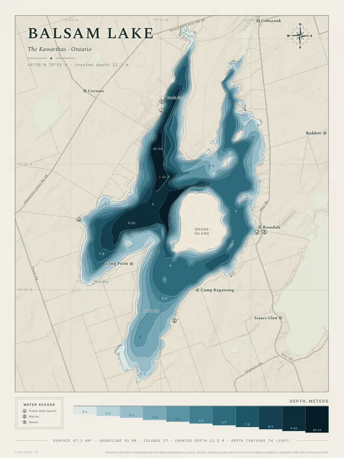
Balsam Lake
Kawartha Lakes, OntarioTwenty-seven islands and nothing deeper than twelve metres on the 1967 chart, with Grand Island filling the middle. The summit of the Trent-Severn Waterway, where the water divides east for the Kawarthas and west for Lake Simcoe.
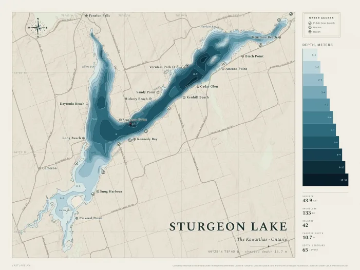
Sturgeon Lake
Kawartha Lakes, OntarioForty-two islands and a charted depth of 10.7 metres, from the province's 1965 survey. The Trent-Severn Waterway runs the length of the lake between the Fenelon Falls lock and Bobcaygeon, and the Scugog River enters from Lindsay at the south-west end.
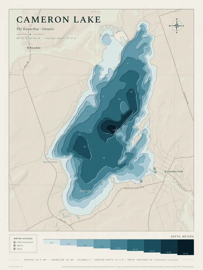
Cameron Lake
Kawartha Lakes, OntarioFive islands and a charted depth of 17.1 metres, from a transect survey the province records without a year. The Trent-Severn Waterway crosses it between the Rosedale lock and Fenelon Falls, where the water descends to Sturgeon Lake.
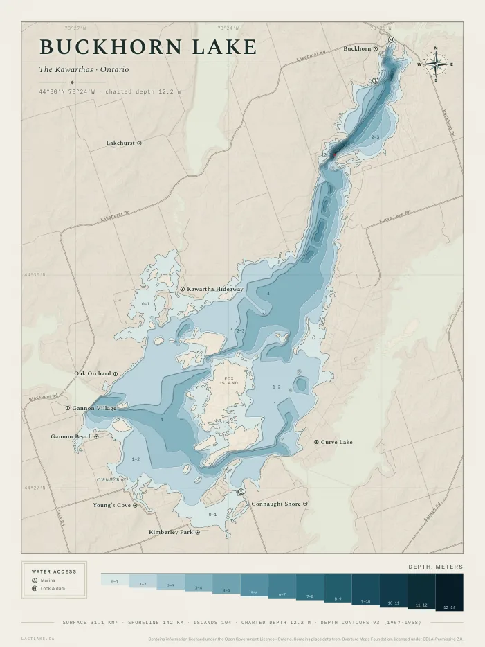
Buckhorn Lake
Peterborough County, OntarioA hundred and four islands and a charted depth of 12.2 metres, from the province's 1967 survey, in the narrows below Buckhorn where the lake drains to Lower Buckhorn Lake. The Trent-Severn Waterway enters from Pigeon Lake through Gannons Narrows and leaves through Lock 31 at Buckhorn, and Curve Lake First Nation holds the peninsula on the east shore between this lake and Chemong Lake.
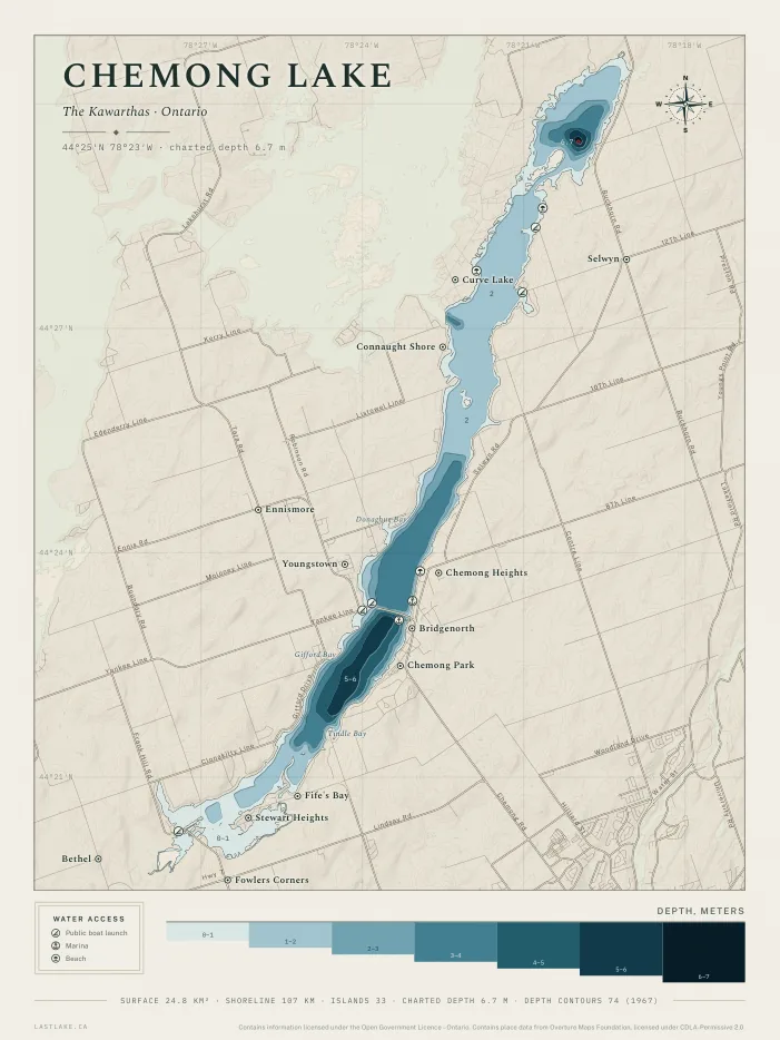
Chemong Lake
Peterborough County, OntarioThirty-three islands and a charted depth of 6.7 metres, from the province's 1967 survey, in the basin at the north end of the upper lake. The province publishes the water under two names, Chemong Lake below the narrows and Upper Chemong Lake above them, and the sheet draws both as one lake. The causeway carries County Road 14 across the water at Bridgenorth, and Curve Lake First Nation holds the west shore of the upper lake.
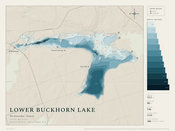
Lower Buckhorn Lake
Peterborough County, OntarioA hundred and thirty-six islands and a charted depth of 11.0 metres, from a transect survey the province records without a year. The Trent-Severn Waterway enters through Lock 31 at Buckhorn and leaves through Lock 30 at Lovesick, where federal dams cross the channels around Wolf Island. Deer Bay reaches south from the main channel and holds the broadest deep water on the sheet.
Not on the list?
Several thousand Ontario lakes have been surveyed for depth, very nearly every lake with cottages on it among them. A lake not on the list can be requested by email, and whether it can be drawn is confirmed before any payment.
Colourways
two palettesThe same drawing, in two palettes. Each palette is checked for contrast, so that land is distinct from the water beside it and deeper water is distinct from shallower. Birchbark is the original.
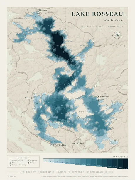 birchbark
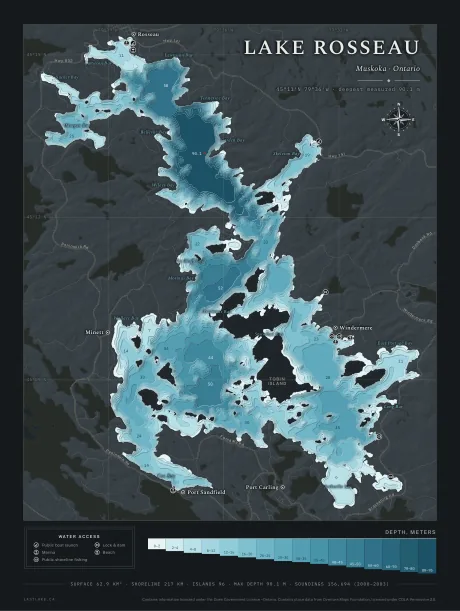 midnight
The red ring on the deepest point is printed on every sheet in every colourway, and is the only red on the paper.
Marking a place
Personalization · $17.50 CADThe sheet is a record of the lake, and it can carry up to three marks of your own, each with its own shape, its own colour and its own lettering. Each mark is placed at the order page and shown on the sheet at print size before payment.
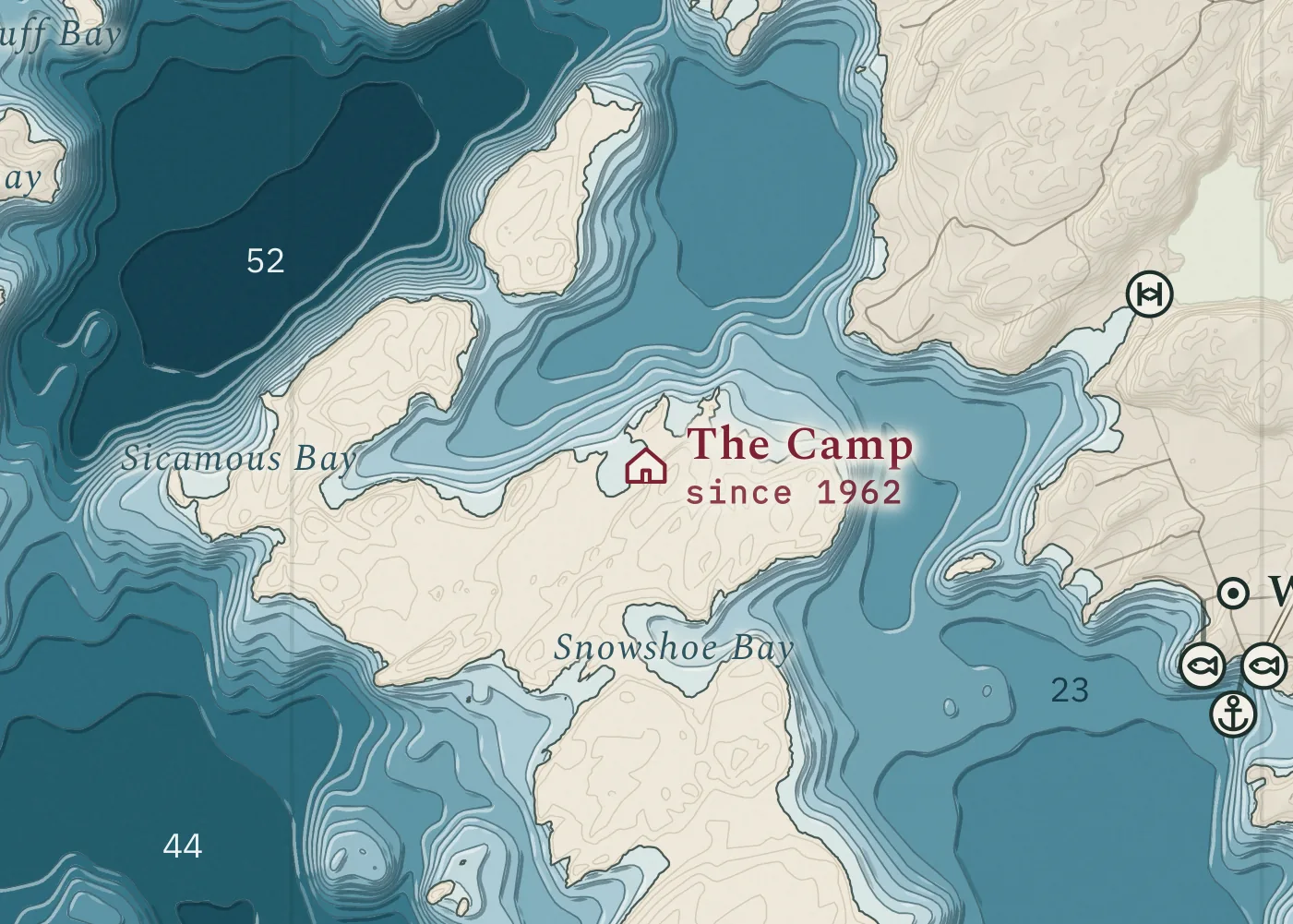
How it works
- 01A pin is dropped on the place, found by searching for a nearby road, bay or town, or by clicking the map.
- 02The wording is typed in. A second line, for a year or a family name, is optional.
- 03The mark is shown on the lake’s own sheet at the size it prints, before payment.
- 04The marks travel with the order. Where the tool could not give the fit wanted, the order can still be placed and the adjustment requested by email. The adjusted sheet is sent back for approval.
Where a mark would fall on a name the map already carries, its label is set just clear of the name and a fine line joins the label to the exact position. The position itself is not moved.
Five shapes, in one size: a mark prints 6.45 mm across on the 18 by 24 inch sheet and scales with the paper. Each shape is filled with the paper’s own colour and then outlined, so it is legible over the palest shallows and the deepest water alike. The monogram holds one or two letters.
Five inks, each shown on every paper the sheet is printed on. Each ink has its own value on birchbark and midnight, so a mark legible on the pale sheet is legible on the dark one. Every value is measured for contrast against the paper it sits on and against the red ring on the deepest point.
Six lettering styles, each taken from a face the sheet already uses, so the wording is set in the same type as the map’s own names. The specimens are shown larger than they print, because at true size on a screen one face cannot be told from another.
the face the sheet names its towns in
the italic it names bays and channels in
the tracked capitals it names islands in
the mono its depth figures are set in
the lake's own title, in miniature
no borrowed register, the sheet's plain face
Sizes and prices
Print to orderThe four sizes are the same drawing at the same proportion. The sheet was laid out for 18 by 24 inches.
Prices are before tax and include postage anywhere in Canada. 30 x 40 in is printed unframed only.
Looking at a property on the water?
Depth is one record out of many. The Rural and Cottage Buyer’s Report gathers what the public record holds about one specific address: shore road allowance, road access, wells, flood mapping, Crown land, wetlands and more, read and checked by a person before it is sent.
Questions
FAQWhich lakes can be drawn?
Several thousand Ontario lakes have been surveyed for depth, very nearly every lake with cottages on it among them. A lake not on the list can be requested by email, and whether it can be drawn is confirmed before any payment.
How is this different from a decorative lake print?
The depth bands are drawn from measurements. Every depth figure on the sheet is a sounding recorded on the water, and the deepest is marked where it was recorded. The names and the roads are taken from the province’s own registers.
Is it a navigation chart?
No. The sheet is a wall map. Depths are interpolated between soundings, shoals move, and nothing on the sheet is surveyed to a navigational standard.
Which size is the sheet laid out for?
The drawing is laid out for 18 by 24 inches. Every size from 12 by 16 to 30 by 40 is the same proportion, so the map is identical at each and the choice is one of wall space.
Can a place be added to the sheet?
Yes, as a paid extra. The place is pinned on a map at the order page, the wording is typed in, and the mark is shown on the lake’s own sheet before payment. Where the tool could not give the fit wanted, the adjustment can be requested by email after ordering, and the adjusted sheet is sent back for approval. Marking a place shows the shapes, the colours and the lettering.
Are other colours available?
Not at present. Each palette is checked for contrast before it is offered, and a one-off colour is not checked, so none is offered.
How does it arrive, and how long does it take?
An unframed print is posted rolled in a rigid tube, a framed print flat in a box, and the digital file is sent by email as a download. Prints are posted within Canada with postage included in the price. Delivery and returns states the delivery period and the replacement of a damaged parcel.
Where does the data come from?
Ontario’s open geodata: the hydrographic network for the shoreline and the islands, the bathymetry survey for the depths, Geographic Names Ontario for the names, and the road network for the roads. The licence line is at the foot of the sheet and at the foot of this page.
Printed to order.
Every lake above is drawn and ready to print. The size, the framing and the colourway are chosen at the order page, where the total is shown before payment. Prints are posted anywhere in Canada, with postage included in the price.
Order a printWhat an order sets
- 01The lake, from those already drawn.
- 02The size, framed or unframed.
- 03The colourway, from birchbark and midnight.
- 04A mark of your own, if wanted, and the digital file alongside the print.
A lake map is a wall map. It is not a navigation chart: depths are interpolated between recorded soundings and are not surveyed to a navigational standard, and water levels, shoals and shorelines change. A lake map is not to be navigated by.
A water access badge records a place listed in the province’s registers. The absence of a badge does not mean there is no access.
A mark ordered on a sheet is a label on a map. It is not a boundary, a lot line, or a statement about who owns any land or water.