Boat Launches on Ontario Lakes
Public boat launches and shoreline access points in the province’s Fishing Access Point register, counted by county and district, and the launches, marinas, beaches and locks marked on 25 Ontario lakes. Ownership, fees and parking as the register records them, and where each operator publishes its own rules.
Last updated 2026-09-28
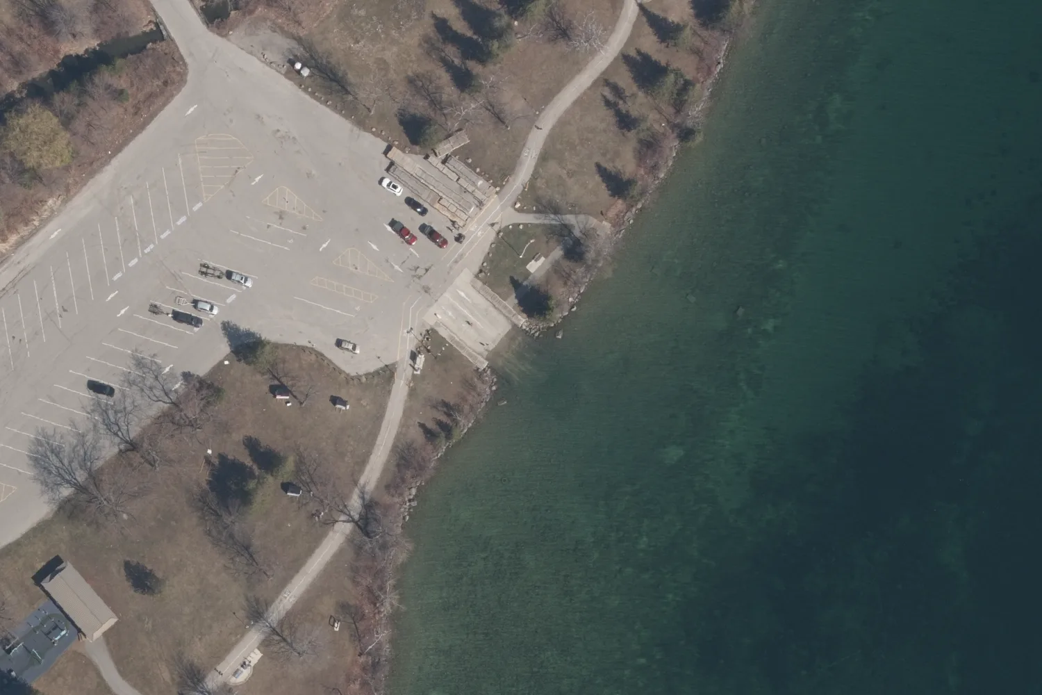
- Boat launches in the register
- 2,207Fishing Access Point register, read September 28, 2026
- Shoreline access points
- 22053 of them with a dock or a pier
- Launches on municipal land
- 364279 provincial, 118 private, 8 federal
- Launches with parking recorded
- 7031,385 with no parking entry
- Lakes tabled below
- 25 lakes57 boat launches marked on them
- Counties and districts tabled
- 44with the regions and single-tier municipalities
Public Boat Launches in Ontario
Ontario’s Fishing Access Point register holds 2,207 boat launches and 220 shoreline access points across the province. The Ministry of Natural Resources keeps the register for Fish ON-Line, the province’s online fishing map, and publishes it as open data.
Each record is one point in one of three classes. A boat launch is a site where a boat can be launched into the water. Enhanced shoreline access is a shore built up for access, with a dock or a pier. Shoreline access is an unimproved place on the shore, recorded for anglers fishing from it. Beside the class, a record holds a site name, the ownership of the land, the surface of the launch, whether parking and a user fee were recorded, whether the site is accessible to people with disabilities, and the date the site was last confirmed visited.
| Class | What a record marks | Records | Parking: yes | User fee: yes | User fee: no |
|---|---|---|---|---|---|
| Boat launch | A site where a boat can be launched into the water | 2,207 | 703 | 68 | 523 |
| Enhanced shoreline access | A shore built up for access, with a dock or a pier | 53 | 28 | 1 | 45 |
| Shoreline access | An unimproved place on the shore, recorded for fishing | 167 | 85 | 6 | 142 |
Most of those fields are filled for a minority of sites. The register gives the surface of 208 launches as concrete, 159 as gravel and 161 as natural shore, and leaves 1,641 unrecorded. It marks 108 launches as accessible to people with disabilities and 136 as not accessible. Site names are held for 1,754 of the 2,427 records.
Who Owns Boat Launches in Ontario
The register records the ownership of the land at each site as federal, provincial, municipal or private. Of its boat launches, 364 are on municipal land, 279 on provincial land, 118 on private land and 8 on federal land, and 1,438 have no ownership recorded.
Municipal Launches
Municipal land holds 364 of the register’s launches, 99 of them in Parry Sound District, 82 in Muskoka and 75 in Haliburton County. Fees, hours and parking rules at a municipal launch are set by the municipality.
Provincial Launches
Provincial land holds 279 launches, 207 of them in the ten territorial districts of the north. A launch inside a provincial park falls under the park’s own permits and rules.
Federal Launches and the Canal Locks
The register records eight launches on federal land. The Trent-Severn Waterway and the Rideau Canal are national historic sites operated by Parks Canada, and Parks Canada’s fee schedule for each lists fees for lockage, for mooring and for launching a boat.
Private Launches and Marinas
Private land holds 118 launches in the register, among them launches at marinas and resorts. A private launch is open on its owner’s terms.
Boat Launches by County and District
The largest counts in the register are in the northern districts: 425 boat launches in Algoma District, 417 in Thunder Bay District and 242 in Kenora District. Parry Sound District holds 137, Muskoka 101 and Haliburton County 101.
Each record is counted in the county, district, region or single-tier municipality its point falls in, on the province’s municipal boundaries. The table lists all 44. Of them, thirteen are single-tier municipalities that belong to no county, such as Kawartha Lakes and Prince Edward County.
| County, district or region | Boat launches | Land ownership of the launches | Shoreline access |
|---|---|---|---|
| Algoma District | 425 | 31 municipal · 17 provincial · 3 private · 374 not recorded | 27 |
| Thunder Bay District | 417 | 11 provincial · 1 private · 405 not recorded | 2 |
| Kenora District | 242 | 12 municipal · 86 provincial · 2 private · 142 not recorded | 42 |
| Parry Sound District | 137 | 99 municipal · 26 provincial · 1 federal · 6 private · 5 not recorded | 22 |
| Haliburton County | 101 | 75 municipal · 7 provincial · 1 private · 18 not recorded | 18 |
| Muskoka | 101 | 82 municipal · 2 provincial · 1 federal · 13 private · 3 not recorded | 54 |
| Frontenac County | 97 | 42 provincial · 55 not recorded | 0 |
| Cochrane District | 87 | 2 municipal · 5 provincial · 1 private · 79 not recorded | 5 |
| Sudbury District | 80 | 29 provincial · 4 private · 47 not recorded | 12 |
| Nipissing District | 65 | 14 municipal · 11 provincial · 40 not recorded | 2 |
| Rainy River District | 54 | 8 municipal · 14 provincial · 18 private · 14 not recorded | 0 |
| Peterborough County | 49 | 3 municipal · 4 federal · 3 private · 39 not recorded | 1 |
| Kawartha Lakessingle-tier municipality | 35 | 5 municipal · 3 provincial · 1 private · 26 not recorded | 3 |
| Timiskaming District | 32 | 2 municipal · 8 provincial · 2 private · 20 not recorded | 4 |
| Hastings County | 30 | 1 provincial · 29 not recorded | 0 |
| Renfrew County | 30 | 1 municipal · 2 provincial · 4 private · 23 not recorded | 0 |
| Northumberland County | 26 | 7 municipal · 3 private · 16 not recorded | 0 |
| Lennox and Addington County | 25 | 1 provincial · 1 federal · 23 not recorded | 0 |
| Norfolk Countysingle-tier municipality | 22 | 13 private · 9 not recorded | 1 |
| Simcoe County | 20 | 11 municipal · 4 provincial · 5 not recorded | 0 |
| York Region | 17 | 1 provincial · 16 private | 2 |
| Durham Region | 12 | 8 private · 4 not recorded | 1 |
| Prince Edward Countysingle-tier municipality | 12 | 1 provincial · 11 not recorded | 0 |
| Bruce County | 11 | 1 municipal · 1 provincial · 3 private · 6 not recorded | 0 |
| Niagara Region | 10 | 10 not recorded | 0 |
| Lanark County | 9 | 2 municipal · 7 provincial | 5 |
| Grey County | 8 | 1 municipal · 1 private · 6 not recorded | 0 |
| Peterboroughsingle-tier municipality | 7 | 2 municipal · 1 federal · 4 not recorded | 3 |
| Haldimand Countysingle-tier municipality | 6 | 2 private · 4 not recorded | 0 |
| Kingstonsingle-tier municipality | 6 | 6 not recorded | 0 |
| Quinte Westsingle-tier municipality | 6 | 2 municipal · 4 not recorded | 0 |
| Torontosingle-tier municipality | 5 | 1 municipal · 3 private · 1 not recorded | 15 |
| Stormont, Dundas and Glengarry | 4 | 3 private · 1 not recorded | 0 |
| Halton Region | 3 | 3 private | 0 |
| Leeds and Grenville | 3 | 2 municipal · 1 not recorded | 0 |
| Bellevillesingle-tier municipality | 2 | 2 not recorded | 0 |
| Elgin County | 2 | 2 not recorded | 0 |
| Hamiltonsingle-tier municipality | 2 | 2 not recorded | 0 |
| Manitoulin District | 2 | 1 private · 1 not recorded | 0 |
| Orilliasingle-tier municipality | 1 | 1 municipal | 0 |
| Ottawasingle-tier municipality | 1 | 1 not recorded | 0 |
| Peel Region | 1 | 1 private | 1 |
| Pembrokesingle-tier municipality | 1 | 1 private | 0 |
| Waterloo Region | 1 | 1 private | 0 |
Boat Launches by Lake
The table below counts the access points marked on 25 Ontario lakes, each read against its own shore: 57 boat launches, 21 shoreline access points, 76 marinas, 43 beaches and 13 locks and dams. Launch names are the register’s own where it gives one.
Muskoka Boat Launches
The province’s register holds 101 boat launches in Muskoka: 82 are on municipal land, 13 on private land, 2 on provincial land and 1 on federal land, and 3 have no ownership recorded. Among the lakes tabled, launches are marked on Lake of Bays (seven); Lake Muskoka (four); Kahshe Lake, Lake Joseph, Lake Rosseau and Lake Vernon (two each); and Mary Lake, Peninsula Lake, Skeleton Lake and Sparrow Lake (one each). On Mary Lake, Port Sydney Beach is an operator entry.
Kawartha Lakes Boat Launches
The province’s register holds 35 boat launches in Kawartha Lakes: 5 are on municipal land, 3 on provincial land and 1 on private land, and 26 have no ownership recorded. Among the lakes tabled, launches are marked on Sturgeon Lake (Kawartha Lakes) (seven); Balsam Lake (three); and Cameron Lake and Pigeon Lake (one each). On Sturgeon Lake, Scotch Line Boat Launch and Southview Estates Boat Launch are operator entries.
Peterborough County Boat Launches
The province’s register holds 49 boat launches in Peterborough County: 4 are on federal land, 3 on municipal land and 3 on private land, and 39 have no ownership recorded. Among the lakes tabled, launches are marked on Chemong Lake (five).
Haliburton County Boat Launches
The province’s register holds 101 boat launches in Haliburton County: 75 are on municipal land, 7 on provincial land and 1 on private land, and 18 have no ownership recorded. Among the lakes tabled, launches are marked on Haliburton Lake and Kawagama Lake (two each). On Haliburton Lake, Haliburton Lake Boat Launch is an operator entry.
Parry Sound Boat Launches
The province’s register holds 137 boat launches in Parry Sound District: 99 are on municipal land, 26 on provincial land, 6 on private land and 1 on federal land, and 5 have no ownership recorded. Among the lakes tabled, launches are marked on Otter Lake (Parry Sound District) (three) and Lake Bernard (one).
Leeds and Grenville Boat Launches
The province’s register holds three boat launches in Leeds and Grenville: two are on municipal land, and one has no ownership recorded. The table below lists the access points marked on Charleston Lake.
Lake Simcoe Boat Launches
Lake Simcoe lies across Simcoe County, York Region and Durham Region. The province’s register holds twenty boat launches in Simcoe County, seventeen in York Region and twelve in Durham Region. Nine boat launches are marked on the lake: Barrie, Tiffin Street area ramp; Bell Ewart; City of Orillia, Collins Drive; Cook's Bay, south end; Innisfil Beach Park ramp; Oro-Medonte ramp near Parkside Beach; Shannon Bay narrows; Shanty Bay; and Sibbald Point Park. Four of them are operator entries, and the other five are the register’s. The lake also has 22 marinas and 19 beaches marked.
| Lake | Boat launches | Shoreline access | Marinas | Beaches | Locks and dams |
|---|---|---|---|---|---|
| Muskoka | |||||
| Lake of Bays | 7Dorset · Dwight Beach · MTO Dorset · Norway Point Park · Port Cunnington · Rabbit Bay · South Portage | 3 | 3 | 1 | – |
| Lake Muskoka | 4George Road · Gravenhurst Wharf · Milford Bay · Weismiller St., Bala | 3 | 10 | 3 | 1 |
| Kahshe Lake | 2Kahshe Lake · Kluey's Bay Landing | – | 1 | 1 | – |
| Lake Joseph | 2Appian Way · Centennial Beach | – | 6 | 1 | – |
| Lake Rosseau | 2Rosseau · Skeleton Bay | 4 | 4 | 1 | 1 |
| Lake Vernon | 2Avery Beach Park · Hutcheson Beach | – | 1 | 2 | – |
| Mary Lake | 1Port Sydney Beach (operator entry) | 1 | 1 | 1 | – |
| Peninsula Lake | 1Tally Ho | 2 | – | 1 | – |
| Skeleton Lake | 1Road 3 | 2 | 1 | 1 | – |
| Sparrow Lake | 1Franklin Park | 1 | 2 | – | – |
| Fairy Lake | – | – | 1 | – | – |
| Gloucester Pool | – | – | 2 | – | 1 |
| Kawartha Lakes | |||||
| Sturgeon Lake (Kawartha Lakes) | 7Crane Bay Road · Pavillion Road · Scotch Line Boat Launch (operator entry) · Southview Estates Boat Launch (operator entry) · Unnamed register launch, Kennedy Bay · Unnamed register launch, Snug Harbour · West Street | – | 5 | 1 | – |
| Balsam Lake | 3Balsam Lake Drive · Balsam Lake Provincial Park · Coldstream Road | – | 2 | 1 | – |
| Cameron Lake | 1Fenelon Falls | – | 1 | 1 | – |
| Pigeon Lake | 1Bass Lake Rd | – | 3 | 2 | 2 |
| Peterborough County | |||||
| Chemong Lake | 512th Line · BEL Rotary Park · Cedarwood Lane · Chemong Causeway Northwest · Frank Hill Road | – | 2 | 3 | – |
| Buckhorn Lake | – | – | 2 | – | 1 |
| Lower Buckhorn Lake | – | – | 1 | – | 5 |
| Haliburton County | |||||
| Haliburton Lake | 2Haliburton Lake · Haliburton Lake Boat Launch (operator entry) | – | 1 | 1 | – |
| Kawagama Lake | 2Fletcher Bay · Kawagama Lake | – | 2 | – | 1 |
| Parry Sound District | |||||
| Otter Lake (Parry Sound District) | 3Little Otter Lake · Otter Lake · Otter Lake Narrows | 1 | 1 | 1 | – |
| Lake Bernard | 1Sundridge | – | – | 2 | 1 |
| Leeds and Grenville | |||||
| Charleston Lake† | – | – | 2 | – | – |
| Simcoe County | |||||
| Lake Simcoe | 9Barrie, Tiffin Street area ramp · Bell Ewart (operator entry) · City of Orillia, Collins Drive · Cook's Bay, south end (operator entry) · Innisfil Beach Park ramp · Oro-Medonte ramp near Parkside Beach · Shannon Bay narrows (operator entry) · Shanty Bay (operator entry) · Sibbald Point Park | 4 | 22 | 19 | – |
† On Charleston Lake, eight records are under review and not counted.
Marinas, Beaches and Locks
Ontario’s register has no class for a marina, and 64 of its records name one in the site name or comment. Of the 76 marinas marked on the lakes tabled, 62 come from the Overture Places dataset, an open dataset of places and businesses, 8 are records in the province’s register and 6 are operator entries.
Of the 43 beaches marked, 12 are named beaches in Ontario’s geographic names record, 6 come from the Overture Places dataset and 25 are operator entries.
Locks and Dams
A lock lifts a boat from one water level to the next. A dam holds the water back, and a boat has no passage through it. Locks and dams on the lakes tabled come from the Ontario Dam Inventory and the Ontario Hydro Network. The locks marked are Bobcaygeon Lock & Dam (Trent-Severn Lock 32) on Pigeon Lake; Buckhorn Lock & Dam (Trent-Severn Lock 31) on Buckhorn Lake and Lower Buckhorn Lake; and Lovesick Lock & Dam (Trent-Severn Lock 30) on Lower Buckhorn Lake.
Canoe and Kayak Launches
Ontario’s register has no separate class for a canoe or kayak launch. Seventy-five of its records name canoes, kayaks, cartop or small boats, or a hand launch in the site name or comment.
The 167 shoreline access records mark unimproved shore, 127 of them on natural ground, and the 53 enhanced shoreline access records mark a dock or a pier. Both classes were recorded for anglers fishing from shore, and the boat launch class covers any site where a boat is launched into the water.
Before Launching
Fees, Hours and Parking
The register records a user fee at 68 of its boat launches and no fee at 523, and holds no fee entry for the other 1,616. Parking is recorded at 703 launches and recorded as absent at 119. Fees, opening hours, permits and parking rules are set by whoever runs each launch and published on its own pages: the municipality for a town dock or a road-end ramp, Ontario Parks for a launch inside a provincial park, Parks Canada for the Trent-Severn Waterway and the Rideau Canal, and the business at a marina.
| Operator | What it publishes |
|---|---|
| Parks Canada, Trent-Severn Waterway | Lockage, mooring and boat launching fees on the waterway, by season. |
| Parks Canada, Rideau Canal | Lockage, mooring and boat launching fees on the canal, by season. |
| Ontario Parks | Permits, fees and rules in each provincial park. |
| The municipality | Town docks, public beaches and road-end ramps, on the municipality’s own website. |
Cleaning a Boat Between Lakes
Since January 1, 2022, Ontario’s regulation under the Invasive Species Act, 2015 has treated a boat as a carrier of invasive species. A boat, its equipment and the vehicle and trailer carrying it must be free of aquatic plants, animals and algae before arriving at a launch. Before a boat is moved overland, its drain plugs must be opened or removed and reasonable steps taken to remove any plants, animals and algae from the boat, its equipment, the vehicle and the trailer. The drain plug rule excludes drinking water, marine sanitary and closed engine cooling systems, and a livewell carrying live fish under a licence to transport them.
Where the Records Come From
The Fishing Access Point register dates from 2012, when the province built it for Fish ON-Line, and is still updated. Of the 2,427 records counted here, 1,580 were last changed in 2013 and 27 in 2026, the latest on September 4, 2026. A last-verified date, the day the site was last confirmed visited, is held for 468 records, 212 of them since 2020. The register is kept by the ministry’s Fish and Wildlife Policy Branch, and Fish ON-Line shows it on a map of the province.
The lake lists draw on four further records: Ontario’s geographic names record for beaches, the Ontario Dam Inventory and the Ontario Hydro Network for locks and dams, and the Overture Places dataset for marinas. An operator entry is an access point added from first-hand knowledge of the lake where no register records one.
Common Questions
Where is the nearest public boat launch?
Ontario’s Fish ON-Line map shows the province’s Fishing Access Point register, which holds 2,207 boat launches and 220 shoreline access points. By county and district, the largest counts are 425 in Algoma District and 417 in Thunder Bay District.
Is there a public boat launch on Lake Simcoe?
Nine boat launches are marked on Lake Simcoe, among them Innisfil Beach Park ramp, Oro-Medonte ramp near Parkside Beach and Sibbald Point Park. The province’s register holds twenty launches in Simcoe County, seventeen in York Region and twelve in Durham Region.
Where are the boat launches in Muskoka?
The register holds 101 boat launches in Muskoka, 82 of them on municipal land. Among the Muskoka lakes tabled, Lake of Bays has seven launches marked and Lake Muskoka four.
Are boat launches free in Ontario?
The register records a user fee at 68 of its 2,207 boat launches and no fee at 523, and holds no fee entry for the rest. Fees are set by the municipality, park, canal or business that runs each launch.
What is the difference between a boat launch and shoreline access?
A boat launch is a site where a boat can be launched into the water. Shoreline access is an unimproved place on the shore recorded for fishing, and enhanced shoreline access is a shore built up with a dock or a pier.
Where can a canoe or kayak be launched?
Ontario’s register has no class for canoe and kayak launches. Its 220 shoreline access records mark shore and docks recorded for anglers, and 75 records name canoes, kayaks, small boats or a hand launch.
Who owns boat launches in Ontario?
The register records the land at 364 launches as municipal, 279 as provincial, 118 as private and 8 as federal. The ownership of the other 1,438 is not recorded.
Does a boat need cleaning before launching in Ontario?
Under Ontario’s invasive species regulation, a boat, its equipment, vehicle and trailer must be free of aquatic plants, animals and algae before arriving at a launch, and drain plugs must be opened or removed before the boat is moved overland.
Do the Trent-Severn and Rideau locks have boat launches?
Parks Canada’s fee schedules for the Trent-Severn Waterway and the Rideau Canal each list a fee for launching a boat. The province’s register records eight launches on federal land.
Lake Maps
Every lake linked in this guide has a page of its own, with its access points numbered on a map beside the province’s other records for the lake. Printed depth maps of the drawn lakes are made to order from the province’s own depth soundings.
See the lake maps All lake pagesSmall print
- The register
- The Fishing Access Point register records the sites reported to the province. An access point missing from it, or missing from a lake’s list, was not ruled out. Fields are as entered and are often years old, and most read Unknown.
- Records not for display
- The province marks a further 1,304 records as sites that should not be made visible in mapping applications or data distribution. None of them enters any figure here.
- Ownership
- The ownership field records who owns the land at a site. It says nothing about who runs a launch or whether the public may use it.
- Fees, hours and rules
- Nothing here states the fee, hours or rules of any site. The register’s fee flag records only whether a fee was reported, and each operator publishes its own rules.
- Counties and districts
- Each record is counted in the county, district, region or single-tier municipality its point falls in, on the province’s municipal boundaries drawn to about 50 meters. A record on a lake that a boundary crosses is counted where its point lies. Nine records sit on open water just outside every boundary and are counted in the nearest, at most 253 meters away.
- The lake table
- Each lake’s access points were read against its shore. A record on another water, a privately owned dock that is not a marina, and a beach not found on the ground are left out, and a record still under review is not counted. A structure whose name includes a lock is counted as a lock and any other as a dam. A dash means no access point of that kind is marked on the lake.
- Watercraft rules
- The watercraft rules are summarized from Ontario Regulation 354/16 under the Invasive Species Act, 2015, in force from January 1, 2022, as read on September 28, 2026. The regulation is the authority.
- Boat launches and shoreline access: Ministry of Natural Resources, Fishing Access Point register, data.ontario.ca/dataset/fishing-access-points, Open Government Licence – Ontario, read September 28, 2026.
- Counties and districts: Ministry of Natural Resources, municipal boundaries, data.ontario.ca/dataset/municipal-boundaries, Open Government Licence – Ontario.
- Beaches: Ontario’s geographic names record (named geographic features). Locks and dams: Ontario Dam Inventory and Ontario Hydro Network hydrographic lines. All Open Government Licence – Ontario.
- Marinas and some beaches: Overture Maps Foundation, Places theme, release 2026-07-22.0, Community Data License Agreement Permissive 2.0 and the other licences listed at docs.overturemaps.org/attribution.
- Lock, mooring and launching fees: Parks Canada, Trent-Severn Waterway and Rideau Canal fee pages, read September 28, 2026.
- Watercraft rules: Ontario Regulation 354/16 under the Invasive Species Act, 2015; Environmental Registry of Ontario notice 019-3465.