Kenora District, Ontario
Lake of the Woods
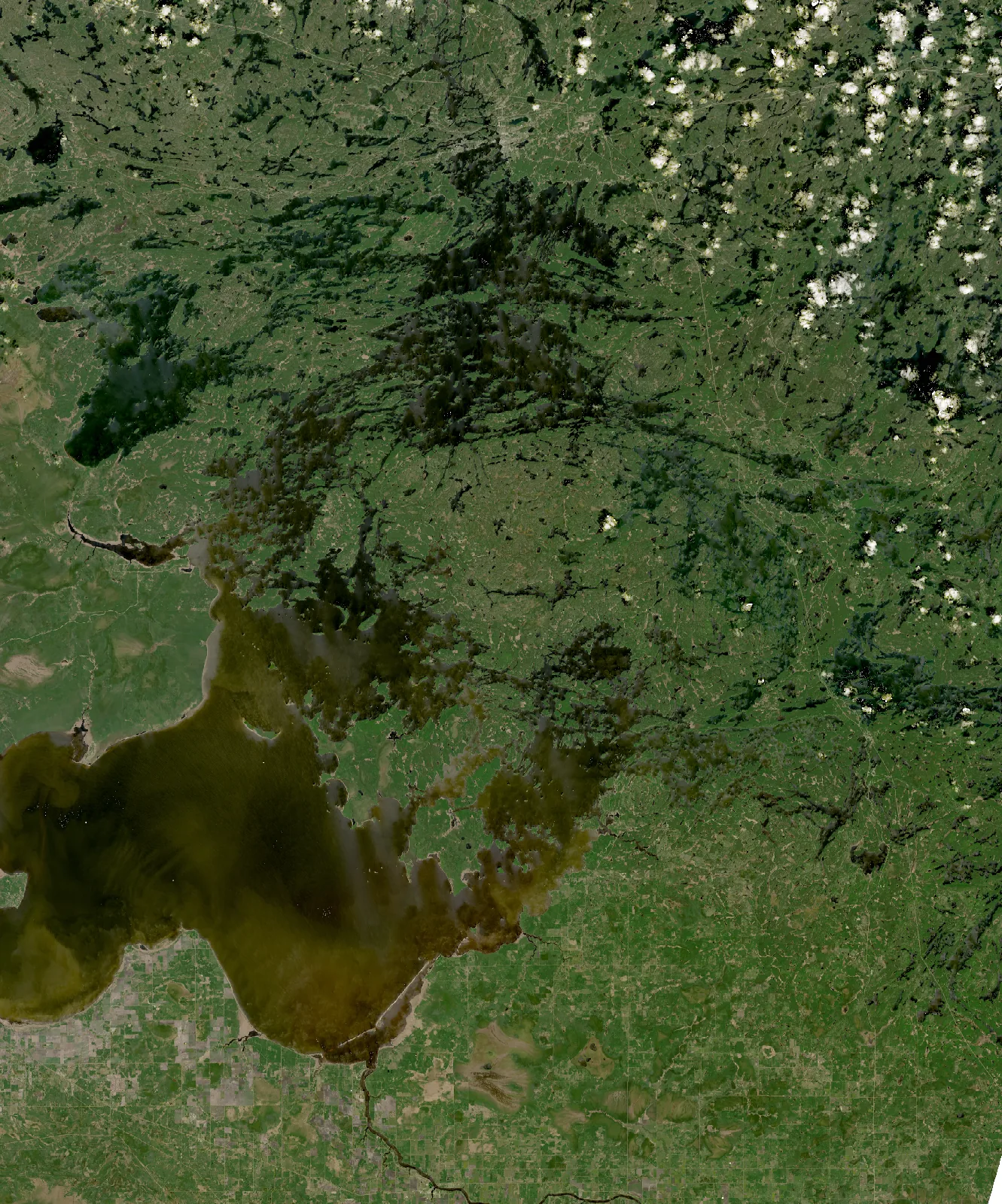
- Surface
- 2,194.4 km²
- Shoreline
- 7,123 km2,568 mainland + 4,555 island shore
- Islands
- 5,249
- Figures cover
- The Ontario part of the lake
Where Lake of the Woods is
Lake of the Woods lies in the District of Rainy River and the District of Kenora, with shoreline in the Township of Dawson, the Township of Sioux Narrows-Nestor Falls, the Township of Lake of the Woods and the City of Kenora.
How deep is Lake of the Woods?
Ontario’s digital bathymetry records hold no soundings and no depth contours within the Ontario Hydro Network’s outline of Lake of the Woods.
See also Ontario's Largest and Deepest Lakes
Surveyed Depths
Ontario has surveyed the depths of several thousand of its lakes over more than half a century. Later surveys were conducted by boat with satellite positioning and produced hundreds of thousands of soundings per lake. Earlier surveys were charted by running transects across the water and drawing depth contours by hand.
Water quality
Ontario’s Lake Partner Program is a volunteer monitoring network. Participants collect water samples for phosphorus analysis and measure water clarity through the summer with a Secchi disk. Most sites are sampled for phosphorus once a year, in spring, and some several times a year between spring and fall. Phosphorus in many lakes rises through the summer, so the two kinds of average are measured on different bases.
Phosphorus is the nutrient that controls how much algae a lake can grow. A lake with little phosphorus stays clear and supports cold-water fish such as lake trout. As phosphorus rises, algae increase, the water clouds, and oxygen in the deep water falls as the algae decay. The province classifies each monitoring site by its average phosphorus:
- Oligotrophic, below 10 micrograms per litre: clear water and low algae.
- Mesotrophic, from 10 to 20: moderately productive water, with more algae and weed growth than an oligotrophic lake but rarely a bloom.
- Eutrophic, above 20: nutrient-rich water, prone to algal blooms and low oxygen at depth.
Lake of the Woods has 139 Lake Partner monitoring sites. 55 have reported phosphorus for the three or more years the province requires before a status is assigned. Two of those sites are classified oligotrophic and 29 mesotrophic and 24 eutrophic.
| Site | Location | Years | Samples a year | Last sampled | Classification |
|---|---|---|---|---|---|
| 2473/12 | ClearWB-Mud Portage | 24 | 5 | 2025 | mesotrophic |
| 2473/2 | AndrewBay-RichesBay | 24 | 5 | 2025 | eutrophic |
| 2473/36 | Ptarmig.B-WCorkscrewIs | 23 | 1 | 2025 | mesotrophic |
| 2473/18 | ClearWB-NDeception B | 21 | 1 | 2025 | mesotrophic |
| 2473/29 | Long Bay, Sioux Narrows | 20 | 3 | 2025 | mesotrophic |
| 2473/39 | S/W of Coney Is | 18 | 4 | 2019 | eutrophic |
| 2473/51 | BishopBToadstl-Royal | 18 | 5 | 2019 | eutrophic |
| 2473/75 | Andrew Bay-Castlerock Island | 17 | 1 | 2021 | eutrophic |
| 2473/33 | Poplar Bay | 16 | 1 | 2018 | mesotrophic |
| 2473/78 | Bulman Bay | 16 | 1 | 2018 | mesotrophic |
| 2473/21 | Echo Bay – SE End | 14 | 1 | 2017 | mesotrophic |
| 2473/4 | Bigstone Bay-Longbow L outlet | 14 | 1 | 2015 | eutrophic |
| 2473/49 | Second Chan-LilyPadB | 14 | 1 | 2016 | eutrophic |
| 2473/117 | SabaskongBayNrMorson | 13 | 1 | 2016 | eutrophic |
| 2473/141 | North of Treaty Isd. | 12 | 3 | 2025 | eutrophic |
| 2473/61 | Cyclone Pt. | 11 | 1 | 2017 | eutrophic |
| 2473/1 | WhitefishBay-CampBay | 10 | 1 | 2014 | mesotrophic |
| 2473/60 | SMorson-FrenchmansRk | 10 | 1 | 2012 | eutrophic |
| 2473/48 | ScottyIs.-Nanton Is. | 9 | 1 | 2011 | eutrophic |
| 2473/116 | Crow Rk Is-Shamis Is | 8 | 1 | 2011 | mesotrophic |
| 2473/23 | French Narrows | 8 | 4 | 2009 | eutrophic |
| 2473/28 | Lobstick Bay | 8 | 2 | 2011 | mesotrophic |
| 2473/53 | Whitefish Bay-Sioux Nar | 8 | 1 | 2010 | mesotrophic |
| 2473/66 | Obabikon Bay | 8 | 1 | 2011 | eutrophic |
| 2473/8 | Clearwater Bay-Kendall In | 8 | 1 | 2023 | mesotrophic |
| 2473/139 | WhitefishB-N Okie Is | 7 | 1 | 2017 | mesotrophic |
| 2473/31 | Middle Island-SW Bay | 7 | 5 | 2008 | eutrophic |
| 2473/101 | Route Bay | 6 | 1 | 2011 | mesotrophic |
| 2473/15 | Clearwater B-Deception B | 6 | 1 | 2007 | mesotrophic |
| 2473/5 | Bigstone Bay-Eagle Pass | 6 | 5 | 2007 | eutrophic |
| 2473/9 | Clearwater Bay-Is Bay | 6 | 1 | 2007 | mesotrophic |
| 2473/10 | Clearwater B-Kendal Inlet | 5 | 1 | 2009 | mesotrophic |
| 2473/112 | Bigsby Is. Deep Bay | 5 | 1 | 2008 | eutrophic |
| 2473/17 | Echo Bay-W Webcoa Rd | 5 | 1 | 2011 | mesotrophic |
| 2473/22 | Echo Bay, W End | 5 | 1 | 2009 | mesotrophic |
| 2473/34 | E off Dawson Is. | 5 | 1 | 2008 | eutrophic |
| 2473/44 | Rush Bay – Brown's Is | 5 | 1 | 2007 | mesotrophic |
| 2473/45 | Rush Bay-Mid Bay | 5 | 1 | 2012 | mesotrophic |
| 2473/47 | Heritage Pk- Little Grassy | 5 | 1 | 2008 | eutrophic |
| 2473/50 | Long Bay, Sioux Narrows | 5 | 1 | 2006 | oligotrophic |
| 2473/54 | Whitefish Bay -W Bell Is | 5 | 1 | 2007 | oligotrophic |
| 2473/65 | N of Mineral Is. | 5 | 1 | 2008 | eutrophic |
| 2473/93 | White Partridge Bay | 5 | 1 | 2009 | mesotrophic |
| 2473/103 | Storm Bay | 4 | 1 | 2011 | eutrophic |
| 2473/11 | NE Town Is.G758 | 4 | 1 | 2011 | mesotrophic |
| 2473/110 | Bigsby Is. Black Pt. | 4 | 1 | 2008 | eutrophic |
| 2473/133 | Bigstone Deep | 4 | 2 | 2013 | mesotrophic |
| 2473/25 | Hades Islands | 4 | 1 | 2006 | mesotrophic |
| 2473/71 | Poplar Bay | 4 | 1 | 2007 | mesotrophic |
| 2473/73 | Oliver Is- SW Allie Is. | 4 | 1 | 2005 | eutrophic |
| 2473/129 | Matheson Bay-E Town Is | 3 | 1 | 2018 | eutrophic |
| 2473/142 | Clearwater Bay Inflow | 3 | 1 | 2018 | eutrophic |
| 2473/32 | Ptarmigan Bay | 3 | 1 | 2006 | mesotrophic |
| 2473/95 | Snake Bay-Sioux Narrows | 3 | 1 | 2005 | mesotrophic |
| 2473/96 | Whitefish Bay-Snake Bay | 3 | 1 | 2005 | mesotrophic |
The longest record is held by site 2473/12 at ClearWB-Mud Portage, with phosphorus sampled several times a year between spring and fall over 24 years to 2025. Its long-term mean phosphorus concentration is 15.83 micrograms per litre, within the mesotrophic band, which runs from 10 to 20.
A Secchi disk is a white or black-and-white plate lowered on a marked line until it disappears from view. The depth at which it vanishes is the Secchi depth, a direct measure of water clarity. Clearer water gives a deeper reading.
The 278 clarity readings at site 2473/12 give a median Secchi depth of 3.0 meters.
Median Secchi depth by year at site 2473/12
- Median Secchi depth
- Shallowest to deepest reading
Lake of the Woods Weather
The weather page for Lake of the Woods carries the forecast over the water, wave heights across the lake and at named places on it, the modelled water temperature, the level and any warnings in effect, updated four times a day from Environment and Climate Change Canada data.
Fish in Lake of the Woods
Ontario’s aquatic resource records name 38 fish species in Lake of the Woods. The province’s other records for the lake name two further species. They appear in the records below.
Popular species in the province’s records
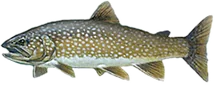 Lake Trouttrout and whitefish
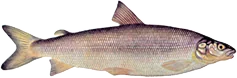 Lake Whitefishtrout and whitefish
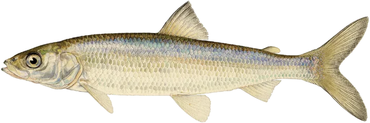 Ciscotrout and whitefish
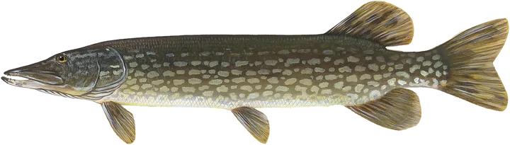 Northern Pikepike
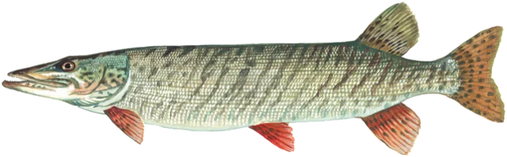 Muskellungepike
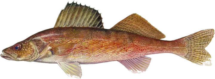 Walleyeperch
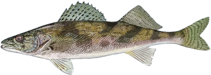 Saugerperch
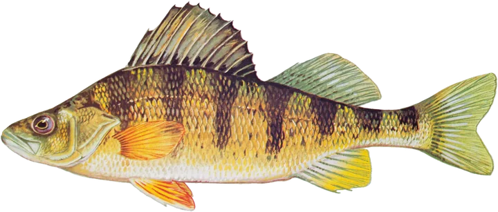 Yellow Perchperch
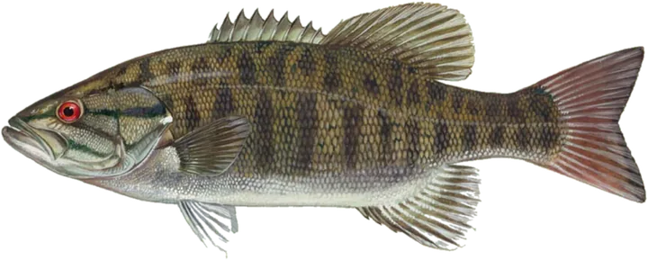 Smallmouth Basssunfish
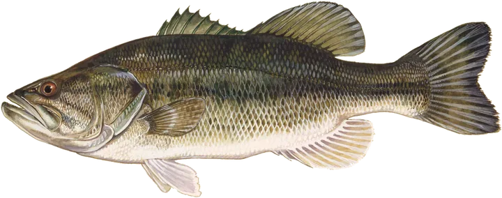 Largemouth Basssunfish
 Black Crappiesunfish
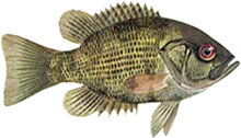 Rock Basssunfish
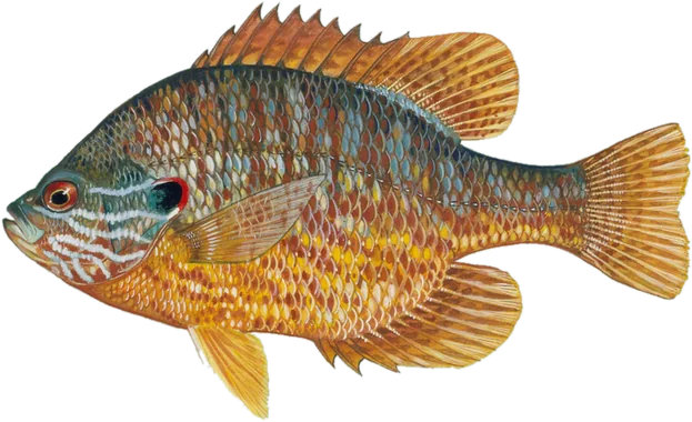 Pumpkinseedsunfish
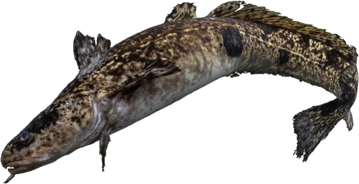 Burbotcod
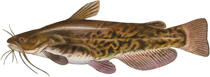 Brown Bullheadcatfish
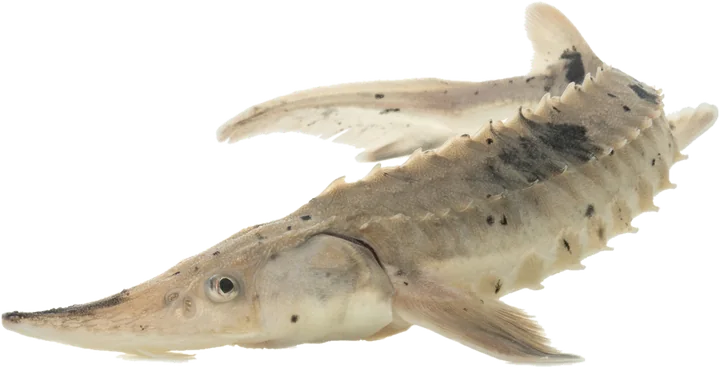 Lake Sturgeonother
| Family | Species |
|---|---|
| Perch | iowa darter, johnny darter, logperch |
| Sucker | shorthead redhorse, silver redhorse, white sucker |
| Smelt | rainbow smelt |
| Minnow | blackchin shiner, emerald shiner, longnose dace, spottail shiner |
| Sculpin | deepwater sculpin, mottled sculpin, sculpins, slimy sculpin |
| Stickleback | ninespine stickleback |
| Bowfin | bowfin |
| Trout-perch | trout-perch |
| Other | mooneye, quillback, redhorse sucker, saugeye, shortjaw cisco, walleye and sauger or any combination |
Spawning areas
Ontario maps 459 fish spawning records within the Lake of the Woods outline, for ten different species, and all of them are mapped below.
By number of records
By area mapped
- Walleye193 areas127.5 ha
- Lake Trout96 areas56.7 ha
- Walleye nursery57 areas26.2 ha
- Northern Pike35 areas323.5 ha
- Lake Whitefish33 areas8.3 ha
- Sauger16 areas13.8 ha
- White Sucker13 areas4.0 ha
- Muskellunge12 areas11.8 ha
- Smallmouth Bass2 areas0.2 ha
- Yellow Perch1 area600 m²
- Shorthead Redhorse1 area0.4 ha
The federal Fisheries Act prohibits the harmful alteration, disruption or destruction of fish habitat without an authorization, so a dock, dredging, infill or shoreline work at a mapped spawning area is reviewed on that basis.
Stocking history
Ontario’s stocking records for Lake of the Woods run from 1946 to 1961 and hold 317 releases. Lake Whitefish account for most of the fish: 205,650,000 released in fourteen of the years between 1946 and 1961. The last recorded release was 4,000,000 walleye eyed eggs in 1961.
| Species | Years | Years with a release | Fish released |
|---|---|---|---|
| Lake Whitefish | 1946 to 1961 | 14 | 205,650,000 |
| Walleye | 1946 to 1961 | 12 | 205,250,000 |
| Lake Trout | 1946 to 1961 | 11 | 878,200 |
| Smallmouth Bass | 1947 | 1 | 4,000 |
The province’s record of stocking for recreational fishing, kept from 2016, lists no release into Lake of the Woods.
Eating the fish
The 2026 Guide to Eating Ontario Fish carries consumption advice for sixteen species taken from Lake of the Woods, tested for contaminants at a sampling location in Kenora Dist. Each figure below is the most meals a month the guide advises for a fish of that length. Where mercury sets the advice, the figure falls as the fish gets longer, because mercury accumulates over a fish’s life. Where the guide has no result yet for certain contaminants at a location, it sets a precautionary limit of 16 meals a month. A zero means the guide advises no meals of that fish at that size.
General population: adultsSensitive population: children under fifteen, women who are or may become pregnant
| Length, cm | 35 to 40 | 40 to 45 | 45 to 50 | 50 to 55 | 55 to 60 | 60 to 65 | 65 to 70 | 70 to 75 | over 75 |
|---|---|---|---|---|---|---|---|---|---|
| General population | 16 | 16 | 16 | 16 | 16 | 16 | 16 | 12 | 4 |
| Sensitive population | 16 | 12 | 12 | 12 | 8 | 8 | 8 | 4 | 0 |
| Length, cm | 15 to 20 | 20 to 25 | 25 to 30 | 30 to 35 | 35 to 40 | 40 to 45 | 45 to 50 | 50 to 55 | 55 to 60 | 60 to 65 | 65 to 70 |
|---|---|---|---|---|---|---|---|---|---|---|---|
| General population | 16 | 16 | 16 | 16 | 16 | 16 | 16 | 16 | 16 | 16 | 16 |
| Sensitive population | 16 | 16 | 16 | 16 | 16 | 16 | 16 | 16 | 16 | 16 | 16 |
| Length, cm | 15 to 20 | 20 to 25 | 25 to 30 | 30 to 35 | 35 to 40 | 40 to 45 |
|---|---|---|---|---|---|---|
| General population | 16 | 16 | 16 | 16 | 16 | 16 |
| Sensitive population | 16 | 16 | 16 | 16 | 16 | 12 |
| Length, cm | 15 to 20 | 20 to 25 | 25 to 30 | 30 to 35 | 35 to 40 | 40 to 45 | 45 to 50 | 50 to 55 | 55 to 60 | 60 to 65 | 65 to 70 | 70 to 75 | over 75 |
|---|---|---|---|---|---|---|---|---|---|---|---|---|---|
| General population | 16 | 16 | 16 | 16 | 16 | 16 | 16 | 16 | 12 | 12 | 8 | 4 | 2 |
| Sensitive population | 16 | 16 | 16 | 16 | 16 | 12 | 8 | 8 | 4 | 4 | 4 | 0 | 0 |
| Length, cm | 35 to 40 | 40 to 45 | 45 to 50 | 50 to 55 | 55 to 60 | 60 to 65 | 65 to 70 | 70 to 75 | over 75 |
|---|---|---|---|---|---|---|---|---|---|
| General population | 16 | 16 | 16 | 16 | 16 | 16 | 16 | 12 | 4 |
| Sensitive population | 16 | 16 | 16 | 12 | 8 | 8 | 4 | 4 | 0 |
| Length, cm | over 75 |
|---|---|
| General population | 2 |
| Sensitive population | 0 |
| Length, cm | 15 to 20 | 20 to 25 | 25 to 30 | 30 to 35 | 35 to 40 | 40 to 45 | 45 to 50 | 50 to 55 |
|---|---|---|---|---|---|---|---|---|
| General population | 16 | 16 | 16 | 16 | 16 | 12 | 8 | 4 |
| Sensitive population | 16 | 12 | 12 | 12 | 8 | 4 | 0 | 0 |
| Length, cm | 20 to 25 | 25 to 30 | 30 to 35 | 35 to 40 | 40 to 45 |
|---|---|---|---|---|---|
| General population | 16 | 16 | 12 | 12 | 8 |
| Sensitive population | 16 | 8 | 4 | 4 | 4 |
| Length, cm | 20 to 25 | 25 to 30 | 30 to 35 |
|---|---|---|---|
| General population | 16 | 16 | 16 |
| Sensitive population | 16 | 16 | 8 |
| Length, cm | 15 to 20 | 20 to 25 | 25 to 30 | 30 to 35 | 35 to 40 |
|---|---|---|---|---|---|
| General population | 16 | 16 | 16 | 16 | 16 |
| Sensitive population | 16 | 16 | 16 | 12 | 8 |
| Length, cm | 15 to 20 | 20 to 25 | 25 to 30 |
|---|---|---|---|
| General population | 16 | 8 | 4 |
| Sensitive population | 12 | 4 | 0 |
| Length, cm | 35 to 40 | 40 to 45 | 45 to 50 | 50 to 55 | 55 to 60 |
|---|---|---|---|---|---|
| General population | 12 | 12 | 12 | 12 | 12 |
| Sensitive population | 12 | 12 | 8 | 8 | 4 |
| Length, cm | 25 to 30 | 30 to 35 |
|---|---|---|
| General population | 16 | 16 |
| Sensitive population | 16 | 8 |
| Length, cm | 25 to 30 | 30 to 35 | 35 to 40 | 40 to 45 | 45 to 50 | 50 to 55 | 55 to 60 |
|---|---|---|---|---|---|---|---|
| General population | 16 | 16 | 16 | 16 | 16 | 16 | 16 |
| Sensitive population | 16 | 16 | 16 | 16 | 16 | 16 | 8 |
| Length, cm | 30 to 35 | 35 to 40 | 40 to 45 | 45 to 50 | 50 to 55 | 55 to 60 |
|---|---|---|---|---|---|---|
| General population | 16 | 16 | 16 | 16 | 16 | 16 |
| Sensitive population | 16 | 16 | 16 | 16 | 12 | 8 |
| Length, cm | 15 to 20 | 20 to 25 | 25 to 30 | 30 to 35 | 35 to 40 | 40 to 45 | 45 to 50 |
|---|---|---|---|---|---|---|---|
| General population | 16 | 16 | 16 | 16 | 16 | 16 | 8 |
| Sensitive population | 16 | 16 | 12 | 12 | 8 | 8 | 4 |
Fisheries Management Zone 5
Lake of the Woods lies in Fisheries Management Zone 5. Ontario sets its fishing seasons and catch limits by zone.
Fisheries management zones around Lake of the Woods
| Species | Open season | Sport licence | Conservation licence |
|---|---|---|---|
| Brook Trout | Open all year | 5 | 2 |
| Brown Trout | Open all year | 5 | 2 |
| Crappie | Open all year | 10 | 5 |
| Lake Trout | Jan. 1 – Sept. 30 | 2, not more than 1 greater than 56 cm (22 in.) from Sept. 1 – Sept. 30 | 1, no size limit |
| Lake Whitefish | Open all year | 12 | 6 |
| Largemouth and Smallmouth Bass or any combination | Open all year | 4; Must be less than 35 cm (13.8 in.) from Jan. 1 – June 30 | 2; Must be less than 35 cm (13.8 in.) from Jan. 1 – June 30 |
| Muskellunge | 3rd Sat. in June – Dec. 15 | 1, must be greater than 102 cm (40 in.) | 0 |
| Northern Pike | Open all year | 4; none greater than 75 cm (29.5 in.) | 2; none greater than 75 cm (29.5 in.) |
| Rainbow Trout | Open all year | 5 | 2 |
| Splake | Open all year | 5 | 2 |
| Sunfish | Open all year | 50 | 25 |
| Walleye and Sauger or any combination | Jan. 1 – Apr. 14 & 3rd Sat. in May – Dec. 31 | 4, not more than 1 greater than 46 cm (18.1 in.) | 2, not more than 1 greater than 46 cm (18.1 in.) |
| Yellow Perch | Open all year | 50 | 25 |
Zone-wide, Smelt may not be used as bait or possessed for use as bait.
| Species | Open season | Sport licence | Conservation licence |
|---|---|---|---|
| Lake Trout | 3rd Sat. in May – Sept. 30 | 0; 0, except for tag holders; 1 in one day; 2, not more than 1 greater than 65 cm (25.6 in.) | 0; 0, except for tag holders; 1, any size |
| Yellow Perch | Zone-wide | 15 | 10 |
| Walleye and Sauger or any combination | Zone-wide | 4; none between 43-70 cm, not more than 1 greater than 70 cm; 2; none between 43-70 cm, not more than 1 greater than 70 cm | 2; none greater than 43 cm |
| Lake Whitefish | Zone-wide | 4 | 2 |
| Muskellunge | Zone-wide | 1; must be greater than 137 cm | 0 |
| Largemouth and Smallmouth Bass or any combination | Zone-wide | 0; from Jan. 1 – June 30 | 0; from Jan. 1 – June 30 |
Where a row reads zone-wide, the zone’s own season or limit above applies. Lake Trout: Fish or fish parts may not be possessed or used as bait. Lake Trout: Barbless hooks only, and for Lake Trout only one barbless hook may be used. Lake Trout: Possession and/or use of fish or fish parts as bait is prohibited from Jan. 1 – Fri. before 3rd Sat. in May. Lake Trout: Only barbless hooks may be used from Jan. 1 – Fri. before 3rd Sat. in May.
| Where | Closed |
|---|---|
| Lake of the Woods – Sabaskong Bay (49°09'N., 94°09"W.) – Godson Twp. – Kenora District | No fishing from Apr. 1 – June 14 |
See also Fishing Seasons in Ontario, Zone by Zone and Fish Stocking in Ontario Lakes
Lake of the Woods Ice Fishing
Ice In / Out Date
Ice has been recorded on Lake of the Woods in 24 winters between 1955 and 1994. The median date of complete ice cover is November 29 and the median date of complete ice loss is May 10, a median season of 162 days.
The longest recorded season is 187 days in 1979-80, and the shortest is 138 days in 1980-81.
Ice in to ice out by winter on Lake of the Woods
- Ice in to ice out
- One date recorded
The record was contributed by W. R. Skinner, Environment Canada to the Global Lake and River Ice Phenology Database, and the ice was read at a weather station rather than from the middle of the lake. Observations were last contributed for 1994, and none have been added since.
Ice conditions
No public record reports the thickness or the condition of the ice on Lake of the Woods on any given day. Ontario publishes ice safety guidance for anyone going out on the ice, at ontario.ca.
See also Lake Ice in Ontario
Islands and names
Lake of the Woods contains 5,249 islands in the Ontario Hydro Network’s outline, 491 of them over 10 hectares and 2,028 under a tenth of a hectare. Seven of them lie mostly inside wetland the province’s Wetland With Significance dataset maps as marsh or fen.
| Island | Hectares | |
|---|---|---|
| 1 | Big Island | 12,788.5 |
| 2 | Bigsby Island | 5,801.5 |
| 3 | Long Point Island | 3,743.7 |
| 4 | Painted Rock Island | 1,714.9 |
| 5 | Hay Island | 1,195.9 |
| 6 | Splitrock Island | 1,157.3 |
| 7 | Dawson Island | 1,121.5 |
| 8 | Corkscrew Island | 1,058.8 |
| 9 | Cliff Island | 1,042.2 |
| 10 | unnamed | 1,018.1 |
Official names
Ontario’s geographic names register lists 616 official names on the water and its islands: 350 islands, 116 bays, five rocks, one harbour, sixteen narrows, 27 points on islands and two rivers. A further 49 named points stand on the mainland shore.
Bays 116
- Adams River Bay
- Andrew Bay
- Ash Bay
- Asmus Bay
- Astron Bay
- Atikaminike Bay
- Bald Indian Bay
- Basil Bay
- Bear Bay
- Big Camp Bay
- Big Traverse Bay
- Bishop Bay
- Boggy Bay
- Boot Bay
- Bottle Bay
- Brûlé Bay
- Bulman Bay
- Burrow Bay
- Cameron Bay
- Camp Bay
- Camp Ten Bay
- Clearwater Bay
- Clipper Bay
- Cloverleaf Bay
- Dawson Bay
- Deception Bay
- Deep Bay
- Deepwater Bay
- Deer Bay
- Devils Bay
- East Bay
- Echo Bay
- Gauthier Bay
- Ghost Bay
- Gohere Bay
- Golf Course Bay
- Gull Bay
- Hansens Bay
- Hanson Bay
- Hay Bay
- Jackpine Bay
- Keewatin Bay
- Kenora Bay
- Lily Pad Bay
- Little Poplar Bay
- Lobstick Bay
- Log Bay
- Long Bay
- Loon Bay
- Lowry Bay
- Matheson Bay
- Matheson Bay
- McCauley Bay
- Micrometer Bay
- Miles Bay
- Monument Bay
- Moore Bay
- Morton Bay
- Norman Bay
- Oak Bay
- Obabikon Bay
- Ogawa Bay
- Oscar's Bay
- Oshie Bay
- Outer Bay
- P.O.W. Bay
- Pine Portage Bay
- Poachers Bay
- Poplar Bay
- Portage Bay
- Portage Bay
- Ptarmigan Bay
- Purdy Bay
- Quandary Bay
- Quiet Bay
- Rat Portage Bay
- Red Cliff Bay
- Redwater Bay
- Redwing Bay
- Reedy Bay
- Regina Bay
- Rheault Bay
- Rice Bay
- Riches Bay
- Route Bay
- Rush Bay
- Sabaskong Bay
- Sabaskosing Bay
- Safety Bay
- Sammons Bay
- Sand Bay
- Sandy Bay
- Shipwreck Bay
- Snake Bay
- Splitrock Bay
- Spruce Portage Bay
- St. Mary's Bay
- Stevens Bay
- Stony Portage Bay
- Storm Bay
- Taylor Bay
- The Bowling Alley
- The Little Traverse
- Thunder Bay
- Trinity Bay
- Turtle Bay
- Verbena Bay
- White Partridge Bay
- Whitefish Bay
- Whiting Bay
- Wiley Bay
- Willow Bay
- Windy Bay
- Witch Bay
- Woodchuck Bay
- Yellow Girl Bay
Shoals and rocks 5
- Balancing Rock
- Gardners Monument
- Gull Rock
- Powassin Rock
- Wydemans Rock
Harbours, cuts and narrows 17
- Allans Narrows
- Barney Narrows
- Bells Harbour
- Big Marsh Narrows
- Big Narrows
- Camerons Narrows
- Fire Island Narrows
- Fish Narrows
- French Narrows
- French Portage Narrows
- Reed Narrows
- Rocky Narrows
- Sioux Narrows
- Splitrock Narrows
- The Narrows
- Treaty Narrows
- Whitefish Narrows
Points on the shore 49
- Bare Point
- Berry Point
- Bishop Point
- Brûlé Point
- Bunting's Point
- Camerons Point
- Carmichael Point
- Cat Point
- Chase Point
- Cyclone Point
- Elmo Point
- Gateway Point
- Heenan Point
- Kellys Point
- Last Point
- Machin Point
- Magnet Point
- Mamiou Point
- McCallum Point
- Mica Point
- Northwest Point
- Oak Point
- Paddle Point
- Picnic Point
- Picture Rock Point
- Pincushion Point
- Pipestone Point
- Pophams Point
- Rabbit Point
- Return Point
- Rocky Point
- Sand Point
- School House Point
- Separation Point
- Sherlock Point
- Sioux Point
- Spike Point
- Splitrock Point
- Spruce Point
- Starting Point
- Starting Point
- Toadstool Point
- Turtle Point
- Twin Point
- Victoria Point
- White Point
- Wiley Point
- Yellow Girl Point
- Yum Yum Point
Nearby lakes
- Kakagi Lake46 km away
- Lake Lulu54 km away
- Dryberry Lake55 km away
- Black Sturgeon Lakes61 km away
Questions about Lake of the Woods
- How big is Lake of the Woods?
The Ontario part of the lake covers 2,194.4 square kilometers and it holds 5,249 islands. Of its 7,123 kilometers of shoreline, 2,568 kilometers is the mainland shore and 4,555 kilometers is the shore of the islands.
- What fish are in Lake of the Woods?
Ontario’s aquatic resource records name 38 species, among them lake trout, walleye, smallmouth bass, largemouth bass, northern pike and muskellunge.
Lake guides
Looking at a property on Lake of the Woods?
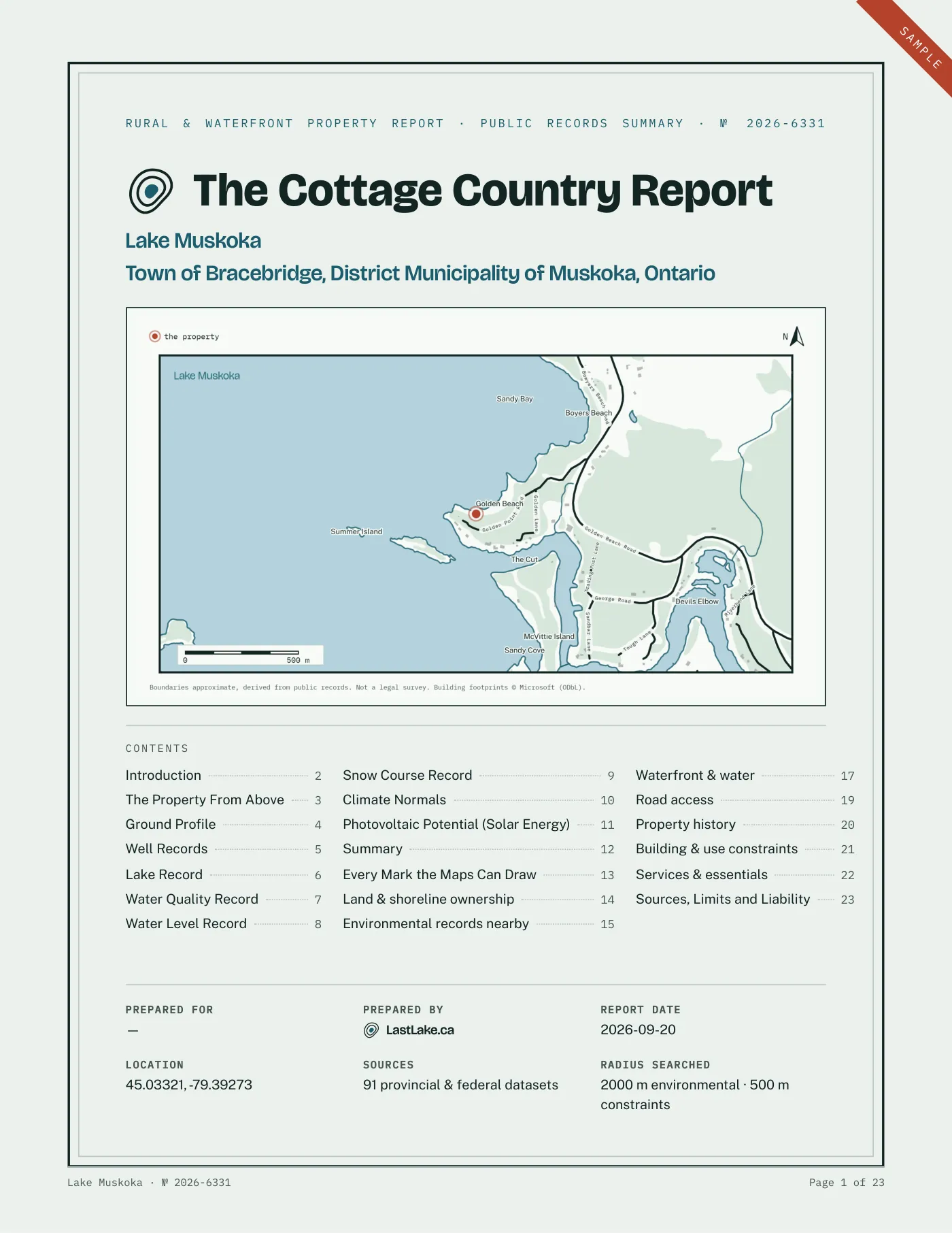
Depth and water quality are two records out of many. Our Rural & Cottage Buyer’s Report gathers what the public record holds about one specific address: shore road allowance, road access, wells, flood mapping, Crown land, wetlands and more, read and checked by a person before it is sent.
Where these figures come from
- Depth, shoreline, islands and named places: Ontario Ministry of Natural Resources bathymetry and the Ontario Hydro Network, © King’s Printer for Ontario, Open Government Licence – Ontario.
- Phosphorus and water clarity: Ontario Lake Partner Program, Ministry of the Environment, Conservation and Parks, Open Government Licence – Ontario. Extract built 2026-10-06.
- Satellite photograph: Landsat 8, 31 May 2015. Neigh, C., Ju, J., Roger, J.-C., Skakun, S., Vermote, E., Claverie, M., Dungan, J., Yin, Z., Freitag, B., and Justice, C. (2021). HLS Operational Land Imager Surface Reflectance and TOA Brightness Daily Global 30m v2.0. NASA Land Processes DAAC. https://doi.org/10.5067/HLS/HLSL30.002. Openly shared without restriction under NASA’s Earth science data use guidance.
- Official names: Geographic Names Ontario, Ministry of Natural Resources, Open Government Licence – Ontario.
- Lake outline and municipal boundaries: Ontario Hydro Network and Ontario municipal boundary records, Ministry of Natural Resources, Open Government Licence – Ontario.
- Fish species: Ontario Aquatic Resource Area records. Spawning areas: Ontario Fish Activity Area records. Both Ministry of Natural Resources, Open Government Licence – Ontario.
- Stocking: Historical Fish Stocking Data and Fish Stocking Data for Recreational Purposes, Ministry of Natural Resources, Open Government Licence – Ontario.
- Consumption advice: Guide to Eating Ontario Fish advisory database, 2026 edition, Ministry of the Environment, Conservation and Parks, Open Government Licence – Ontario.
- Seasons and limits: Ontario recreational fishing regulations data, Ministry of Natural Resources, Open Government Licence – Ontario.
- Zone boundaries: Fisheries Management Zone, Ministry of Natural Resources, Open Government Licence – Ontario.
- Fish plates: Duane Raver, U.S. Fish and Wildlife Service; Ellen Edmonson and Hugh Chrisp, New York State Conservation Department; Timothy Knepp, U.S. Fish and Wildlife Service; U.S. Fish and Wildlife Service. All public domain.
- Ice dates: Benson, B., Magnuson, J. and Sharma, S. (2000), Global Lake and River Ice Phenology Database, Version 1, National Snow and Ice Data Center, doi 10.7265/N5W66HP8. This lake’s record contributed by W. R. Skinner, Environment Canada.