Ontario's Largest and Deepest Lakes
How many lakes Ontario holds by the province’s own count, the largest and deepest of the 265 lakes in the lake index, the Great Lakes on the province’s border, and what a charted depth and a shoreline figure measure.
Last updated 2026-09-28
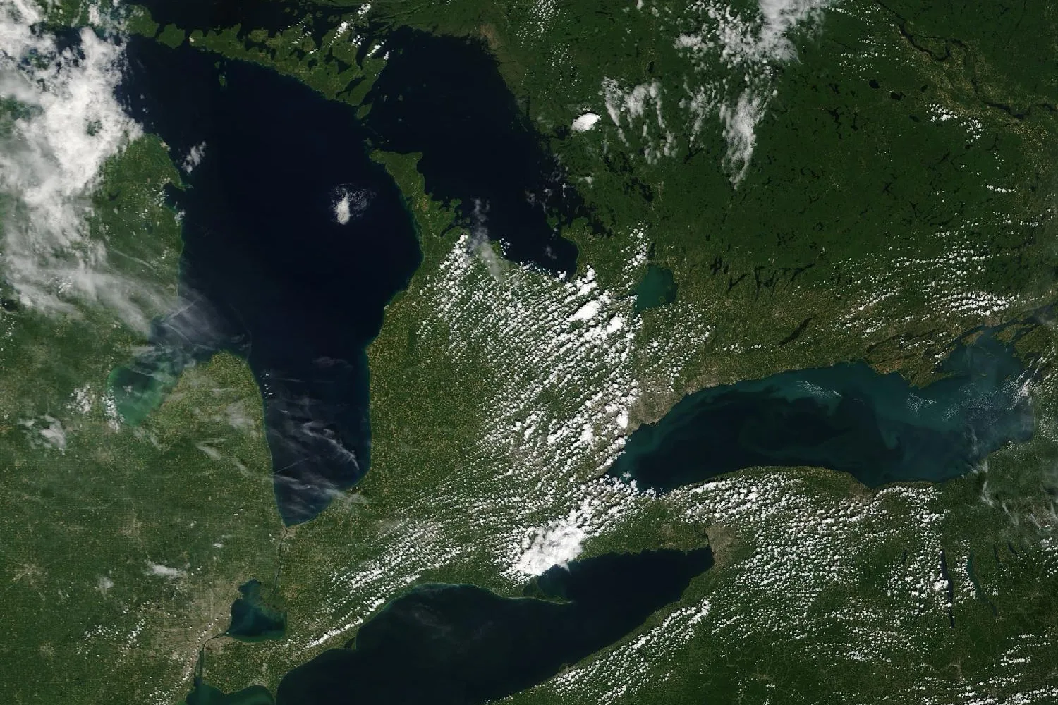
- Lakes in Ontario
- 250,000inland lakes, the province’s stated count
- Largest surface in the index
- 4,498.7 km²Lake Nipigon
- Deepest contour in the index
- 124.4 mWanapitei Lake, a minimum
- Deepest sounding in the index
- 92.5 mLake Joseph, 152,057 soundings
- Most islands in the index
- 5,249Lake of the Woods, Ontario part
- Lake Superior at its deepest
- 406 mthe deepest of the Great Lakes
How Many Lakes Are in Ontario?
The Government of Ontario gives the province’s count as 250,000 inland lakes, in addition to the Canadian portion of four of the Great Lakes. Elsewhere the province states the total as more than 250,000 lakes.
A count of lakes rests on a definition of a lake. The province’s map of surface water, the Ontario Hydro Network, classes every body of water by type, among them lake, pond, beaver pond, kettle lake and reservoir, so a pond and a lake are separate entries in it.
The rankings below cover the 265 lakes in the lake index. Each figure is read from the province’s own records: the surface, shoreline and islands from the Ontario Hydro Network’s outline of the lake, and the depth from the province’s bathymetry surveys.
The Largest Lakes in Ontario
Among the 265 lakes in the index, Lake Nipigon covers the largest surface, 4,498.7 square kilometers, followed by the Ontario part of Lake of the Woods at 2,194.4 and Lac Seul in Kenora District at 1,206.5.
The surface figure is the area of open water inside the lake’s outline, with its islands left out. Lake Muskoka covers 119.9 square kilometers of water, and the smallest lake in the index, Butterfly Lake, covers 0.6 square kilometers.
| Lake | Surface km² | Shoreline km | Islands | Depth | |
|---|---|---|---|---|---|
| 1 | Lake NipigonThunder Bay District | 4,498.7 | 2,5391,194 mainland + 1,345 island shore | 1,121 | no digital record |
| 2 | Lake of the WoodsKenora DistrictOntario part | 2,194.4 | 7,1232,568 mainland + 4,555 island shore | 5,249 | no digital record |
| 3 | Lac SeulKenora District | 1,206.5 | 3,4872,168 mainland + 1,319 island shore | 1,488 | 36.6 mdeepest contour |
| 4 | Lake NipissingNipissing District | 834.5 | 1,009610 mainland + 399 island shore | 1,037 | 70.0 mdeepest contour |
| 5 | Lake SimcoeSimcoe County, York and Durham | 723.0 | 303254 mainland + 49 island shore | 31 | 41.0 mdeepest contour |
| 6 | Eagle Lake (Kenora District)Kenora District | 281.9 | 1,011628 mainland + 383 island shore | 692 | 24.4 mdeepest contour |
| 7 | Lac des Mille LacsThunder Bay District | 245.2 | 881517 mainland + 364 island shore | 574 | 27.4 mdeepest contour |
| 8 | Sturgeon Lake (Thunder Bay District)Thunder Bay District | 244.5 | 1,060583 mainland + 477 island shore | 797 | 79.2 mdeepest contour |
| 9 | Lake TemagamiNipissing District | 208.6 | 1,048629 mainland + 419 island shore | 1,075 | 73.2 mdeepest contour |
| 10 | Minnitaki LakeKenora District | 176.4 | 687440 mainland + 247 island shore | 376 | 45.7 mdeepest contour |
| 11 | Red LakeKenora District | 165.5 | 592428 mainland + 164 island shore | 201 | 42.7 mdeepest contour |
| 12 | Dog Lake (Thunder Bay District)Thunder Bay District | 145.9 | 373294 mainland + 79 island shore | 121 | 100.0 mdeepest contour |
| 13 | Wanapitei LakeSudbury District | 133.3 | 154112 mainland + 42 island shore | 94 | 124.4 mdeepest contour |
| 14 | Lake MuskokaMuskoka | 119.9 | 451261 mainland + 190 island shore | 220 | 73.1 mdeepest sounding |
| 15 | Kakagi LakeKenora District | 112.3 | 475250 mainland + 225 island shore | 368 | 54.9 mdeepest contour |
| 16 | Night Hawk LakeCochrane District | 108.8 | 164147 mainland + 17 island shore | 46 | 4.6 mdeepest contour |
| 17 | Lake ManitouManitoulin District | 106.5 | 120113 mainland + 7 island shore | 25 | 48.8 mdeepest contour |
| 18 | Wabigoon LakeKenora District | 102.9 | 317204 mainland + 113 island shore | 238 | 15.0 mdeepest contour |
| 19 | Dryberry LakeKenora District | 96.3 | 388287 mainland + 101 island shore | 154 | 103.6 mdeepest contour |
| 20 | Rice LakeNorthumberland and Peterborough County | 92.3 | 167121 mainland + 46 island shore | 44 | 9.0 mdeepest contour |
| 21 | White Otter LakeKenora District | 86.3 | 238182 mainland + 56 island shore | 56 | 48.8 mdeepest contour |
| 22 | Lake PanacheSudbury District | 80.9 | 421295 mainland + 126 island shore | 211 | 54.9 mdeepest contour |
| 23 | Missinaibi LakeAlgoma District | 80.5 | 263228 mainland + 35 island shore | 82 | 76.2 mdeepest contour |
| 24 | Lady Evelyn LakeTimiskaming District | 68.1 | 352235 mainland + 117 island shore | 289 | 15.2 mdeepest contour |
| 25 | Lake of BaysMuskoka | 67.4 | 191160 mainland + 31 island shore | 30 | 79.2 mdeepest sounding |
The Deepest Lakes in Ontario
Among the lakes in the index with a depth record, Wanapitei Lake in Sudbury District holds the deepest charted contour, 124.4 meters, and the water within it descends even farther. The deepest sounding in the index is on Lake Joseph in Muskoka, 92.5 meters.
Dryberry Lake at 103.6 meters and Dog Lake (Thunder Bay District) at 100.0 meters hold the next deepest contours. The Lake Joseph figure is determined from 152,057 soundings taken during Ontario’s 2003 survey. Charleston Lake at 92.0 meters and Lake Rosseau at 90.1 meters hold the next deepest soundings.
| Lake | Depth | Kind | Records | Survey | Surface km² | |
|---|---|---|---|---|---|---|
| 1 | Wanapitei LakeSudbury District | 124.4 m | Deepest contoura minimum | 196 contours | not recorded | 133.3 |
| 2 | Dryberry LakeKenora District | 103.6 m | Deepest contoura minimum | 795 contours | not recorded | 96.3 |
| 3 | Dog Lake (Thunder Bay District)Thunder Bay District | 100.0 m | Deepest contoura minimum | 209 contours | not recorded | 145.9 |
| 4 | Lake JosephMuskoka | 92.5 m | Deepest sounding | 152,057 soundings | 2003 | 51.6 |
| 5 | Charleston LakeLeeds and Grenville | 92.0 m | Deepest sounding | 165,198 soundings | 2004 | 26.4 |
| 6 | Big Rideau LakeLeeds and Grenville | 91.4 m | Deepest contoura minimum | 299 contours | 1972 | 45.9 |
| 7 | Lake RosseauMuskoka | 90.1 m | Deepest sounding | 156,694 soundings | 2000 to 2003 | 62.9 |
| 8 | Bark LakeRenfrew County | 85.3 m | Deepest contoura minimum | 50 contours | not recorded | 42.7 |
| 9 | Matinenda LakeAlgoma District | 85.3 m | Deepest contoura minimum | 147 contours | 1965 | 41.4 |
| 10 | Redstone LakeHaliburton County | 80.5 m | Deepest contoura minimum | 131 contours | 1967 | 11.8 |
| 11 | Skeleton LakeMuskoka | 79.9 m | Deepest sounding | 15,268 soundings | 2004 | 20.5 |
| 12 | Lake of BaysMuskoka | 79.2 m | Deepest sounding | 3,607 soundings | 1969 | 67.4 |
| 13 | Sturgeon Lake (Thunder Bay District)Thunder Bay District | 79.2 m | Deepest contoura minimum | 389 contours | 1972 | 244.5 |
| 14 | Lauzon LakeAlgoma District | 79.0 m | Deepest contoura minimum | 85 contours | 1972 | 22.2 |
| 15 | Missinaibi LakeAlgoma District | 76.2 m | Deepest contoura minimum | 100 contours | not recorded | 80.5 |
| 16 | Kawagama LakeHaliburton County | 75.9 m | Deepest sounding | 20,228 soundings | 2018 | 31.6 |
| 17 | Halls LakeHaliburton County | 74.0 m | Deepest sounding | 15,171 soundings | 2008 | 5.4 |
| 18 | Basswood LakeAlgoma District | 73.2 m | Deepest contoura minimum | 35 contours | 1965 | 27.1 |
| 19 | Kennisis LakeHaliburton County | 73.2 m | Deepest contoura minimum | 88 contours | 1974 | 14.4 |
| 20 | Lake TemagamiNipissing District | 73.2 m | Deepest contoura minimum | 347 contours | 1969 | 208.6 |
| 21 | Ranger LakeAlgoma District | 73.2 m | Deepest contoura minimum | 79 contours | not recorded | 23.3 |
| 22 | Lake MuskokaMuskoka | 73.1 m | Deepest sounding | 365,520 soundings | 2000 | 119.9 |
| 23 | Fairy LakeMuskoka | 70.7 m | Deepest sounding | 78,310 soundings | 2004 | 7.0 |
| 24 | Lake NipissingNipissing District | 70.0 m | Deepest contoura minimum | 2,691 contours | transect | 834.5 |
| 25 | Aylen LakeRenfrew County | 67.1 m | Deepest contoura minimum | 44 contours | 1972 | 21.2 |
| 26 | Desert LakeFrontenac County | 67.1 m | Deepest contoura minimum | 41 contours | 1971 | 3.8 |
| 27 | Trout Lake (Nipissing District)Nipissing District | 67.1 m | Deepest contoura minimum | 63 contours | transect | 18.9 |
What Charted Depth Means
The province’s lake depths come from two kinds of record. A sounding is a depth measured at one point, and a depth contour is a line joining points of equal depth, drawn from soundings.
Sounding surveys. The province holds sounding records for 43 lakes in the index, 2,008,329 soundings between them, dated 1969 to 2018. The province’s record states that its soundings were taken mainly with an echo sounder positioned by GPS. On these lakes the depth figure is the deepest sounding, the maximum recorded depth.
Contour surveys. The province holds depth contours alone for 216 lakes in the index, 26,691 contours between them, dated 1955 to 2023 where a date is recorded. The province surveyed them to map fish habitat. On these lakes the depth figure is the deepest contour, the charted depth: the water inside that contour is deeper, by an amount the contour record does not state, so a charted depth is a minimum.
Six lakes in the index, among them Lake Nipigon and Lake of the Woods, hold no soundings and no depth contours in the province’s digital bathymetry records within their outlines, and have no depth in the rankings.
The Great Lakes on Ontario’s Border
Lake Superior, Lake Huron, Lake Erie and Lake Ontario border Ontario. Lake Superior is the largest and the deepest of the four, covering 82,100 square kilometers and reaching 406 meters.
Lake Huron, Georgian Bay included, covers 59,600 square kilometers and reaches 229 meters. Lake Ontario is the smallest of the four by surface, 18,960 square kilometers, and reaches 244 meters. Lake Erie is the shallowest, with a maximum depth of 64 meters and an average of 19.
| Lake | Surface km² | Maximum depth | Average depth |
|---|---|---|---|
| Lake Superior | 82,100 | 406 m | 147 m |
| Lake Huron | 59,600 | 229 m | 59 m |
| Lake Erie | 25,700 | 64 m | 19 m |
| Lake Ontario | 18,960 | 244 m | 86 m |
Shoreline and Islands
The shoreline figure for each lake is the length of its mainland shore and of every island shore added together, and each is given with its two parts.
The Ontario part of Lake of the Woods has the longest shoreline in the index, 7,123 kilometers, and the most islands, 5,249. Of its shoreline, 2,568 kilometers is mainland shore and 4,555 the shore of its islands. Island shore makes up more than half the shoreline of the Ontario part of Lake of the Woods (64 percent), Stony Lake (56 percent), Newboro Lake (53 percent) and Lake Nipigon (53 percent).
Lake Muskoka has 451 kilometers of shoreline, 261 of it mainland shore and 190 the shore of its 220 islands. A shoreline figure that leaves the islands out, or that is measured on a coarser map, is shorter.
An island is counted at any size: every piece of land surrounded by the lake’s water in the provincial outline is one island. Eighteen lakes in the index hold no island, among them Lake Wolsey, Lake Doré and Drag Lake.
| Lake | Islands | Shoreline km | Mainland km | Island shore km |
|---|---|---|---|---|
| Lake of the WoodsKenora DistrictOntario part | 5,249 | 7,123 | 2,568 | 4,555 |
| Lac SeulKenora District | 1,488 | 3,487 | 2,168 | 1,319 |
| Lake NipigonThunder Bay District | 1,121 | 2,539 | 1,194 | 1,345 |
| Lake TemagamiNipissing District | 1,075 | 1,048 | 629 | 419 |
| Lake NipissingNipissing District | 1,037 | 1,009 | 610 | 399 |
| Sturgeon Lake (Thunder Bay District)Thunder Bay District | 797 | 1,060 | 583 | 477 |
| Eagle Lake (Kenora District)Kenora District | 692 | 1,011 | 628 | 383 |
| Lac des Mille LacsThunder Bay District | 574 | 881 | 517 | 364 |
| Marmion LakeRainy River District | 531 | 467 | 248 | 219 |
| Onaping LakeSudbury District | 426 | 619 | 408 | 211 |
| Stony LakePeterborough County | 417 | 229 | 100 | 129 |
| Minnitaki LakeKenora District | 376 | 687 | 440 | 247 |
The Deepest and Largest Lakes by Region
In Muskoka, Lake Joseph holds the deepest record, 92.5 meters by sounding, and Lake Muskoka the largest surface, 119.9 square kilometers. In Haliburton County, Redstone Lake holds the deepest record, 80.5 meters by contour, and Kawagama Lake the largest surface, 31.6 square kilometers.
| Region | Lakes | Deepest | Largest surface |
|---|---|---|---|
| Algoma District | 6 | Matinenda Lake85.3 m, deepest contour | Missinaibi Lake80.5 km² |
| Frontenac County | 14 | Desert Lake67.1 m, deepest contour | Bobs Lake29.1 km² |
| Haliburton County | 34 | Redstone Lake80.5 m, deepest contour | Kawagama Lake31.6 km² |
| Hastings County | 7 | Papineau Lake61.0 m, deepest contour | Baptiste Lake22.3 km² |
| Kawartha Lakes | 9 | Crystal Lake32.9 m, deepest contour | Balsam Lake47.6 km² |
| Kenora District | 18 | Dryberry Lake103.6 m, deepest contour | Lake of the Woods2,194.4 km²Ontario part |
| Lanark County | 5 | Silver Lake21.9 m, deepest contour | Mississippi Lake24.4 km² |
| Leeds and Grenville | 8 | Charleston Lake92.0 m, deepest sounding | Big Rideau Lake45.9 km² |
| Muskoka | 25 | Lake Joseph92.5 m, deepest sounding | Lake Muskoka119.9 km² |
| Nipissing District | 11 | Lake Temagami73.2 m, deepest contour | Lake Nipissing834.5 km² |
| Parry Sound District | 25 | Blackstone Lake57.9 m, deepest contour | Lake Bernard21.0 km² |
| Peterborough County | 22 | Jack Lake54.4 m, deepest sounding | Buckhorn Lake31.3 km² |
| Renfrew County | 13 | Bark Lake85.3 m, deepest contour | Bark Lake42.7 km² |
| Simcoe County | 6 | Tea Lake17.6 m, deepest sounding | Lake Couchiching45.4 km² |
| Sudbury District | 14 | Wanapitei Lake124.4 m, deepest contour | Wanapitei Lake133.3 km² |
| Thunder Bay District | 12 | Dog Lake (Thunder Bay District)100.0 m, deepest contour | Lake Nipigon4,498.7 km² |
| Timiskaming District | 7 | Long Lake (Timiskaming District)45.0 m, deepest sounding | Lady Evelyn Lake68.1 km² |
Common Questions
What is the deepest lake in Ontario?
Lake Superior, at 406 meters, is the deepest lake on Ontario’s border. Among the lakes in the index, Wanapitei Lake holds the deepest charted contour, 124.4 meters, and Lake Joseph the deepest sounding, 92.5 meters.
What is the biggest lake in Ontario?
Lake Superior, at 82,100 square kilometers, is the largest lake on Ontario’s border, and part of it lies in the United States. Among the lakes in the index, Lake Nipigon covers the largest surface, 4,498.7 square kilometers, followed by the Ontario part of Lake of the Woods at 2,194.4 and Lac Seul at 1,206.5.
How many lakes are in Ontario?
The Government of Ontario gives the count as 250,000 inland lakes, in addition to its share of four Great Lakes.
How deep is Lake Muskoka?
Lake Muskoka reaches a maximum recorded depth of 73.1 meters, determined from 365,520 soundings taken during Ontario’s 2000 survey.
How deep is Lake Simcoe?
The deepest mapped contour on Lake Simcoe is 41.0 meters, and the water within that boundary descends even farther. The province’s bathymetry record holds 2,104 contours for the lake, recorded during Ontario’s 1957 survey.
How deep is Georgian Bay?
Georgian Bay is part of Lake Huron, which reaches 229 meters at its deepest and averages 59. Those figures are for the whole lake, bay included.
What is the deepest lake in Muskoka?
Among the 25 lakes in Muskoka in the index, Lake Joseph holds the deepest record, 92.5 meters by sounding. Lake Rosseau follows at 90.1, Skeleton Lake at 79.9 and Lake of Bays at 79.2, all by sounding.
What is the deepest lake in Haliburton?
Among the 34 lakes in Haliburton County in the index, Redstone Lake holds the deepest record, 80.5 meters by contour. Kawagama Lake follows at 75.9 by sounding, Halls Lake at 74.0 by sounding and Kennisis Lake at 73.2 by contour.
What does charted depth mean?
A charted depth is the deepest depth contour recorded on a lake. The water inside that contour is deeper, by an amount the contour record does not state, so a charted depth is a minimum.
Why is the shoreline longer than other published figures?
The shoreline figure adds the shore of every island to the mainland shore, and it is measured on the province’s detailed outline of the lake. A figure that counts the mainland only, or is measured on a coarser map, is shorter.
Which lake has the most islands?
Among the lakes in the index, the Ontario part of Lake of the Woods holds the most, 5,249 islands, with 4,555 kilometers of island shore.
Lake Maps
Depth maps of thirty-two Ontario lakes are printed to order, each drawn from the province’s own soundings and depth contours, with the lake’s surface, shoreline, islands and depth printed beneath the map.
See the lake maps All lake pagesSmall print
- Depth
- A depth reading is the distance from the water surface on the day of survey to the lake bottom. Lake levels vary through the season and between years. No depth here is for navigation, and the province’s bathymetry records carry the same warning.
- Charted depth
- A charted depth is the deepest contour recorded and is a minimum; the depth within it was not recorded. The rankings place maximums and minimums in one order, marked by kind, so a lake ranked by its deepest contour may be deeper than a lake ranked above it by sounding.
- Survey coverage
- Not every survey covered every arm of a lake, and the province’s index does not always record where a survey ended. A lake’s deepest record is the deepest place its survey measured. The survey shown for a lake is its recorded survey year where one is recorded, and otherwise the year of its deepest record.
- Lakes tabled
- Every ranking covers the 265 lakes in the lake index and changes as lakes are added. Each lake is counted once in the regional table, under the region its own page names. Lake of the Woods extends beyond Ontario, and its figures here are for the Ontario part of the lake, measured on the province’s outline of the water on the Ontario side, and ranked by them.
- Shoreline and surface
- The shoreline figure is the length of the mainland shore and of every island shore added together, measured on the Ontario Hydro Network’s outline of the lake. The surface figure is the area of water inside that outline, less the area of its islands. The provincial outline is mapped to within a few meters of the shore, and a shoreline measured from a coarser map comes out shorter, which is why a figure published elsewhere is often lower.
- Islands
- An island is any land surrounded by the lake’s water in the provincial outline, counted at any size.
- The count of lakes
- The 250,000 figure is the Government of Ontario’s stated count, read on its own pages. Neither page states the smallest water counted or the record the count was taken from, and a count of lakes depends on both.
- The Great Lakes
- The Great Lakes figures are for each whole lake, including waters in the United States, and are measured at the lakes’ low water datum, a fixed reference level for charting. They come from a different source and method from the inland figures and are tabled apart from them.
- Depths: Ontario Ministry of Natural Resources, Bathymetry points and Bathymetry lines, © King’s Printer for Ontario, Open Government Licence – Ontario.
- Surface, shoreline and islands: Ontario Hydro Network – Waterbody, © King’s Printer for Ontario, Open Government Licence – Ontario.
- Count of lakes: Government of Ontario, Fisheries in Ontario and About Ontario, read September 28, 2026.
- Great Lakes: The Great Lakes: An Environmental Atlas and Resource Book, third edition, 1995, Government of Canada and United States Environmental Protection Agency, as tabled by the NOAA Great Lakes Environmental Research Laboratory, Physical Characteristics of the Great Lakes, read September 28, 2026.