
Ontario lake records
Ontario’s most complete lake information system.
- Surveyed depths
- Water temperature
- Fish and spawning
- Stocking
- Eating advice
- Marinas and launches
- Islands and names
Find a lake
265 lake pages
All 265 lakes
Largest first within each region Lake MuskokaGravenhurst · Bracebridge · Muskoka Lakes73mMax depth120km²Surface220IslandsLake page→
 Lake of BaysHuntsville · Lake of Bays · Algonquin Highlands79mMax depth67km²Surface30IslandsLake page→
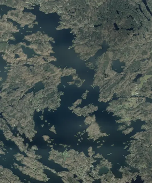 Lake RosseauMuskoka Lakes · Seguin90mMax depth63km²Surface96IslandsLake page→
 Lake JosephMuskoka Lakes · Seguin92mMax depth52km²Surface93IslandsLake page→
 Skeleton LakeHuntsville · Muskoka Lakes80mMax depth20km²Surface30IslandsLake page→
 Lake VernonHuntsville43mMax depth16km²Surface10IslandsLake page→
 Six Mile LakeGeorgian Bay13km²Surface102IslandsLake page→
 Gloucester PoolSevern · Georgian Bay≥ 27mCharted depth12km²Surface91IslandsLake page→
 Sparrow LakeGravenhurst · Severn≥ 12mCharted depth11km²Surface20IslandsLake page→
 Mary LakeHuntsville59mMax depth11km²Surface8IslandsLake page→
 Three Mile LakeMuskoka Lakes≥ 9mCharted depth9km²Surface3IslandsLake page→
 Peninsula LakeHuntsville · Lake of Bays37mMax depth8km²Surface3IslandsLake page→
 Kahshe LakeGravenhurst≥ 18mCharted depth8km²Surface47IslandsLake page→
 Fairy LakeHuntsville71mMax depth7km²Surface5IslandsLake page→
 Wood LakeBracebridge≥ 12mCharted depth4km²Surface8IslandsLake page→
 Bella LakeLake of Bays41mMax depth4km²Surface4IslandsLake page→
 Buck LakeHuntsville · Mcmurrich/Monteith25mMax depth3km²Surface1IslandsLake page→
 Morrison LakeGravenhurst18mMax depth2km²Surface12IslandsLake page→
 Gibson LakeGeorgian Bay≥ 12mCharted depth2km²Surface4IslandsLake page→
 Dotty LakeLake of Bays31mMax depth2km²Surface4IslandsLake page→
 Stewart LakeMuskoka Lakes · Georgian Bay≥ 18mCharted depth2km²Surface2IslandsLake page→
 Riley LakeGravenhurst≥ 15mCharted depth1km²Surface4IslandsLake page→
 Bigwind LakeBracebridge35mMax depth1km²Surface3IslandsLake page→
 Bass LakeMuskoka Lakes≥ 11mCharted depth1km²Surface0IslandsLake page→
 Butterfly LakeMuskoka Lakes≥ 5mCharted depth1km²Surface1IslandsLake page→
 Lake BernardSundridge · Strong48mMax depth21km²Surface2IslandsLake page→
 Wahwashkesh LakeWhitestone≥ 43mCharted depth18km²Surface40IslandsLake page→
 Ahmic LakeRyerson · Magnetawan≥ 24mCharted depth16km²Surface21IslandsLake page→
 Restoule Lake≥ 24mCharted depth12km²Surface8IslandsLake page→
 Manitouwabing LakeMckellar · Mcdougall12km²Surface49IslandsLake page→
 Eagle LakeMachar≥ 18mCharted depth10km²Surface42IslandsLake page→
 Doe LakeMcmurrich/Monteith · Ryerson · Perry≥ 15mCharted depth9km²Surface3IslandsLake page→
 Lake CecebeRyerson · Magnetawan≥ 18mCharted depth8km²Surface6IslandsLake page→
 Healey Lakethe Archipelago≥ 21mCharted depth7km²Surface27IslandsLake page→
 Sand LakeKearney50mMax depth6km²Surface2IslandsLake page→
 Otter LakeSeguin45mMax depth6km²Surface13IslandsLake page→
 Blackstone Lakethe Archipelago≥ 58mCharted depth5km²Surface9IslandsLake page→
 Pickerel LakeArmour · Kearney42mMax depth5km²Surface0IslandsLake page→
 Crane Lakethe Archipelago34mMax depth5km²Surface9IslandsLake page→
 Horseshoe LakeSeguin≥ 18mCharted depth4km²Surface6IslandsLake page→
 Three Mile LakeArmour≥ 6mCharted depth4km²Surface8IslandsLake page→
 Bear LakeMcmurrich/Monteith≥ 9mCharted depth3km²Surface12IslandsLake page→
 Harris Lake≥ 18mCharted depth3km²Surface10IslandsLake page→
 Little Lake JosephMuskoka Lakes · Seguin41mMax depth3km²Surface2IslandsLake page→
 Whitefish LakeSeguin≥ 30mCharted depth3km²Surface6IslandsLake page→
 Clear LakeSeguin47mMax depth2km²Surface2IslandsLake page→
 Star LakeSeguin≥ 18mCharted depth2km²Surface2IslandsLake page→
 Bay LakePerry23mMax depth1km²Surface4IslandsLake page→
 Rankin LakeSeguin≥ 18mCharted depth1km²Surface3IslandsLake page→
 Clear LakePerry27mMax depth1km²Surface5IslandsLake page→
 Lake SimcoeOrillia · Bradford West Gwillimbury · Oro-Medonte≥ 41mCharted depth723km²Surface31IslandsLake page→
 Kawagama LakeDysart Et Al · Algonquin Highlands76mMax depth32km²Surface30IslandsLake page→
 Kennisis LakeDysart Et Al≥ 73mCharted depth14km²Surface51IslandsLake page→
 Paudash LakeFaraday · Highlands East≥ 49mCharted depth12km²Surface21IslandsLake page→
 Redstone LakeDysart Et Al≥ 80mCharted depth12km²Surface11IslandsLake page→
 Gull LakeMinden Hills≥ 49mCharted depth10km²Surface15IslandsLake page→
 Haliburton LakeDysart Et Al≥ 50mCharted depth10km²Surface9IslandsLake page→
 Drag LakeDysart Et Al≥ 55mCharted depth10km²Surface0IslandsLake page→
 Kashagawigamog LakeMinden Hills · Dysart Et Al≥ 40mCharted depth8km²Surface3IslandsLake page→
 Boshkung LakeAlgonquin Highlands≥ 61mCharted depth7km²Surface4IslandsLake page→
 Kushog LakeAlgonquin Highlands≥ 37mCharted depth7km²Surface14IslandsLake page→
 Halls LakeAlgonquin Highlands74mMax depth5km²Surface0IslandsLake page→
 Percy LakeDysart Et Al≥ 30mCharted depth5km²Surface2IslandsLake page→
 Raven LakeLake of Bays · Algonquin Highlands≥ 37mCharted depth5km²Surface31IslandsLake page→
 Big Hawk LakeAlgonquin Highlands≥ 52mCharted depth4km²Surface10IslandsLake page→
 Twelve Mile LakeMinden Hills≥ 27mCharted depth4km²Surface1IslandsLake page→
 Maple LakeAlgonquin Highlands≥ 37mCharted depth3km²Surface0IslandsLake page→
 Soyers LakeMinden Hills≥ 49mCharted depth3km²Surface4IslandsLake page→
 Mountain LakeMinden Hills≥ 30mCharted depth3km²Surface1IslandsLake page→
 Horseshoe LakeMinden Hills≥ 21mCharted depth3km²Surface6IslandsLake page→
 St. Nora LakeAlgonquin Highlands≥ 37mCharted depth3km²Surface2IslandsLake page→
 Miskwabi LakeDysart Et Al≥ 43mCharted depth3km²Surface0IslandsLake page→
 Canning LakeMinden Hills≥ 20mCharted depth2km²Surface4IslandsLake page→
 Sherborne LakeAlgonquin Highlands≥ 30mCharted depth2km²Surface18IslandsLake page→
 Eagle LakeDysart Et Al≥ 24mCharted depth2km²Surface2IslandsLake page→
 Esson LakeHighlands East · Dysart Et Al≥ 32mCharted depth2km²Surface5IslandsLake page→
 Oxtongue LakeAlgonquin Highlands≥ 24mCharted depth2km²Surface11IslandsLake page→
 Bob LakeMinden Hills≥ 60mCharted depth2km²Surface7IslandsLake page→
 Little Kennisis LakeDysart Et Al≥ 44mCharted depth2km²Surface2IslandsLake page→
 Moore LakeMinden Hills≥ 22mCharted depth2km²Surface3IslandsLake page→
 Salerno LakeHighlands East · Minden Hills≥ 12mCharted depth2km²Surface1IslandsLake page→
 Beech LakeAlgonquin Highlands≥ 24mCharted depth1km²Surface0IslandsLake page→
 Davis LakeMinden Hills≥ 28mCharted depth1km²Surface10IslandsLake page→
 Gooderham LakeHighlands East≥ 18mCharted depth1km²Surface3IslandsLake page→
 South LakeMinden Hills≥ 11mCharted depth1km²Surface0IslandsLake page→
 Head LakeDysart Et Al≥ 5mCharted depth1km²Surface0IslandsLake page→
 Pigeon LakeSelwyn · Trent Lakes · Kawartha Lakes≥ 12mCharted depth49km²Surface87IslandsLake page→
 Balsam LakeKawartha Lakes≥ 12mCharted depth48km²Surface27IslandsLake page→
 Sturgeon LakeKawartha Lakes≥ 11mCharted depth44km²Surface42IslandsLake page→
 Cameron LakeKawartha Lakes≥ 17mCharted depth14km²Surface5IslandsLake page→
 Head LakeKawartha Lakes≥ 7mCharted depth9km²Surface36IslandsLake page→
 Canal LakeKawartha Lakes≥ 4mCharted depth8km²Surface30IslandsLake page→
 Four Mile LakeKawartha Lakes≥ 18mCharted depth8km²Surface19IslandsLake page→
 Crystal LakeTrent Lakes≥ 33mCharted depth5km²Surface29IslandsLake page→
 Shadow LakeKawartha Lakes≥ 22mCharted depth4km²Surface14IslandsLake page→
 Mitchell LakeKawartha Lakes≥ 2mCharted depth3km²Surface16IslandsLake page→
 Buckhorn LakeSelwyn · Trent Lakes≥ 12mCharted depth31km²Surface104IslandsLake page→
 Stony LakeNorth Kawartha · Selwyn · Douro-Dummer≥ 31mCharted depth27km²Surface417IslandsLake page→
 Chemong LakeSelwyn · Kawartha Lakes≥ 7mCharted depth25km²Surface33IslandsLake page→
 Chandos LakeNorth Kawartha≥ 46mCharted depth16km²Surface33IslandsLake page→
 Jack LakeHavelock-Belmont-Methuen · North Kawartha54mMax depth14km²Surface139IslandsLake page→
 Lower Buckhorn LakeSelwyn · Trent Lakes≥ 11mCharted depth12km²Surface136IslandsLake page→
 Clear LakeSelwyn · Douro-Dummer≥ 13mCharted depth11km²Surface66IslandsLake page→
 Crowe LakeHavelock-Belmont-Methuen · Marmora and Lake≥ 15mCharted depth11km²Surface20IslandsLake page→
 Kasshabog LakeHavelock-Belmont-Methuen≥ 24mCharted depth10km²Surface142IslandsLake page→
 Eels LakeHighlands East · North Kawartha≥ 24mCharted depth9km²Surface59IslandsLake page→
 Belmont LakeHavelock-Belmont-Methuen≥ 16mCharted depth8km²Surface24IslandsLake page→
 Catchacoma LakeTrent Lakes≥ 44mCharted depth7km²Surface15IslandsLake page→
 Mississagua LakeTrent Lakes≥ 44mCharted depth7km²Surface27IslandsLake page→
 Anstruther LakeNorth Kawartha≥ 39mCharted depth6km²Surface8IslandsLake page→
 Round LakeHavelock-Belmont-Methuen≥ 8mCharted depth6km²Surface6IslandsLake page→
 Sandy LakeTrent Lakes≥ 12mCharted depth4km²Surface3IslandsLake page→
 Gold LakeNorth Kawartha · Trent Lakes≥ 37mCharted depth3km²Surface5IslandsLake page→
 Cordova LakeHavelock-Belmont-Methuen≥ 12mCharted depth3km²Surface27IslandsLake page→
 Lovesick LakeNorth Kawartha · Selwyn · Trent Lakes≥ 25mCharted depth3km²Surface57IslandsLake page→
 Big Cedar LakeNorth Kawartha≥ 18mCharted depth2km²Surface11IslandsLake page→
 Big Bald LakeTrent Lakes≥ 9mCharted depth2km²Surface54IslandsLake page→
 Little Bald LakeTrent Lakes≥ 7mCharted depth2km²Surface52IslandsLake page→
 White LakeDouro-Dummer≥ 9mCharted depth2km²Surface4IslandsLake page→
 Beaver LakeTrent Lakes≥ 18mCharted depth2km²Surface2IslandsLake page→
 Lake CouchichingOrillia · Severn · Oro-Medonte45km²Surface44IslandsLake page→
 Dalrymple LakeRamara · Kawartha Lakes≥ 9mCharted depth14km²Surface16IslandsLake page→
 Lake St. JohnRamara≥ 6mCharted depth6km²Surface10IslandsLake page→
 Bass LakeOro-Medonte10mMax depth6km²Surface0IslandsLake page→
 MacLean LakeSevern11mMax depth1km²Surface6IslandsLake page→
 Farlain LakeTiny5mMax depth1km²Surface0IslandsLake page→
 Tea LakeSevern18mMax depth1km²Surface8IslandsLake page→
 Rice LakeAlnwick/Haldimand · Hamilton · Asphodel-Norwood≥ 9mCharted depth92km²Surface44IslandsLake page→
 Lake NipissingWest Nipissing · Callander · St.-Charles≥ 70mCharted depth834km²Surface1037IslandsLake page→
 Lake TemagamiTemagami≥ 73mCharted depth209km²Surface1075IslandsLake page→
 Obabika LakeTemagami≥ 40mCharted depth33km²Surface67IslandsLake page→
 Red Cedar LakeTemagami≥ 30mCharted depth23km²Surface94IslandsLake page→
 Rabbit LakeTemagami≥ 43mCharted depth21km²Surface53IslandsLake page→
 Trout LakeNorth Bay · East Ferris≥ 67mCharted depth19km²Surface26IslandsLake page→
 Lake NosbonsingEast Ferris · Bonfield · Chisholm≥ 14mCharted depth18km²Surface9IslandsLake page→
 Lake TalonBonfield · Calvin≥ 58mCharted depth14km²Surface22IslandsLake page→
 Net LakeTemagami≥ 43mCharted depth8km²Surface29IslandsLake page→
 Cassels LakeTemagami≥ 30mCharted depth7km²Surface14IslandsLake page→
 Turtle LakeBonfield≥ 52mCharted depth2km²Surface20IslandsLake page→
 Big Rideau LakeTay Valley · Rideau Lakes · Drummond/North Elmsley≥ 91mCharted depth46km²Surface188IslandsLake page→
 Charleston LakeAthens · Leeds and the Thousand Islands92mMax depth26km²Surface152IslandsLake page→
 Newboro LakeRideau Lakes≥ 23mCharted depth16km²Surface185IslandsLake page→
 Sand LakeRideau Lakes≥ 14mCharted depth9km²Surface43IslandsLake page→
 Upper Beverley LakeRideau Lakes · Leeds and the Thousand Islands≥ 6mCharted depth6km²Surface31IslandsLake page→
 Otter LakeRideau Lakes≥ 37mCharted depth6km²Surface13IslandsLake page→
 Whitefish LakeRideau Lakes · Leeds and the Thousand Islands≥ 8mCharted depth4km²Surface27IslandsLake page→
 Red Horse LakeLeeds and the Thousand Islands≥ 37mCharted depth3km²Surface12IslandsLake page→
 Mississippi LakeBeckwith · Mississippi Mills · Drummond/North Elmsley≥ 9mCharted depth24km²Surface15IslandsLake page→
 White LakeGreater Madawaska · Mcnab/Braeside · Lanark Highlands≥ 9mCharted depth24km²Surface64IslandsLake page→
 Christie LakeTay Valley≥ 18mCharted depth6km²Surface28IslandsLake page→
 Dalhousie LakeLanark Highlands19mMax depth6km²Surface0IslandsLake page→
 Silver LakeTay Valley · Central Frontenac≥ 22mCharted depth2km²Surface2IslandsLake page→
 Bobs LakeSouth Frontenac · Tay Valley · Central Frontenac≥ 24mCharted depth29km²Surface113IslandsLake page→
 Big Gull LakeNorth Frontenac · Central Frontenac≥ 24mCharted depth25km²Surface154IslandsLake page→
 Crotch LakeNorth Frontenac≥ 24mCharted depth16km²Surface74IslandsLake page→
 Sharbot LakeCentral Frontenac≥ 30mCharted depth15km²Surface75IslandsLake page→
 Kashwakamak LakeNorth Frontenac≥ 21mCharted depth12km²Surface80IslandsLake page→
 Loughborough LakeSouth Frontenac≥ 5mCharted depth11km²Surface105IslandsLake page→
 Devil LakeSouth Frontenac≥ 43mCharted depth11km²Surface51IslandsLake page→
 Dog LakeSouth Frontenac≥ 55mCharted depth10km²Surface52IslandsLake page→
 Sydenham LakeSouth Frontenac≥ 34mCharted depth7km²Surface68IslandsLake page→
 Eagle LakeCentral Frontenac≥ 30mCharted depth6km²Surface36IslandsLake page→
 Palmerston LakeNorth Frontenac≥ 55mCharted depth6km²Surface13IslandsLake page→
 Kennebec LakeCentral Frontenac≥ 30mCharted depth5km²Surface14IslandsLake page→
 Crow LakeSouth Frontenac · Central Frontenac≥ 34mCharted depth4km²Surface8IslandsLake page→
 Desert LakeSouth Frontenac≥ 67mCharted depth4km²Surface10IslandsLake page→
 Lake ManitouAssiginack · Billings · Central Manitoulin≥ 49mCharted depth106km²Surface25IslandsLake page→
 Lake KagawongBillings · Central Manitoulin · Gordon / Barrie Island≥ 34mCharted depth56km²Surface3IslandsLake page→
 Mindemoya LakeBillings · Central Manitoulin≥ 18mCharted depth38km²Surface1IslandsLake page→
 Lake WolseyGordon / Barrie Island · Burpee and Mills25mMax depth23km²Surface0IslandsLake page→
 Wanapitei LakeGreater Sudbury≥ 124mCharted depth133km²Surface94IslandsLake page→
 Lake PanacheKillarney · Greater Sudbury≥ 55mCharted depth81km²Surface211IslandsLake page→
 Onaping Lake≥ 49mCharted depth67km²Surface426IslandsLake page→
 Agnew LakeNairn and Hyman · Greater Sudbury · Sables-Spanish Rivers≥ 37mCharted depth32km²Surface77IslandsLake page→
 Kukagami LakeGreater Sudbury≥ 55mCharted depth18km²Surface144IslandsLake page→
 Nepewassi LakeMarkstay-Warren · St.-Charles≥ 12mCharted depth12km²Surface30IslandsLake page→
 Windy LakeGreater Sudbury≥ 55mCharted depth11km²Surface14IslandsLake page→
 Vermilion LakeGreater Sudbury13mMax depth11km²Surface2IslandsLake page→
 Long LakeGreater Sudbury38mMax depth9km²Surface12IslandsLake page→
 Trout LakeFrench River≥ 60mCharted depth9km²Surface37IslandsLake page→
 Ramsey LakeGreater Sudbury25mMax depth8km²Surface17IslandsLake page→
 Fairbank LakeGreater Sudbury≥ 43mCharted depth7km²Surface9IslandsLake page→
 Nepahwin LakeGreater Sudbury≥ 22mCharted depth1km²Surface7IslandsLake page→
 Richard LakeGreater Sudbury10mMax depth1km²Surface0IslandsLake page→
 Baptiste LakeHastings Highlands≥ 30mCharted depth22km²Surface23IslandsLake page→
 Weslemkoon LakeTudor and Cashel · Addington Highlands≥ 52mCharted depth20km²Surface154IslandsLake page→
 Moira LakeCentre Hastings · Tweed≥ 9mCharted depth8km²Surface7IslandsLake page→
 Papineau LakeHastings Highlands≥ 61mCharted depth8km²Surface2IslandsLake page→
 Wollaston LakeWollaston≥ 30mCharted depth4km²Surface2IslandsLake page→
 Steenburg LakeTudor and Cashel · Limerick≥ 20mCharted depth3km²Surface8IslandsLake page→
 Lake St. PeterHastings Highlands≥ 27mCharted depth2km²Surface1IslandsLake page→
 Bark LakeHastings Highlands · South Algonquin · Madawaska Valley≥ 85mCharted depth43km²Surface18IslandsLake page→
 Golden LakeBonnechere Valley · North Algona Wilberforce · Killaloe, Hagarty and Richards≥ 24mCharted depth36km²Surface19IslandsLake page→
 Round LakeKillaloe, Hagarty and Richards≥ 50mCharted depth30km²Surface14IslandsLake page→
 Kamaniskeg LakeHastings Highlands · Madawaska Valley≥ 40mCharted depth22km²Surface8IslandsLake page→
 Aylen LakeSouth Algonquin · Madawaska Valley≥ 67mCharted depth21km²Surface13IslandsLake page→
 Lake ClearBonnechere Valley≥ 37mCharted depth17km²Surface20IslandsLake page→
 Black Donald LakeGreater Madawaska · North Frontenac≥ 43mCharted depth16km²Surface53IslandsLake page→
 Lake DoréNorth Algona Wilberforce≥ 21mCharted depth15km²Surface0IslandsLake page→
 Calabogie LakeGreater Madawaska≥ 24mCharted depth14km²Surface15IslandsLake page→
 Muskrat LakeWhitewater Region≥ 64mCharted depth12km²Surface1IslandsLake page→
 Centennial LakeGreater Madawaska · North Frontenac≥ 30mCharted depth8km²Surface31IslandsLake page→
 Constant LakeBonnechere Valley≥ 18mCharted depth6km²Surface19IslandsLake page→
 Mink LakeNorth Algona Wilberforce≥ 12mCharted depth6km²Surface1IslandsLake page→
 Lake ScugogScugog · Kawartha Lakes≥ 6mCharted depth66km²Surface18IslandsLake page→
 Skootamatta LakeAddington Highlands≥ 27mCharted depth12km²Surface30IslandsLake page→
 Varty LakeStone Mills≥ 3mCharted depth6km²Surface4IslandsLake page→
 Buckshot LakeNorth Frontenac · Addington Highlands≥ 34mCharted depth4km²Surface6IslandsLake page→
 Lake Opeongo59km²Surface167IslandsLake page→
 Canoe Lake≥ 37mCharted depth4km²Surface13IslandsLake page→
 Lake EugeniaGrey Highlands≥ 12mCharted depth6km²Surface9IslandsLake page→
 Conestogo LakeMapleton≥ 24mCharted depth6km²Surface2IslandsLake page→
 Lake BelwoodCentre Wellington≥ 12mCharted depth6km²Surface1IslandsLake page→
 Puslinch LakePuslinch≥ 3mCharted depth2km²Surface5IslandsLake page→
 Lady Evelyn LakeTemagami≥ 15mCharted depth68km²Surface289IslandsLake page→
 Larder LakeLarder Lake · Mcgarry39mMax depth37km²Surface45IslandsLake page→
 Watabeag Lake42mMax depth21km²Surface19IslandsLake page→
 Mistinikon LakeMatachewan32mMax depth13km²Surface51IslandsLake page→
 Long LakeCharlton and Dack45mMax depth10km²Surface4IslandsLake page→
 Kenogami Lake8mMax depth9km²Surface14IslandsLake page→
 Sesekinika Lake11mMax depth6km²Surface27IslandsLake page→
 Night Hawk LakeTimmins≥ 5mCharted depth109km²Surface46IslandsLake page→
 Frederick House LakeIroquois Falls · Timmins≥ 15mCharted depth41km²Surface4IslandsLake page→
 Remi LakeMoonbeam≥ 15mCharted depth25km²Surface14IslandsLake page→
 Porcupine LakeTimmins≥ 5mCharted depth3km²Surface0IslandsLake page→
 Lake NipigonGreenstone4499km²Surface1121IslandsLake page→
 Lac des Mille Lacs≥ 27mCharted depth245km²Surface574IslandsLake page→
 Sturgeon Lake≥ 79mCharted depth244km²Surface797IslandsLake page→
 Dog Lake≥ 100mCharted depth146km²Surface121IslandsLake page→
 White Lake≥ 46mCharted depth61km²Surface41IslandsLake page→
 Kenogamisis LakeGreenstone≥ 30mCharted depth42km²Surface45IslandsLake page→
 Whitefish Lake≥ 6mCharted depth30km²Surface5IslandsLake page→
 Lower Shebandowan Lake≥ 12mCharted depth23km²Surface33IslandsLake page→
 Upper Shebandowan Lake≥ 37mCharted depth19km²Surface100IslandsLake page→
 Middle Shebandowan Lake≥ 24mCharted depth18km²Surface30IslandsLake page→
 Wildgoose LakeGreenstone≥ 15mCharted depth18km²Surface27IslandsLake page→
 Hawkeye Lake≥ 37mCharted depth4km²Surface0IslandsLake page→
 Missinaibi Lake≥ 76mCharted depth80km²Surface82IslandsLake page→
 Matinenda LakeBlind River≥ 85mCharted depth41km²Surface40IslandsLake page→
 Basswood LakeHuron Shores≥ 73mCharted depth27km²Surface5IslandsLake page→
 Ranger Lake≥ 73mCharted depth23km²Surface27IslandsLake page→
 Lauzon Lakethe North Shore · Blind River≥ 79mCharted depth22km²Surface37IslandsLake page→
 Chiblow LakeBlind River≥ 67mCharted depth20km²Surface22IslandsLake page→
 Lake of the WoodsDawson · Sioux Narrows-Nestor Falls · Lake of the Woods2194km²Surface in Ontario5249Islands in OntarioLake page→
 Lac SeulEar Falls≥ 37mCharted depth1206km²Surface1488IslandsLake page→
 Eagle LakeMachin≥ 24mCharted depth282km²Surface692IslandsLake page→
 Minnitaki LakeSioux Lookout≥ 46mCharted depth176km²Surface376IslandsLake page→
 Red LakeRed Lake≥ 43mCharted depth166km²Surface201IslandsLake page→
 Kakagi LakeSioux Narrows-Nestor Falls≥ 55mCharted depth112km²Surface368IslandsLake page→
 Wabigoon LakeDryden≥ 15mCharted depth103km²Surface238IslandsLake page→
 Dryberry LakeSioux Narrows-Nestor Falls≥ 104mCharted depth96km²Surface154IslandsLake page→
 White Otter Lake≥ 49mCharted depth86km²Surface56IslandsLake page→
 Wabaskang Lake≥ 24mCharted depth61km²Surface48IslandsLake page→
 Dinorwic Lake≥ 10mCharted depth49km²Surface114IslandsLake page→
 Black Sturgeon LakesKenora≥ 30mCharted depth30km²Surface71IslandsLake page→
 Abram LakeSioux Lookout≥ 37mCharted depth25km²Surface31IslandsLake page→
 Pelican LakeSioux Lookout≥ 30mCharted depth24km²Surface20IslandsLake page→
 Thunder LakeDryden≥ 21mCharted depth11km²Surface11IslandsLake page→
 Malachi Lake≥ 18mCharted depth11km²Surface8IslandsLake page→
 Lake Lulu≥ 14mCharted depth5km²Surface6IslandsLake page→
 Longpine Lake≥ 6mCharted depth2km²Surface4IslandsLake page→
 Miller LakeNorthern Bruce Peninsula≥ 6mCharted depth3km²Surface0IslandsLake page→
 Chesley LakeSouth Bruce Peninsula≥ 17mCharted depth2km²Surface4IslandsLake page→
 Marmion LakeAtikokan≥ 30mCharted depth62km²Surface531IslandsLake page→
 Eva Lake≥ 46mCharted depth18km²Surface24IslandsLake page→
Every lake page
What a lake page holds
The sections are the same on every lake, in this order. A section with no record for that lake is left out rather than filled. Each is read from a named public record, and the page says which. The examples here are one lake’s own.
Surveyed depths
The maximum recorded depth, with the soundings and the survey behind it, and the deepest point circled on the province’s outline of the lake.
The lake from above
The province’s own aerial photograph of the whole lake, in the season it was flown.
Water quality
Phosphorus and clarity at each monitored site, against the province’s own bands, season by season.
Median Secchi depth by year at site 2476/1
- Median Secchi depth
- Shallowest to deepest reading
Water temperature
How a lake warms and layers through the summer, from the province’s own stations where it has them and from the nearest long-running record where it does not, labelled with the lake it was taken on.
- February, under ice
- May
- June
- July
- August
- September
- October
Fish
The species recorded, spawning areas mapped, stocking by year, the eating advice for each, and the zone’s seasons and limits.
 Lake Trouttrout and whitefish
 Lake Whitefishtrout and whitefish
Ice
The date an ice hut must come off, and the dates a century of records gives for the ice forming and leaving.
Getting on the water
Marinas, launches, beaches and locks, numbered on a map of the shore.
Islands and names
The islands, counted and measured, and the register’s names for every point, bay and shoal.
- Little Gull IslandIsland
- Morinus BayBay
- Sunset PointPoint
- Baker ShoalShoal
- Sucker LakeLake
- Indian RiverRiver
Questions
The questions people ask about the lake, each answered from the same records.
- How deep is Lake Rosseau?
Its maximum recorded depth is 90.1 meters, determined during Ontario’s 2000 to 2003 survey.
- How big is Lake Rosseau?
Its surface covers 62.9 square kilometers and it holds 96 islands. Of its 217 kilometers of shoreline, 139 kilometers is the mainland shore and 78 kilometers is the shore of the islands.
- What fish are in Lake Rosseau?
Ontario’s aquatic resource records name 27 species, among them lake trout, walleye, smallmouth bass, largemouth bass, northern pike and muskellunge. The lake’s spawning, consumption and stocking records also name rainbow trout and brook trout.
Ontario lake depths
Depth records for 265 Ontario lakes, from the province’s bathymetric surveys, with each lake’s surface area, shoreline and islands.
Where a depth is marked charted, the figure is the deepest contour on the chart and is a minimum. The water within that contour is deeper, and the records do not state by how much. All other depths are the deepest single sounding recorded.
Shoreline is the length of the mainland shore and of every island shore added together, measured on the province’s outline of the lake. Each lake’s own page gives the two figures separately. Surface is the area of water inside that outline, less the area of its islands.
Where a lake is marked Ontario part, the lake extends beyond Ontario, and its figures are measured on the province’s outline of the water on the Ontario side.
Surveyed depths
Ontario has surveyed the depths of several thousand of its lakes over more than half a century. Later surveys were conducted by boat with satellite positioning and produced hundreds of thousands of soundings per lake. Earlier surveys were charted by running transects across the water and drawing depth contours by hand.
A survey may end before the lake does, and the province’s index does not always record where. Each lake is checked against the province’s scanned historic survey sheets before drawing, and its page notes any area the modern survey left unmeasured.
Lake maps
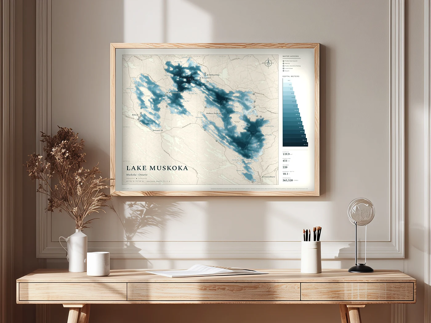
Each lake, drawn as a wall map
Every depth sounding in the province’s survey, drawn as bands of colour on a printed sheet, with the named places and the ways onto the water. Printed to order in two colourways and four sizes, and a place of the customer’s own can be marked on it.
The buyer’s report
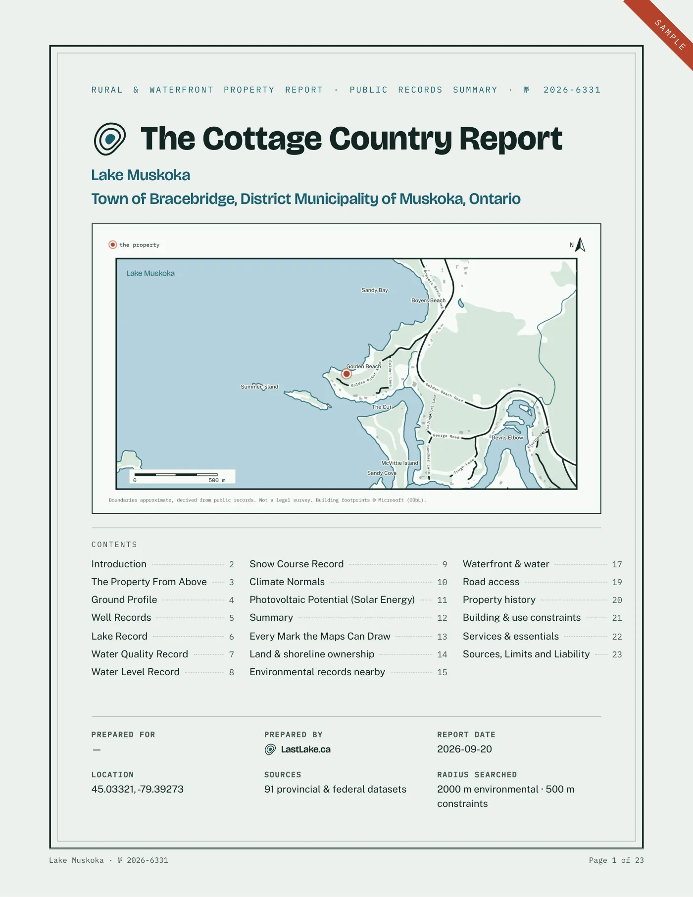
One property, read from the public record
A report on one rural or waterfront property: Crown interests, flood mapping, road access, wells, wetlands and services, drawn from provincial and federal records and read by a person before it is sent.